falkirk FK10 Postcodes
Spending a fortune on conveyancing?

Compare instant, low-cost online quotes from trusted conveyancing solicitors.
Backed by experts, our no-obligation service searches through the best conveyancing quotes on the market to save you time and money.
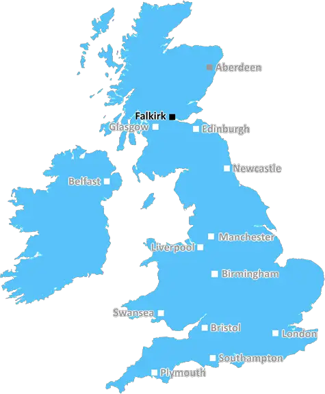
Falkirk (FK10)
The FK10 postcode area is located in the Falkirk postcode town region, within the county of Clackmannanshire, and contains a total of 1069 individual postcodes.
There are 27 electoral wards in the FK10 postcode area, including Alloa, Alva, Bonnybridge, Callander, Clackmannan, Crianlarich, Denny, Dollar, Doune, Dunblane, Falkirk, Grangemouth, Killin, Larbert, Lochearnhead, Menstrie, Stirling, Tillicoultry which come under the local authority of the Clackmannanshire Council.
Combining the whole postcode region, 0% of people in FK10 are classed as having an AB social grade, (i.e. 'white-collar' middle-upper class), compared to 27% across the UK.
This does not mean that the people of FK10 are poorer than other areas, but it may give an indication that there are areas of deprivation.
The FK10 postcode covers five small towns and villages � Grangemouth, Brightons, Polmont, Redding, and Rumford � in the Falkirk district of Scotland, situated between Edinburgh and Glasgow. It is bordered by the neighbouring postcodes of EH48, FK2, FK11, FK3 and KY4.
Grangemouth is known as the gateway to Scotland's Central Belt, a key industrial area in the country's manufacturing and shipping industry, and is home to the huge Grangemouth Petrol Chemical Complex. Brightons and Polmont are located around the River Forth, and offer plenty of outdoor activities, parks and greenspace, as well as trails and golf courses. Redding, meanwhile, is a former mining village lying in the heart of Scotland and surrounded by the spectacular Touch Hills. And lastly, Rumford is an attractive village situated close to the Carron Valley Reservoir.
Although the district of Falkirk is steeped in history, the FK10 postcode has recently become the focus of major regeneration efforts, with investments in housing, community projects, infrastructure development, and business development. This has in turn attracted several new businesses to the area, bringing with them much needed jobs and prosperity for the local economy. The postcode also has some great shopping opportunities, including the well-established Grangemouth Retail Park, a range of local independent shops, boutiques, and cafes.
In terms of transport, FK10 is exceptionally well-connected to Scotland's larger towns and cities. It is served by the M9 motorway and several other main roads, with frequent bus services to Edinburgh, Glasgow, Dunfermline and other regional towns, as well as excellent rail links. Falkirk High station in the FK10 postcode provides access to Intercity services throughout Scotland. The postcode also lies close to Glasgow International Airport, making it a convenient location for those looking to access air travel.

Demographics
Clackmannanshire

FK10 is located in the county of Clackmannanshire, in Scotland.
Clackmannanshire has a total population of 0, making it the largest county in the UK.
Clackmannanshire has a total area of square miles, and a population density of people per square kilometre. For comparison, Greater London has a density of 5,618 people/km2.
| Outward Code | FK10 |
| Postal Town | Falkirk |
| MSOA Name | Alloa West |
| LSOA Name | |
| County | Clackmannanshire |
| Region | Clackmannanshire |
| Country | Scotland |
| Local Authority | Clackmannanshire |
| Area Classification | Unclassified |
FK10 Electoral Wards
The postal region of FK10, includes the local towns, villages, electoral wards and stations of:
Dig even deeper into the FK10 postcode by clicking on a postcode below:
Click on an outward postal code below for more information about the area. Each 'outward' postcode give you a comprehensive list of all postcodes within the outward code area (FK) and estimated address.
Click on an 'outward' code for more information. For example, the outward postcode page 'EC2M' will give you an alphabetical list covering all postcodes located in the region, from 'EC2M 1BB' through to 'EC2M 7YA'.
Chris H
Monday, April 8, 2024
We don't have any views of FK10 right now. If you live in FK10 or have visited it, please help us to help others by telling others what you think of this neighbourhood.
Add your view of FK10
People need your local expertise. If you live in FK10 or have first-hand knowledge of the neighbourhood, please consider sharing your views. It's completely anonymous - all we ask is for your initials.
Please tell us what you like about the FK10 postcode area, what you don't like, and what it's like to live or work here.
| LOCAL AMENITIES | |
| FAMILY FRIENDLY | |
| PARKING | |
| GREEN SPACES |
From the Postcode Area blog

Deciphering Crime Rates - a Deep Dive Into UK Postcode Analysis
Ever wondered about the crime rate in your UK postcode? You're not alone. We've dug deep into the data, uncovering trends and patterns that'll make your head spin.

Death of the High Street?
The BBC reports that despite councils' attempts to kurb them, the UK's high streets have seen a huge growth in fast food outlets. Could this mark the death knell for the Great British high street, and what can we do about it to halt its decline?

Discrimination by Postcode
You really couldn't make it up, could you? Some of the country's most vulnerable people are missing out on their weekly £25 Cold Weather Payment, just because the system that's in operation is discriminating against them because payments are based on postcode, rather than geographic location.

The Redesign is Underway
Well, the current website was absolutely in dire need of a good redesign - from the ground up. So I set out to pull it all apart and get it up and running again to become the most comprehensive guide to every postcode in the UK. And it's been a long, tough job from start to finish - and quite possibly the biggest project I've ever undertaken.
SOCIAL GRADES
According to census records, 0% of people here have a social grade of AB (highest), compared to the national average of 27%.