enfield EN8 Postcodes
Spending a fortune on conveyancing?

Compare instant, low-cost online quotes from trusted conveyancing solicitors.
Backed by experts, our no-obligation service searches through the best conveyancing quotes on the market to save you time and money.
Enfield (EN8)
The EN8 postcode area is located in the Enfield postcode town region, within the county of Hertfordshire, and contains a total of 1410 individual postcodes.
There are 9 electoral wards in the EN8 postcode area, including Barnet, Broxbourne, Enfield, Hoddesdon, Potters Bar, Waltham Abbey, Waltham Cross which come under the local authority of the Broxbourne Council.
Combining the whole postcode region, 15% of people in EN8 are classed as having an AB social grade, (i.e. 'white-collar' middle-upper class), compared to 27% across the UK.
This does not mean that the people of EN8 are poorer than other areas, but it may give an indication that there are areas of deprivation.
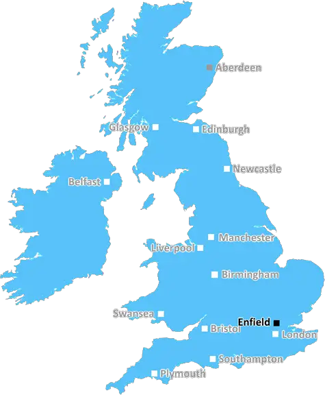
The EN8 postcode is found within the Enfield district of London, England. It is largely a suburban area located north of the M25. The postcode covers a range of towns and villages, including Cheshunt, Goffs Oak, Waltham Cross and Waltham Abbey.
The area has a semi-rural feel in the southeast, although modern residential development is spreading to the west and east along the A10. Recently built housing estates, such as Borehamwood, join established estates such as brick-house Turnford.
The main shopping areas in the area are Waltham Cross, Cheshunt and Waltham Abbey. Waltham Cross offers a variety of high street stores and eateries, while Cheshunt is home to a large Tesco Extra superstore. Waltham Abbey is a preserved ancient market town in the centre of the postcode, home to a historic church and graceful windmill.
Larger industries in the area include Lee Valley Regional Park, Theobalds Park and The Tottenham Hotspur Football Club. Lee Valley Regional Park is a picturesque area oozing with activities such as cycling, fishing, and various clubs. Theobalds Park is an attractively landscaped estate set against the backdrop of historic Tudor ruins, while Tottenham Hotspur Football Club is a professional football stadium located in the north of EN8.
For commuting, the postcode has easy access to the M25 motorway which provides roads to the London A412, and the A10 which connects to London and the East Coast. Rail access is also provided at both Waltham Cross and Cheshunt railway stations, with journeys to London taking around 25-30 minutes. Additionally, the area is served by numerous bus routes, linking it to places such as Enfield Town, Hackney, and Loughton.
Education is mainly provided by the EN8 Postcode Education Trust. This trust is a joint venture between Hertfordshire and Enfield Councils and provides education to all schools within the postcode area, ranging from primary, secondary, and further education.
The EN8 postcode is known for its rural charm and variety of amenities. It is an ideal postcode for those who want to experience city life but who also want to live within a more peaceful and relaxing environment.

Demographics

Hertfordshire

EN8 is located in the county of Hertfordshire, in England.
Hertfordshire has a total population of 1,176,700, making it the 12th largest county in the UK.
Hertfordshire has a total area of 634 square miles, and a population density of 716 people per square kilometre. For comparison, Greater London has a density of 5,618 people/km2.
| Outward Code | EN8 |
| Postal Town | Enfield |
| MSOA Name | Broxbourne 010 |
| LSOA Name | Broxbourne 010E |
| County | Hertfordshire |
| Region | Hertfordshire |
| Country | England |
| Local Authority | Broxbourne |
| Area Classification | Urban with Major Conurbation |
EN8 Electoral Wards
The postal region of EN8, includes the local towns, villages, electoral wards and stations of:
Dig even deeper into the EN8 postcode by clicking on a postcode below:
Click on an outward postal code below for more information about the area. Each 'outward' postcode give you a comprehensive list of all postcodes within the outward code area (EN) and estimated address.
Click on an 'outward' code for more information. For example, the outward postcode page 'EC2M' will give you an alphabetical list covering all postcodes located in the region, from 'EC2M 1BB' through to 'EC2M 7YA'.
Chris H
Monday, April 8, 2024
We don't have any views of EN8 right now. If you live in EN8 or have visited it, please help us to help others by telling others what you think of this neighbourhood.
Add your view of EN8
People need your local expertise. If you live in EN8 or have first-hand knowledge of the neighbourhood, please consider sharing your views. It's completely anonymous - all we ask is for your initials.
Please tell us what you like about the EN8 postcode area, what you don't like, and what it's like to live or work here.
| LOCAL AMENITIES | |
| FAMILY FRIENDLY | |
| PARKING | |
| GREEN SPACES |
Local News Hertfordshire
Late Posh strike breaks Wycombe hearts at Wembley
Harrison Burrows scores twice, including a stoppage-time winner, as Peterborough beat Wycombe at Wembley to secure the EFL Trophy for a second time.
BBC News99 for a private ambulance in Hertfordshire
MET Medical has launched the service for St Albans, Harpenden, Hatfield and Welwyn.
BBC NewsThree arrests after spate of armed robberies
Staff say they were threatened with a gun at four businesses in Luton, Bedford and Dunstable.
BBC NewsMan seriously hurt after car crashes into roundabout
A 27-year-old suspect is arrested on suspicion of causing serious injury by dangerous driving.
BBC NewsWatford and Preston play out goalless draw
Watford and Preston play out a relatively drab goalless draw in the Championship.
BBC NewsDelays on M25 and M1 as equipment is transported
An abnormal load bound for a power station will affect some M1 and M25 traffic this weekend.
BBC NewsBurrows stars as Posh beat Wycombe to lift EFL Trophy
Harrison Burrows scores twice, including a stoppage-time winner, as Peterborough beat Wycombe at Wembley to secure the EFL Trophy for a second time.
BBC NewsFormer Luton manager Kinnear dies aged 77
Former Wimbledon and Newcastle United manager Joe Kinnear dies at the age of 77, his family announces.
BBC NewsFrom the Postcode Area blog

Deciphering Crime Rates - a Deep Dive Into UK Postcode Analysis
Ever wondered about the crime rate in your UK postcode? You're not alone. We've dug deep into the data, uncovering trends and patterns that'll make your head spin.

Death of the High Street?
The BBC reports that despite councils' attempts to kurb them, the UK's high streets have seen a huge growth in fast food outlets. Could this mark the death knell for the Great British high street, and what can we do about it to halt its decline?

Discrimination by Postcode
You really couldn't make it up, could you? Some of the country's most vulnerable people are missing out on their weekly £25 Cold Weather Payment, just because the system that's in operation is discriminating against them because payments are based on postcode, rather than geographic location.

The Redesign is Underway
Well, the current website was absolutely in dire need of a good redesign - from the ground up. So I set out to pull it all apart and get it up and running again to become the most comprehensive guide to every postcode in the UK. And it's been a long, tough job from start to finish - and quite possibly the biggest project I've ever undertaken.
SOCIAL GRADES
According to census records, 15% of people here have a social grade of AB (highest), compared to the national average of 27%.