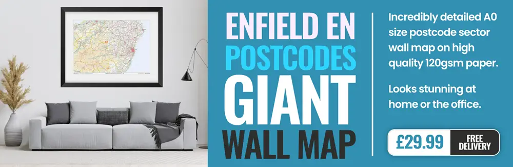
enfield EN1 Postcodes
Spending a fortune on conveyancing?

Compare instant, low-cost online quotes from trusted conveyancing solicitors.
Backed by experts, our no-obligation service searches through the best conveyancing quotes on the market to save you time and money.
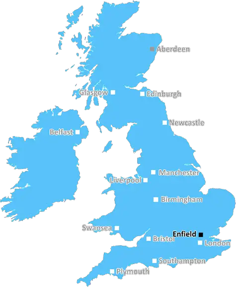
Enfield (EN1)
The EN1 postcode area is located in the Enfield postcode town region, within the county of Greater London, and contains a total of 1675 individual postcodes.
There are 3 electoral wards in the EN1 postcode area, including Barnet, Broxbourne, Enfield, Hoddesdon, Potters Bar, Waltham Abbey, Waltham Cross which come under the local authority of the Enfield Council.
Combining the whole postcode region, 23% of people in EN1 are classed as having an AB social grade, (i.e. 'white-collar' middle-upper class), compared to 27% across the UK.
This does not mean that the people of EN1 are poorer than other areas, but it may give an indication that there are areas of deprivation.
EN1 is a postcode district in the Enfield district of North London, England. As of 2021, its estimated population is 134,033. Located north of the inner city, it borders the London Borough of Haringey to the north and west, the London Borough of Enfield to the north and east, and the London Borough of Waltham Forest to the south.
The postcode is intersected by the A10 and A1000 roads which lead to the A406 North Circular. It is conveniently placed for public transport, with Southbury railway station in the east and four London Overground stations in the west. In addition, there are numerous bus routes serving the area.
EN1 is made up mostly of residential areas, although a few commercial and industrial districts can be found. Along with Southbury Road, Hertford Road in Southbury is also home to local shops and businesses. To the north, the area includes two large shopping centres � The Bowes Centre and The Pavilion stores. The popular Angel Centre, with its variety of shops, restaurants, and a cinema, sits on the intersection of the A10 and A406 roads.
The whole of the postcode is covered by two local authorities � Enfield Borough Council and Middlesex County Council. The area is defended by the 2�5th Battalions of the London Regiment, and there is a police station near The Angel Centre. There are several primary, secondary, and tertiary schools in the district, and many open spaces in the form of parks and green sites, such as the Town Park, Arnos Park, and Whitewebbs Park.

Demographics
Greater London

EN1 is located in the county of Greater London, in England.
Greater London has a total population of 8,778,500, making it the 1st largest county in the UK.
Greater London has a total area of 606 square miles, and a population density of 5594 people per square kilometre. For comparison, Greater London has a density of 5,618 people/km2.
| Outward Code | EN1 |
| Postal Town | Enfield |
| MSOA Name | Enfield 015 |
| LSOA Name | Enfield 015D |
| County | Greater London |
| Region | Greater London |
| Country | England |
| Local Authority | Enfield |
| Area Classification | Urban with Major Conurbation |
EN1 Electoral Wards
The postal region of EN1, includes the local towns, villages, electoral wards and stations of:
Dig even deeper into the EN1 postcode by clicking on a postcode below:
Click on an outward postal code below for more information about the area. Each 'outward' postcode give you a comprehensive list of all postcodes within the outward code area (EN) and estimated address.
Click on an 'outward' code for more information. For example, the outward postcode page 'EC2M' will give you an alphabetical list covering all postcodes located in the region, from 'EC2M 1BB' through to 'EC2M 7YA'.
AG, enfield
Wednesday, March 6, 2019
great busses and train services, local shops and marked, cineworld, gym, restaurants. Multitude of good shopping centers Against high pollution levels caused by numerous traffic lights and poorly implemented cycle lanes in neighbouring roads
Add your view of EN1
People need your local expertise. If you live in EN1 or have first-hand knowledge of the neighbourhood, please consider sharing your views. It's completely anonymous - all we ask is for your initials.
Please tell us what you like about the EN1 postcode area, what you don't like, and what it's like to live or work here.
| LOCAL AMENITIES | |
| FAMILY FRIENDLY | |
| PARKING | |
| GREEN SPACES |
From the Postcode Area blog

Deciphering Crime Rates - a Deep Dive Into UK Postcode Analysis
Ever wondered about the crime rate in your UK postcode? You're not alone. We've dug deep into the data, uncovering trends and patterns that'll make your head spin.

Death of the High Street?
The BBC reports that despite councils' attempts to kurb them, the UK's high streets have seen a huge growth in fast food outlets. Could this mark the death knell for the Great British high street, and what can we do about it to halt its decline?

Discrimination by Postcode
You really couldn't make it up, could you? Some of the country's most vulnerable people are missing out on their weekly £25 Cold Weather Payment, just because the system that's in operation is discriminating against them because payments are based on postcode, rather than geographic location.

The Redesign is Underway
Well, the current website was absolutely in dire need of a good redesign - from the ground up. So I set out to pull it all apart and get it up and running again to become the most comprehensive guide to every postcode in the UK. And it's been a long, tough job from start to finish - and quite possibly the biggest project I've ever undertaken.
SOCIAL GRADES
According to census records, 23% of people here have a social grade of AB (highest), compared to the national average of 27%.