durham DH2 Postcodes
Spending a fortune on conveyancing?

Compare instant, low-cost online quotes from trusted conveyancing solicitors.
Backed by experts, our no-obligation service searches through the best conveyancing quotes on the market to save you time and money.
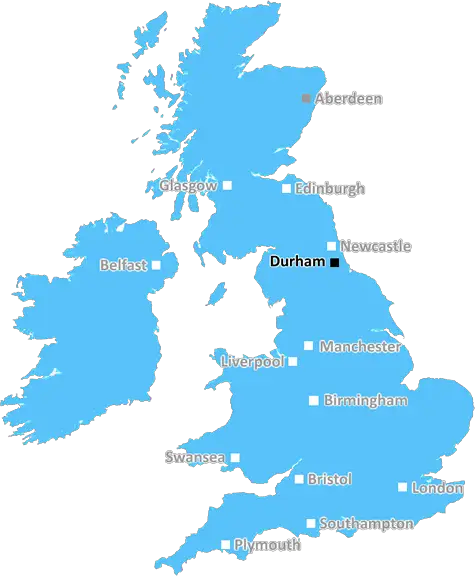
Durham (DH2)
The DH2 postcode area is located in the Durham postcode town region, within the county of Durham, and contains a total of 847 individual postcodes.
There are 21 electoral wards in the DH2 postcode area, including Chester Le Street, Consett, Durham, Houghton Le Spring, Stanley which come under the local authority of the County Durham Council.
Combining the whole postcode region, 19% of people in DH2 are classed as having an AB social grade, (i.e. 'white-collar' middle-upper class), compared to 27% across the UK.
This does not mean that the people of DH2 are poorer than other areas, but it may give an indication that there are areas of deprivation.
DH2 is a postcode district in the Durham district in the North East of England. It covers the towns of Birtley, Bramley, Grangetown, Harraton, Burdon and Houghton-Le-Spring in the foreground.
The postcode district is part of the Tyne and Wear county and includes part of the District of Sunderland, forming a part of the cities of Sunderland and Durham. It is located at the southern edge of the metropolitan area of Newcastle/Gateshead, which also includes the postcode district DH5.
The DH2 postcode district is home to a population of around 27,400 people and is a mix of urban and rural. It covers an area of approximately 14 square miles.
The main roads that run through the DH2 postcode district are the A183, A182, and A19. The area is served by Sunderland Metropolitan Railway and has several bus routes that link to the district's towns and local amenities.
The district has a selection of shops, supermarkets, gyms, post offices and banks. There are several churches within the district, some dating back to the medieval period.
The DH2 postcode district is located on the South Tyneside coastline and overlooks the River Wear. The area is popular for its countryside and sea walks as well as the nearby National Trust and RSPB-managed reserves.
The area is popular with commuters, due its close proximity to Newcastle City Centre and its easy access to the East Coast mainline.
Schools located in the DH2 postcode district include Birtley Primary School, St James' CofE Academy, Lordsmoor Primary School and St Aidan's Catholic Primary School.

Demographics

Durham

DH2 is located in the county of Durham, in England.
Durham has a total population of 0, making it the largest county in the UK.
Durham has a total area of square miles, and a population density of people per square kilometre. For comparison, Greater London has a density of 5,618 people/km2.
| Outward Code | DH2 |
| Postal Town | Durham |
| MSOA Name | County Durham 007 |
| LSOA Name | County Durham 007D |
| County | Durham |
| Region | Durham |
| Country | England |
| Local Authority | County Durham |
| Area Classification | Largely Rural (rural including hub towns 50-79%) |
DH2 Electoral Wards
The postal region of DH2, includes the local towns, villages, electoral wards and stations of:
Dig even deeper into the DH2 postcode by clicking on a postcode below:
Click on an outward postal code below for more information about the area. Each 'outward' postcode give you a comprehensive list of all postcodes within the outward code area (DH) and estimated address.
Click on an 'outward' code for more information. For example, the outward postcode page 'EC2M' will give you an alphabetical list covering all postcodes located in the region, from 'EC2M 1BB' through to 'EC2M 7YA'.
Chris H
Tuesday, April 9, 2024
We don't have any views of DH2 right now. If you live in DH2 or have visited it, please help us to help others by telling others what you think of this neighbourhood.
Add your view of DH2
People need your local expertise. If you live in DH2 or have first-hand knowledge of the neighbourhood, please consider sharing your views. It's completely anonymous - all we ask is for your initials.
Please tell us what you like about the DH2 postcode area, what you don't like, and what it's like to live or work here.
| LOCAL AMENITIES | |
| FAMILY FRIENDLY | |
| PARKING | |
| GREEN SPACES |
Local News County Durham
Living Desert Zoo and Gardens in California chooses n-gage.io tech
North East based global attraction experience software specialists n-gage.io has secured its first major US contract with the Living Desert Zoo and Gardens in California, which has launched a new mobi&hellip
Northern EchoSi King's special message for Dave Myers' 6000 bike riders
Si King has paid tribute to the thousands of people who took part in a ride for The Hairy Bikers star Dave Myers.
Northern EchoCarol Vorderman and Richard Holden social media spat
Broadcaster and media personality Carol Vorderman has hit out at North Durham MP Richard Holden over a letter he wrote to Sir Keir Starmer about Angela Rayner's former living arrangements
Northern EchoA66 Darlington crash claims life of 25-year-old Middlesbrough man
Cleveland Police have named 25-year-old Joseph Potts who has tragically died following a crash on the A66 near Darlington over the weekend.
Northern EchoDurham Lane LIVE: Road near A66 closed after crash
Durham Lane near the A66 has been closed this morning following a crash between two vehicles. The Northern Echo has the latest updates here.
Northern EchoHartlepool arsonist caused 25,000 worth of damage to cars
A Hartlepool firebug who caused around 25,000 worth of damage to cars when he went on three arson sprees has been branded a dangerous offender.
Northern EchoDog dies after illegal bike collision on Durham cycle path
An information appeal has been launched by Stanley Police after a dog has died after being hit by an illegal off-road bike on a County Durham cycle route.
Northern EchoNorthallerton Bowling Club open day on Saturday, April 20
Northallerton Bowling Club is holding an open day on Saturday, April 20.
Northern EchoFrom the Postcode Area blog

Deciphering Crime Rates - a Deep Dive Into UK Postcode Analysis
Ever wondered about the crime rate in your UK postcode? You're not alone. We've dug deep into the data, uncovering trends and patterns that'll make your head spin.

Death of the High Street?
The BBC reports that despite councils' attempts to kurb them, the UK's high streets have seen a huge growth in fast food outlets. Could this mark the death knell for the Great British high street, and what can we do about it to halt its decline?

Discrimination by Postcode
You really couldn't make it up, could you? Some of the country's most vulnerable people are missing out on their weekly £25 Cold Weather Payment, just because the system that's in operation is discriminating against them because payments are based on postcode, rather than geographic location.

The Redesign is Underway
Well, the current website was absolutely in dire need of a good redesign - from the ground up. So I set out to pull it all apart and get it up and running again to become the most comprehensive guide to every postcode in the UK. And it's been a long, tough job from start to finish - and quite possibly the biggest project I've ever undertaken.
SOCIAL GRADES
According to census records, 19% of people here have a social grade of AB (highest), compared to the national average of 27%.