dumfries DG13 Postcodes
Spending a fortune on conveyancing?

Compare instant, low-cost online quotes from trusted conveyancing solicitors.
Backed by experts, our no-obligation service searches through the best conveyancing quotes on the market to save you time and money.
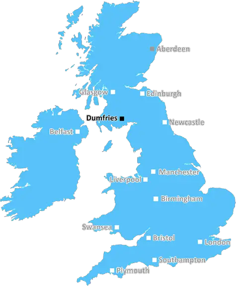
Dumfries (DG13)
The DG13 postcode area is located in the Dumfries postcode town region, within the county of Dumfriesshire, and contains a total of 160 individual postcodes.
There are 28 electoral wards in the DG13 postcode area, including Annan, Canonbie, Castle Douglas, Dalbeattie, Dumfries, Gretna, Kirkcudbright, Langholm, Lockerbie, Moffat, Newton Stewart, Sanquhar, Stranraer, Thornhill which come under the local authority of the Dumfries & Galloway Council.
Combining the whole postcode region, 0% of people in DG13 are classed as having an AB social grade, (i.e. 'white-collar' middle-upper class), compared to 27% across the UK.
This does not mean that the people of DG13 are poorer than other areas, but it may give an indication that there are areas of deprivation.
DG13 is a postcode district in the Dumfries district located in the southwest corner of Scotland. It is one of five postcodes in the district with a total population of around 60,000 people. It covers an area of approximately 126 square kilometres.
The main towns and villages in the DG13 postcode district are: Annan, Gretna, Lockerbie, Canonbie, Ecclefechan, Kirkpatrick-Fleming and Ruthwell. Many of these locations are known for having an interesting history � for example, Annan is sometimes known as �Scotland's Ancient Capital' due to its strong historical connections and its importance as a stronghold for the early Scots in the Middle Ages. Lockerbie was the site of the infamous Pan Am Flight 103 bombing in 1988.
DG13 has a rich agricultural heritage, as its fertile soils have been used to produce crops such as oats, barley, wheat and turnips. Livestock industries such as dairy farming and beef production are also significant. In addition, the area is known for producing a variety of cheeses, including the famous Dumfries Cream.
The region has some unique landscapes, including the Lochmabenstone � a natural rock formation which is linked to historical legends and folklore. It is known as a pilgrimage site for some, and it sits in beautiful woodland near Lockerbie. Other local attractions include the Annandale Way, a walking trail that runs to Annan, as well as the Wavefront surfing site in Annan and the Solway Coastline.
The region is also known for its strong culture and sporting heritage, and plays host to a number of local festivals including the world-renowned Sound of Jura music festival. The historic area of Gretna Green is also located within the DG13 postcode district, and is a popular tourist spot for weddings.
In recent years, the region has experienced significant investment in regeneration and infrastructure such as the Gretna Gateway Outlet Shopping Centre, which has brought new jobs to the area. This is in addition to the area's important telecommunications and transport links, ensuring the DG13 region is well connected to the rest of the world.

Demographics
Dumfriesshire

DG13 is located in the county of Dumfriesshire, in Scotland.
Dumfriesshire has a total population of 0, making it the largest county in the UK.
Dumfriesshire has a total area of square miles, and a population density of people per square kilometre. For comparison, Greater London has a density of 5,618 people/km2.
| Outward Code | DG13 |
| Postal Town | Dumfries |
| MSOA Name | Langholm and Canonbie |
| LSOA Name | |
| County | Dumfriesshire |
| Region | Dumfriesshire |
| Country | Scotland |
| Local Authority | Dumfries & Galloway |
| Area Classification | Unclassified |
DG13 Electoral Wards
The postal region of DG13, includes the local towns, villages, electoral wards and stations of:
Dig even deeper into the DG13 postcode by clicking on a postcode below:
Click on an outward postal code below for more information about the area. Each 'outward' postcode give you a comprehensive list of all postcodes within the outward code area (DG) and estimated address.
Click on an 'outward' code for more information. For example, the outward postcode page 'EC2M' will give you an alphabetical list covering all postcodes located in the region, from 'EC2M 1BB' through to 'EC2M 7YA'.
Chris H
Wednesday, April 10, 2024
We don't have any views of DG13 right now. If you live in DG13 or have visited it, please help us to help others by telling others what you think of this neighbourhood.
Add your view of DG13
People need your local expertise. If you live in DG13 or have first-hand knowledge of the neighbourhood, please consider sharing your views. It's completely anonymous - all we ask is for your initials.
Please tell us what you like about the DG13 postcode area, what you don't like, and what it's like to live or work here.
| LOCAL AMENITIES | |
| FAMILY FRIENDLY | |
| PARKING | |
| GREEN SPACES |
From the Postcode Area blog

Deciphering Crime Rates - a Deep Dive Into UK Postcode Analysis
Ever wondered about the crime rate in your UK postcode? You're not alone. We've dug deep into the data, uncovering trends and patterns that'll make your head spin.

Death of the High Street?
The BBC reports that despite councils' attempts to kurb them, the UK's high streets have seen a huge growth in fast food outlets. Could this mark the death knell for the Great British high street, and what can we do about it to halt its decline?

Discrimination by Postcode
You really couldn't make it up, could you? Some of the country's most vulnerable people are missing out on their weekly £25 Cold Weather Payment, just because the system that's in operation is discriminating against them because payments are based on postcode, rather than geographic location.

The Redesign is Underway
Well, the current website was absolutely in dire need of a good redesign - from the ground up. So I set out to pull it all apart and get it up and running again to become the most comprehensive guide to every postcode in the UK. And it's been a long, tough job from start to finish - and quite possibly the biggest project I've ever undertaken.
SOCIAL GRADES
According to census records, 0% of people here have a social grade of AB (highest), compared to the national average of 27%.