derby DE3 Postcodes
Spending a fortune on conveyancing?

Compare instant, low-cost online quotes from trusted conveyancing solicitors.
Backed by experts, our no-obligation service searches through the best conveyancing quotes on the market to save you time and money.
Derby (DE3)
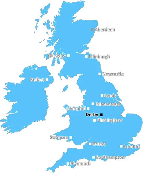
The DE3 postcode area is located in the Derby postcode town region, within the county of Derbyshire, and contains a total of 2583 individual postcodes.
There are 5 electoral wards in the DE3 postcode area, including Alfreton, Ashbourne, Bakewell, Belper, Burton-On-Trent, Derby, Heanor, Ilkeston, Matlock, Ripley, Swadlincote which come under the local authority of the Derby Council.
Combining the whole postcode region, 23% of people in DE3 are classed as having an AB social grade, (i.e. 'white-collar' middle-upper class), compared to 27% across the UK.
This does not mean that the people of DE3 are poorer than other areas, but it may give an indication that there are areas of deprivation.
The DE3 postcode is located in the Derby district in the East Midlands region of England. It covers the rural villages, small towns and hamlets around Repton, including Catton, Measham, Staunton Harold, Willington, Twyford, Etwall, Melbourne and Egginton. The area is largely rural, with small pockets of urban development.
Due to its close proximity to places such as Burton on Trent, Birmingham, Leicester and Nottingham, the area is of great economic importance for the East Midlands and wider UK. The area has seen significant residential developments, many of which are connected to businesses based in these larger cities.
The day-to-day life in the area is heavily based around agriculture and forestry, with many small villages and hamlets made up largely of these activities. Tourists increasingly visit the area to take in the beautiful views, explore the local wildlife and culture, or enjoy its historical attractions, such as Repton's Priory Church.
The area has excellent transport connections - intersected by the A50 and A38 roads - making it accessible to both the east and the west. The journey time from Derby to London is just two and a half hours, and the area has excellent rail links with the likes of Birmingham, Leicester and beyond.
Education plays a large part in day-to-day life in this area, with a good range of state and private schools, including Repton School, Mount St. Bernard College and de Ferrers Academy - all of which have outstanding performance ratings. In the summer, the area plays host to many festivals and events, including the Melbourne Country Fair and the National Forest Fair.
Other attractions in the area include the National Memorial Arboretum, Tutbury Castle and Calke Abbey. Shops, pubs and other facilities are plentiful, with chains and independent establishments providing a range of services and entertainment.
DE3 is a pleasant and vibrant area, with excellent transport links and facilities allowing visitors and locals alike to experience a variety of landscapes, environmental, historical and cultural attractions.

Demographics

Derbyshire

DE3 is located in the county of Derbyshire, in England.
Derbyshire has a total population of 1,042,000, making it the 20th largest county in the UK.
Derbyshire has a total area of 1013 square miles, and a population density of 396 people per square kilometre. For comparison, Greater London has a density of 5,618 people/km2.
| Outward Code | DE3 |
| Postal Town | Derby |
| MSOA Name | Derby 015 |
| LSOA Name | Derby 015E |
| County | Derbyshire |
| Region | Derbyshire |
| Country | England |
| Local Authority | Derby |
| Area Classification | Urban with City and Town |
DE3 Electoral Wards
The postal region of DE3, includes the local towns, villages, electoral wards and stations of:
Dig even deeper into the DE3 postcode by clicking on a postcode below:
Click on an outward postal code below for more information about the area. Each 'outward' postcode give you a comprehensive list of all postcodes within the outward code area (DE) and estimated address.
Click on an 'outward' code for more information. For example, the outward postcode page 'EC2M' will give you an alphabetical list covering all postcodes located in the region, from 'EC2M 1BB' through to 'EC2M 7YA'.
Chris H
Sunday, April 7, 2024
We don't have any views of DE3 right now. If you live in DE3 or have visited it, please help us to help others by telling others what you think of this neighbourhood.
Add your view of DE3
People need your local expertise. If you live in DE3 or have first-hand knowledge of the neighbourhood, please consider sharing your views. It's completely anonymous - all we ask is for your initials.
Please tell us what you like about the DE3 postcode area, what you don't like, and what it's like to live or work here.
| LOCAL AMENITIES | |
| FAMILY FRIENDLY | |
| PARKING | |
| GREEN SPACES |
Local News Derbyshire
Unfit and frustrated Mackworth man sheds eight stone in 12 months
John turned his life around after realising he was too unfit to walk to the local park
Derby TelegraphJail for driver who left pensioner with catastrophic injuries in Long Eaton
'At times in hospital I wish I had been killed'
Derby TelegraphGirls arrested after teenager injured in fight
Three 15-year-olds and a 14-year-old remain in custody, say police.
BBC NewsPeople's Postcode Lottery winning streets for April 3 to April 5, 2024
A lot of postcodes won a share of some cash
Derby TelegraphNo play possible at Durham & Derbyshire on day two
No play is possible at Durham against Hampshire and Derbyshire against Gloucestershire for a second straight day.
BBC NewsAllestree residents livid as 'brutal' bungalow extension allowed
Residents shouted at councillors 'shame on you' and 'disgrace'
Derby TelegraphPicture-perfect Peak District village dark past brought back to life
The village became famous after the Black Death
Derby TelegraphDerby's Guildhall in line for 24m restoration
The Grade II listed building was at risk of falling into disrepair, the council said.
BBC NewsFrom the Postcode Area blog

Deciphering Crime Rates - a Deep Dive Into UK Postcode Analysis
Ever wondered about the crime rate in your UK postcode? You're not alone. We've dug deep into the data, uncovering trends and patterns that'll make your head spin.

Death of the High Street?
The BBC reports that despite councils' attempts to kurb them, the UK's high streets have seen a huge growth in fast food outlets. Could this mark the death knell for the Great British high street, and what can we do about it to halt its decline?

Discrimination by Postcode
You really couldn't make it up, could you? Some of the country's most vulnerable people are missing out on their weekly £25 Cold Weather Payment, just because the system that's in operation is discriminating against them because payments are based on postcode, rather than geographic location.

The Redesign is Underway
Well, the current website was absolutely in dire need of a good redesign - from the ground up. So I set out to pull it all apart and get it up and running again to become the most comprehensive guide to every postcode in the UK. And it's been a long, tough job from start to finish - and quite possibly the biggest project I've ever undertaken.
SOCIAL GRADES
According to census records, 23% of people here have a social grade of AB (highest), compared to the national average of 27%.