derby DE23 Postcodes
Spending a fortune on conveyancing?

Compare instant, low-cost online quotes from trusted conveyancing solicitors.
Backed by experts, our no-obligation service searches through the best conveyancing quotes on the market to save you time and money.
Derby (DE23)
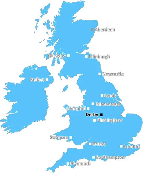
The DE23 postcode area is located in the Derby postcode town region, within the county of Derbyshire, and contains a total of 1518 individual postcodes.
There are 8 electoral wards in the DE23 postcode area, including Alfreton, Ashbourne, Bakewell, Belper, Burton-On-Trent, Derby, Heanor, Ilkeston, Matlock, Ripley, Swadlincote which come under the local authority of the Derby Council.
Combining the whole postcode region, 19% of people in DE23 are classed as having an AB social grade, (i.e. 'white-collar' middle-upper class), compared to 27% across the UK.
This does not mean that the people of DE23 are poorer than other areas, but it may give an indication that there are areas of deprivation.
The DE23 postcode, located within the Derby district of England, is a postcode district which encompasses part of the city of Derby. It covers the areas of Allestree, Osmaston, Breadsall, Oakwood, and Mackworth.
The district is bordered by the A52, the A6, and the M1 motorway, making it easily accessible for those travelling by car. It is served by six bus routes and is within walking distance of Derby train station.
Allestree is a mix of residential and commercial areas, with a variety of shops and amenities available. The Allestree Park is located in the area, offering scenic views, walking trails, and playful adventures for local families.
The area of Osmaston consists mainly of residential properties, with the odd retail outlet here and there. It is a popular location for families due to a number of good schools in the area, as well as being close to Derby city centre.
Breadsall has some scant retail and commercial offerings, but mostly consists of residential properties. It has become increasingly popular among professionals with its convenient location and excellent infrastructure.
Oakwood is a more upmarket area of DE23, with the streets lined with well-presented family homes. The suburb is known for its thriving local community and excellent transport links. There are a number of high quality schools in the area.
Mackworth is an area of Derby partially covered by the DE23 postcode. Most of the area is composed of modern and attractive housing, with good amenities such as shops and public spaces nearby. It is close to the University of Derby campus, making it popular with students.
TheDE23 postcode represents an area of Derby with a great range of amenities and excellent transport links. Its selection of residential areas mean it is a desirable area for families and professionals, with plenty of leisure activities and schools available.

Demographics

Derbyshire

DE23 is located in the county of Derbyshire, in England.
Derbyshire has a total population of 1,042,000, making it the 20th largest county in the UK.
Derbyshire has a total area of 1013 square miles, and a population density of 396 people per square kilometre. For comparison, Greater London has a density of 5,618 people/km2.
| Outward Code | DE23 |
| Postal Town | Derby |
| MSOA Name | Derby 022 |
| LSOA Name | Derby 022B |
| County | Derbyshire |
| Region | Derbyshire |
| Country | England |
| Local Authority | Derby |
| Area Classification | Urban with City and Town |
DE23 Electoral Wards
The postal region of DE23, includes the local towns, villages, electoral wards and stations of:
Dig even deeper into the DE23 postcode by clicking on a postcode below:
Click on an outward postal code below for more information about the area. Each 'outward' postcode give you a comprehensive list of all postcodes within the outward code area (DE) and estimated address.
Click on an 'outward' code for more information. For example, the outward postcode page 'EC2M' will give you an alphabetical list covering all postcodes located in the region, from 'EC2M 1BB' through to 'EC2M 7YA'.
Chris H
Saturday, April 6, 2024
We don't have any views of DE23 right now. If you live in DE23 or have visited it, please help us to help others by telling others what you think of this neighbourhood.
Add your view of DE23
People need your local expertise. If you live in DE23 or have first-hand knowledge of the neighbourhood, please consider sharing your views. It's completely anonymous - all we ask is for your initials.
Please tell us what you like about the DE23 postcode area, what you don't like, and what it's like to live or work here.
| LOCAL AMENITIES | |
| FAMILY FRIENDLY | |
| PARKING | |
| GREEN SPACES |
Local News Derbyshire
Teen injured in Ilkeston street fight, police make 4 arrests
A teenager suffered a swollen lip, cut to the head and grazes and was taken to hospital
Derby TelegraphPlans to tighten shared home rules put to public
Residents are concerned too many shared homes creates problems like parking and fly-tipping.
BBC NewsMoxon saves point for Portsmouth against Derby
Owen Moxon's stunning strike rescues a point for Portsmouth in an entertaining draw with League One promotion rivals Derby.
BBC NewsPatel wants 'belief' & 'aggression' at Derbyshire
All-rounder Samit Patel wants to help bring greater belief to Derbyshire and promises an aggressive brand of cricket.
BBC NewsGirls arrested after teenager injured in fight
Three 15-year-olds and a 14-year-old remain in custody, say police.
BBC NewsMan who stabbed Costa worker in head jailed
Darren Laken, 31, stole a pack of knives before attacking the worker, a court hears.
BBC NewsJaw-dropping Peak District walk that is perfect to avoid the crowds
The route isn't as popular with tourists
Derby TelegraphRolls-Royce expansion gets go-ahead but concerns over more Pride Park traffic
A new multi-storey car park and footbridge will be built near The Wyvern
Derby TelegraphFrom the Postcode Area blog

Deciphering Crime Rates - a Deep Dive Into UK Postcode Analysis
Ever wondered about the crime rate in your UK postcode? You're not alone. We've dug deep into the data, uncovering trends and patterns that'll make your head spin.

Death of the High Street?
The BBC reports that despite councils' attempts to kurb them, the UK's high streets have seen a huge growth in fast food outlets. Could this mark the death knell for the Great British high street, and what can we do about it to halt its decline?

Discrimination by Postcode
You really couldn't make it up, could you? Some of the country's most vulnerable people are missing out on their weekly £25 Cold Weather Payment, just because the system that's in operation is discriminating against them because payments are based on postcode, rather than geographic location.

The Redesign is Underway
Well, the current website was absolutely in dire need of a good redesign - from the ground up. So I set out to pull it all apart and get it up and running again to become the most comprehensive guide to every postcode in the UK. And it's been a long, tough job from start to finish - and quite possibly the biggest project I've ever undertaken.
SOCIAL GRADES
According to census records, 19% of people here have a social grade of AB (highest), compared to the national average of 27%.