dartford DA17 Postcodes
Spending a fortune on conveyancing?

Compare instant, low-cost online quotes from trusted conveyancing solicitors.
Backed by experts, our no-obligation service searches through the best conveyancing quotes on the market to save you time and money.
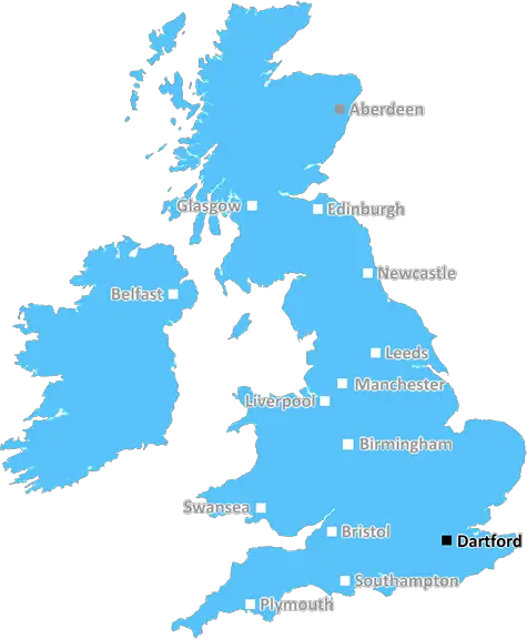
Dartford (DA17)
The DA17 postcode area is located in the Dartford postcode town region, within the county of Greater London, and contains a total of 497 individual postcodes.
There are 3 electoral wards in the DA17 postcode area, including Belvedere, Bexley, Bexleyheath, Dartford, Erith, Gravesend, Greenhithe, Longfield, Sidcup, Swanscombe, Welling which come under the local authority of the Bexley Council.
Combining the whole postcode region, 16% of people in DA17 are classed as having an AB social grade, (i.e. 'white-collar' middle-upper class), compared to 27% across the UK.
This does not mean that the people of DA17 are poorer than other areas, but it may give an indication that there are areas of deprivation.
DA17 is an urban postcode in the UK, located within the London Borough of Bexley in South East London. DA17 has an eclectic mix of residential, commercial and industrial districts, with most of the coverage being residential.
It is home to approximately 8,000 people as of mid-2018, making it a fairly busy area. Much of the area is popular with young professionals due to its easy commute to the city centre and affordable housing for first-time buyers.
The postcode area spans across three wards in the London Borough of Bexley and is divided into three postcode 'districts', all containing six postcodes in total. The largest of these districts is the Belvedere postcode district, which covers most of the postcode area.
The district has its own shopping centre, Belvedere Shopping Centre, with a number of popular high-street stores. There is also a range of smaller stores and eateries located a short distance away.
DA17 is also home to a number of small parks and gardens that host a range of flora and fauna.
Many of the roads in the area are narrow and residential, making them particularly attractive to families with young children. It is also a popular area for dog walkers.
Transport links in the DA17 postcode area are quite good, with routes leading to London and Kent. The nearest tube station is Abbey Wood, located on the London Crossrail line, which allows for easy access into Central London. Additionally, there are several bus routes serving the area and providing access to local amenities.
Historically, there are several listed buildings and sites to be found in the DA17 postcode area, ranging from churches, pubs, mills, and other houses of historic importance.
DA17 is an urban postcode area located within the London Borough of Bexley that offers a mix of residential, commercial and industrial districts, as well as some historic buildings. It is popular with young professionals and families due to its good transport links and access to amenities.

Demographics

Greater London

DA17 is located in the county of Greater London, in England.
Greater London has a total population of 8,778,500, making it the 1st largest county in the UK.
Greater London has a total area of 606 square miles, and a population density of 5594 people per square kilometre. For comparison, Greater London has a density of 5,618 people/km2.
| Outward Code | DA17 |
| Postal Town | Dartford |
| MSOA Name | Bexley 003 |
| LSOA Name | Bexley 003C |
| County | Greater London |
| Region | Greater London |
| Country | England |
| Local Authority | Bexley |
| Area Classification | Urban with Major Conurbation |
DA17 Electoral Wards
The postal region of DA17, includes the local towns, villages, electoral wards and stations of:
Dig even deeper into the DA17 postcode by clicking on a postcode below:
Click on an outward postal code below for more information about the area. Each 'outward' postcode give you a comprehensive list of all postcodes within the outward code area (DA) and estimated address.
Click on an 'outward' code for more information. For example, the outward postcode page 'EC2M' will give you an alphabetical list covering all postcodes located in the region, from 'EC2M 1BB' through to 'EC2M 7YA'.
Chris H
Saturday, April 6, 2024
We don't have any views of DA17 right now. If you live in DA17 or have visited it, please help us to help others by telling others what you think of this neighbourhood.
Add your view of DA17
People need your local expertise. If you live in DA17 or have first-hand knowledge of the neighbourhood, please consider sharing your views. It's completely anonymous - all we ask is for your initials.
Please tell us what you like about the DA17 postcode area, what you don't like, and what it's like to live or work here.
| LOCAL AMENITIES | |
| FAMILY FRIENDLY | |
| PARKING | |
| GREEN SPACES |
Local News Kent
Play area climbing frame removed after safety inspection
A climbing frame in a children's play park has been removed after an inspection highlighted safety concerns and extensive repairs' needed.
Kent OnlineUK Space Agency primed for Harwell Campus landing
The government agency has taken around 10,500 sq ft of space in the Quad Two building.
Property WeekA house of paradise or a council house with a big shed on the side?'
Don't believe everything you read! Secret Drinker heads to a town centre sports bar that isn't all it says it is.
Kent OnlineNewFlex opens new Cambridge workspace The Quad
NewFlex said the site isone of the UK's strongest out-of-London business destinations.
Property WeekSurrey strikes 32.2m deal to buy offices from cash-strapped Woking Council
Surrey County Council will move staff into Victoria Gate building, formerly let to McLaren, later this year.
Property WeekUniversity staff vote to strike over job losses and cut courses
Staff at a Kent university have voted to strike over courses being cut and in defence of jobs.
Kent OnlineBuildings demolished to make way for town's fourth Costa branch
Two warehouse buildings have vanished as another Costa Coffee outlet moves closer to completion and opening.
Kent OnlineJohnson & Johnson signs lease at Tempo in Maidenhead
The pharmaceuticals giantwill move staff from its Thames Valley campuses in High Wycombe and Pinewood to the L&G-owned building.
Property WeekFrom the Postcode Area blog

Deciphering Crime Rates - a Deep Dive Into UK Postcode Analysis
Ever wondered about the crime rate in your UK postcode? You're not alone. We've dug deep into the data, uncovering trends and patterns that'll make your head spin.

Death of the High Street?
The BBC reports that despite councils' attempts to kurb them, the UK's high streets have seen a huge growth in fast food outlets. Could this mark the death knell for the Great British high street, and what can we do about it to halt its decline?

Discrimination by Postcode
You really couldn't make it up, could you? Some of the country's most vulnerable people are missing out on their weekly £25 Cold Weather Payment, just because the system that's in operation is discriminating against them because payments are based on postcode, rather than geographic location.

The Redesign is Underway
Well, the current website was absolutely in dire need of a good redesign - from the ground up. So I set out to pull it all apart and get it up and running again to become the most comprehensive guide to every postcode in the UK. And it's been a long, tough job from start to finish - and quite possibly the biggest project I've ever undertaken.
SOCIAL GRADES
According to census records, 16% of people here have a social grade of AB (highest), compared to the national average of 27%.