coventry CV21 Postcodes
Spending a fortune on conveyancing?

Compare instant, low-cost online quotes from trusted conveyancing solicitors.
Backed by experts, our no-obligation service searches through the best conveyancing quotes on the market to save you time and money.
Coventry (CV21)
The CV21 postcode area is located in the Coventry postcode town region, within the county of Warwickshire, and contains a total of 1452 individual postcodes.
There are 14 electoral wards in the CV21 postcode area, including Atherstone, Bedworth, Coventry, Kenilworth, Leamington Spa, Nuneaton, Rugby, Shipston-On-Stour, Southam, Stratford-Upon-Avon, Warwick which come under the local authority of the Rugby Council.
Combining the whole postcode region, 22% of people in CV21 are classed as having an AB social grade, (i.e. 'white-collar' middle-upper class), compared to 27% across the UK.
This does not mean that the people of CV21 are poorer than other areas, but it may give an indication that there are areas of deprivation.
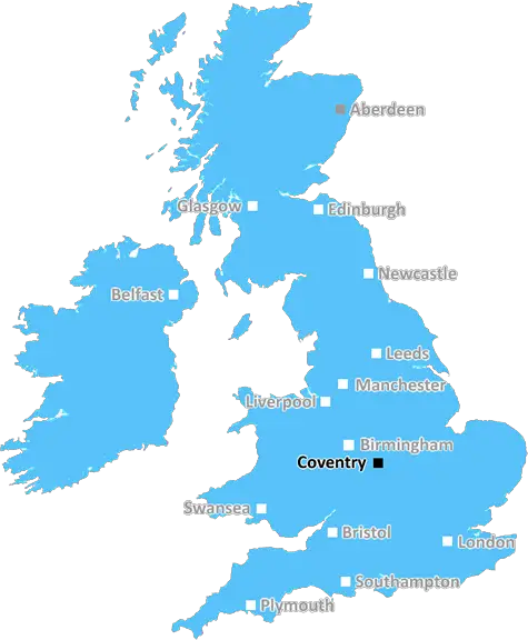
CV21 postcode is an area situated in the Coventry district, in the English county of Warwickshire. It belongs to the West Midlands region, and is commonly referred to as the Binley and Willenhall area. It covers the area of the Binley Woods, Willenhall Wood, and Hill Top, and also includes some residential areas such as Wentworth Rise, Slough Fields, and Houndsfield Drive.
The postcode falls under the Coventry North East constituency and has road links with the M6 motorway and A45/A46 trunk roads. Coventry university is located nearby, which ensures the area is popular among students. Furthermore, there are many services and transport links that benefit the area, such as Coventry Rail Station which lies just on the outskirts of CV21.
The Oxford Canal is a prominent landmark of the area, and it runs through the Binley and Willenhall area. The canal offers many leisure activities such as fishing and walking, though sailing is prohibited due to the narrow width of canal. There are numerous parks in the area, such as Heath Lane Park, Portobello Park, which are popular among families for outdoor activities such as walking and jogging.
In terms of education, the area hosts numerous primary schools including St Christopher Primary School, All Saints Primary School, and Clifford Bridge Primary Academy, as well as high schools such as Whitley Academy and Sixth Form. Additionally, CV21 hosts religious places of worship, such as Holyhead Church, St Christopher Church and St Augustine Church.
In terms of health care, there are a range of health and dental services and surgeries around the area, providing residents with essential NHS services. Furthermore, retail services and a range of independent stores provide convenience and essentials to those in the CV21 postcode.
The area has good access to recreational spots and attractions, with an easy commute to nearby cities such as Birmingham, Leicester, and Wolverhampton. It offers great landscapes of countryside and hospitality to its visitors and is popular among cyclists for its off-road routes and scenic views. Finally, the CV21 postcode is an up and coming area offering all the benefits of living in an urban area while still being in close proximity to countryside and culture.

Demographics

Warwickshire

CV21 is located in the county of Warwickshire, in England.
Warwickshire has a total population of 556,800, making it the 39th largest county in the UK.
Warwickshire has a total area of 763 square miles, and a population density of 281 people per square kilometre. For comparison, Greater London has a density of 5,618 people/km2.
| Outward Code | CV21 |
| Postal Town | Coventry |
| MSOA Name | Rugby 002 |
| LSOA Name | Rugby 002E |
| County | Warwickshire |
| Region | Warwickshire |
| Country | England |
| Local Authority | Rugby |
| Area Classification | Urban with City and Town |
CV21 Electoral Wards
The postal region of CV21, includes the local towns, villages, electoral wards and stations of:
Dig even deeper into the CV21 postcode by clicking on a postcode below:
Click on an outward postal code below for more information about the area. Each 'outward' postcode give you a comprehensive list of all postcodes within the outward code area (CV) and estimated address.
Click on an 'outward' code for more information. For example, the outward postcode page 'EC2M' will give you an alphabetical list covering all postcodes located in the region, from 'EC2M 1BB' through to 'EC2M 7YA'.
Chris H
Monday, April 8, 2024
We don't have any views of CV21 right now. If you live in CV21 or have visited it, please help us to help others by telling others what you think of this neighbourhood.
Add your view of CV21
People need your local expertise. If you live in CV21 or have first-hand knowledge of the neighbourhood, please consider sharing your views. It's completely anonymous - all we ask is for your initials.
Please tell us what you like about the CV21 postcode area, what you don't like, and what it's like to live or work here.
| LOCAL AMENITIES | |
| FAMILY FRIENDLY | |
| PARKING | |
| GREEN SPACES |
Local News Warwickshire
Children's edition of First Folio published
The illustrated book features edited versions of all 36 plays of William Shakespeare's First Folio.
BBC NewsBarnard helps give Bears edge over Worcestershire
Ed Barnard shines against former county Worcestershire as Warwickshire build a strong position on day two of their County Championship meeting.
BBC NewsWebcam: Peregrine falcons nesting on Town Hall
Live feed of falcons nesting in central Leamington
Warwick District CouncilCoventry boost play-off hopes by beating Leeds
Coventry City stay in the mix for a Championship play-off spot with victory over Leeds United, who miss the chance to go top.
BBC NewsArchaeological investigations mark start of work on historic Warwick site
An exciting project to restore some of Warwick's most important historic buildings is now making headway.
Warwick District CouncilPoll Letters issued for Elections in Warwick District
Poll letters notifying residents of Elections taking place in Warwick District on Thursday 2 May 2024 have been sent out in the past couple of weeks.
Warwick District CouncilLeamington's peregrine falcons lay their first egg
Three live webcams are capturing views of a nesting pair of birds in the town.
BBC NewsPolice hunt after teenager stabbed in face
Warwickshire Police says it has a large presence in Bedworth as officers try to find the suspect.
BBC NewsFrom the Postcode Area blog

Deciphering Crime Rates - a Deep Dive Into UK Postcode Analysis
Ever wondered about the crime rate in your UK postcode? You're not alone. We've dug deep into the data, uncovering trends and patterns that'll make your head spin.

Death of the High Street?
The BBC reports that despite councils' attempts to kurb them, the UK's high streets have seen a huge growth in fast food outlets. Could this mark the death knell for the Great British high street, and what can we do about it to halt its decline?

Discrimination by Postcode
You really couldn't make it up, could you? Some of the country's most vulnerable people are missing out on their weekly £25 Cold Weather Payment, just because the system that's in operation is discriminating against them because payments are based on postcode, rather than geographic location.

The Redesign is Underway
Well, the current website was absolutely in dire need of a good redesign - from the ground up. So I set out to pull it all apart and get it up and running again to become the most comprehensive guide to every postcode in the UK. And it's been a long, tough job from start to finish - and quite possibly the biggest project I've ever undertaken.
SOCIAL GRADES
According to census records, 22% of people here have a social grade of AB (highest), compared to the national average of 27%.