chelmsford CM18 Postcodes
Spending a fortune on conveyancing?

Compare instant, low-cost online quotes from trusted conveyancing solicitors.
Backed by experts, our no-obligation service searches through the best conveyancing quotes on the market to save you time and money.
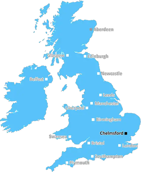
Chelmsford (CM18)
The CM18 postcode area is located in the Chelmsford postcode town region, within the county of Essex, and contains a total of 597 individual postcodes.
There are 6 electoral wards in the CM18 postcode area, including Billericay, Bishops Stortford, Braintree, Brentwood, Burnham-On-Crouch, Chelmsford, Dunmow, Epping, Harlow, Ingatestone, Maldon, Ongar, Sawbridgeworth, Southminster, Stansted, Witham which come under the local authority of the Harlow Council.
Combining the whole postcode region, 13% of people in CM18 are classed as having an AB social grade, (i.e. 'white-collar' middle-upper class), compared to 27% across the UK.
This does not mean that the people of CM18 are poorer than other areas, but it may give an indication that there are areas of deprivation.
The CM18 postcode is in the borough of Chelmsford, within the county of Essex, UK. It is located approximately 22 miles from the administrative centre of Chelmsford city.
The postcode district is centred approximately 6 miles west of the town of Harlow, close to the rivers Lea and Stort. It includes the rural and suburban areas of Barnston, Stacy Green and High Laver, as well as the villages of Matching and Matching Tye. It is also located close to the Grand Union Canal and the M25 motorway.
CM18 covers a wide area, stretching from the eastern edge of Epping Forest to the M25 in the east and from London in the south to the county boundaries of Essex and Hertfordshire.
The majority of properties in the area are detached private houses located in small villages set in wooded countryside and agricultural areas. Recent development has brought modern housing, shops and leisure activities, as well as employment opportunities in the nearby town of Harlow and in London. Schools serving the area include Matching Green, Harlow Hill and High Laver Primary School.
Two of the main businesses in CM18 is a local farm shop, Oak Farm Retail, which runs a cafe and sells a wide range of locally sourced foods and craft beers. The other is Post Office Green, a garden centre, nursery and cafe.
The area is popular with nature lovers, with access to a variety of wildlife including badgers, foxes and deers and several nature reserves dotted in the area. The nearby Stansted Airport, with its many flights to domestic and international destinations, is a short drive away. There is easy access to the M25 and London, as well as easy access to the beautiful countryside of Essex and Suffolk.

Demographics

Essex

CM18 is located in the county of Essex, in England.
Essex has a total population of 1,802,200, making it the 7th largest county in the UK.
Essex has a total area of 1417 square miles, and a population density of 491 people per square kilometre. For comparison, Greater London has a density of 5,618 people/km2.
| Outward Code | CM18 |
| Postal Town | Chelmsford |
| MSOA Name | Harlow 006 |
| LSOA Name | Harlow 006E |
| County | Essex |
| Region | Essex |
| Country | England |
| Local Authority | Harlow |
| Area Classification | Urban with City and Town |
CM18 Electoral Wards
The postal region of CM18, includes the local towns, villages, electoral wards and stations of:
Dig even deeper into the CM18 postcode by clicking on a postcode below:
Click on an outward postal code below for more information about the area. Each 'outward' postcode give you a comprehensive list of all postcodes within the outward code area (CM) and estimated address.
Click on an 'outward' code for more information. For example, the outward postcode page 'EC2M' will give you an alphabetical list covering all postcodes located in the region, from 'EC2M 1BB' through to 'EC2M 7YA'.
Chris H
Monday, April 8, 2024
We don't have any views of CM18 right now. If you live in CM18 or have visited it, please help us to help others by telling others what you think of this neighbourhood.
Add your view of CM18
People need your local expertise. If you live in CM18 or have first-hand knowledge of the neighbourhood, please consider sharing your views. It's completely anonymous - all we ask is for your initials.
Please tell us what you like about the CM18 postcode area, what you don't like, and what it's like to live or work here.
| LOCAL AMENITIES | |
| FAMILY FRIENDLY | |
| PARKING | |
| GREEN SPACES |
Local News Essex
Southend seafront pub among best dog-friendly pubs in Essex
As the weather gets warmer, many of us will be looking forward toenjoying a refreshing cold beer in a pub garden during a sunny afternoon
The EchoTT Group sells Southampton industrial units for 5.7m
The 1.85-acre siteis split into two self-contained units, one let to Sentry Self Storage and the other to Active Freight Management.
Property WeekThe 5 Asda & Tesco product to get rid of bathroom mould
If you have mould in your bathroom, what is the best way to go about removing it?
Daily GazettePeople's Postcode Lottery Essex winners in March 2024
Across Essex, seven postcodes were named among the winners.
The EchoLook back at when flooding in Dedham saw river burst its banks
Floodwater has covered parts of a Colchester village following a yellow weather warning for rain.
Daily GazetteHow to claim 520 & get a refund if your flight is cancelled
With the days getting longer and the weather getting warmer, many of us will already be daydreaming of our summer holiday.
Daily GazettePolice urge public to call 999 'immediately' if they see this man
Police want to speak to the 23-year-old in connection with violent disorder and possession of an offensive weapon
Essex LiveAnaesthetist stole drugs from NHS for 'chemsex'
Jonathon Dean, who looked forward to "playing God with those drugs", is jailed.
BBC NewsFrom the Postcode Area blog

Deciphering Crime Rates - a Deep Dive Into UK Postcode Analysis
Ever wondered about the crime rate in your UK postcode? You're not alone. We've dug deep into the data, uncovering trends and patterns that'll make your head spin.

Death of the High Street?
The BBC reports that despite councils' attempts to kurb them, the UK's high streets have seen a huge growth in fast food outlets. Could this mark the death knell for the Great British high street, and what can we do about it to halt its decline?

Discrimination by Postcode
You really couldn't make it up, could you? Some of the country's most vulnerable people are missing out on their weekly £25 Cold Weather Payment, just because the system that's in operation is discriminating against them because payments are based on postcode, rather than geographic location.

The Redesign is Underway
Well, the current website was absolutely in dire need of a good redesign - from the ground up. So I set out to pull it all apart and get it up and running again to become the most comprehensive guide to every postcode in the UK. And it's been a long, tough job from start to finish - and quite possibly the biggest project I've ever undertaken.
SOCIAL GRADES
According to census records, 13% of people here have a social grade of AB (highest), compared to the national average of 27%.