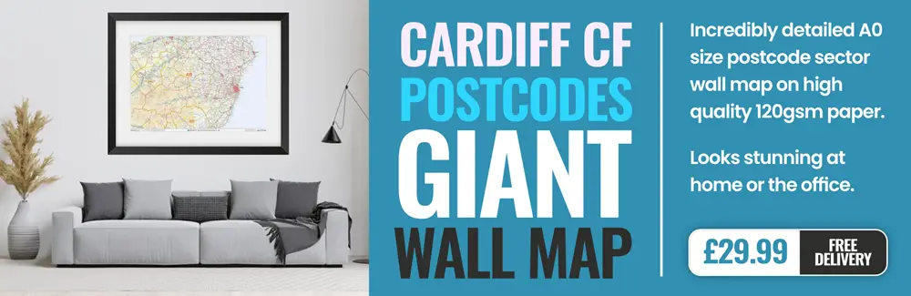
cardiff CF14 Postcodes
Spending a fortune on conveyancing?

Compare instant, low-cost online quotes from trusted conveyancing solicitors.
Backed by experts, our no-obligation service searches through the best conveyancing quotes on the market to save you time and money.
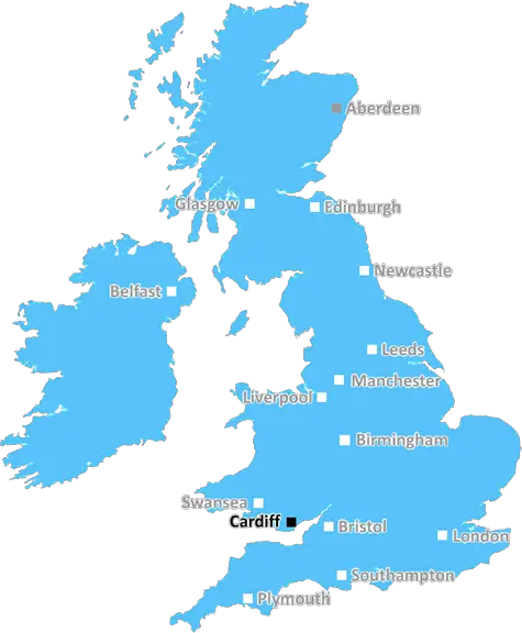
Cardiff (CF14)
The CF14 postcode area is located in the Cardiff postcode town region, within the county of Glamorgan, and contains a total of 2160 individual postcodes.
There are 21 electoral wards in the CF14 postcode area, including Aberdare, Bargoed, Barry, Bridgend, Caerphilly, Cardiff, Cowbridge, Dinas Powys, Ferndale, Hengoed, Llantwit Major, Maesteg, Merthyr Tydfil, Mountain Ash, Penarth, Pentre, Pontyclun, Pontypridd, Porth, Porthcawl, Tonypandy, Treharris, Treorchy which come under the local authority of the Cardiff Council.
Combining the whole postcode region, 33% of people in CF14 are classed as having an AB social grade, (i.e. 'white-collar' middle-upper class), compared to 27% across the UK.
This does not mean that the people of CF14 are wealthier - or higher class - than average, but it can be an indication that the area may be prospering and desirable to live in.
The CF14 postcode includes a large portion of the northwest part of Cardiff in Wales, UK. It covers areas such as Cyncoed, Riverside, Llandaff North, Pentyrch and Danescourt, as well as the Cathedral of St David. The area boasts an impressive range of cultural, educational and leisure facilities, as well as some of the most desirable housing in the city.
The postcode is home to two places of further education, as Cardiff and Vale College and Cardiff Metropolitan University's Cyncoed Campus are both located here. It also boasts St David's College, one of the top schools in Wales.
Cardiff University's Main Building and Cathays Park are both situated in this postcode, and Cathays Park has been declared a Site of Special Scientific Interest. The area houses several historic buildings, including the Grade II* listed Emmanuel Church, Cardiff. It is also home to City Hall, the Welsh National War Memorial, and several parks and nature reserves, such as Forest Farm Nature Reserve, Llandaff Fields Nature Reserve and Radyr Recycling Centre.
For those looking to experience local nightlife, there are plenty of pubs and bars to enjoy. Rugby fans can also watch their team at the Cardiff Arms Park, close by. Retail-wise, the postcode is home to numerous small independent businesses and a few larger stores like Wilko, Iceland and Wilkinsons.
As far as restaurants and caf�s are concerned, there's an array of international options including Italian, Chinese, Indian and Mexican. Prices vary, from cheap favourites like O'neills and Spud-U-Like, to the more luxurious La Colombe, which serves modern French cuisine. Other popular eateries in the area include The Rhiw, Calabrisella and The Potted Pig.
When it comes to transport, Cardiff Queen Street and Cardiff Central are the two closest main line stations, and Cardiff Bus services run throughout the postcode. Cardiff International Airport is also located nearby for those who are looking to travel further afield.

Demographics
Glamorgan

CF14 is located in the county of Glamorgan, in Wales.
Glamorgan has a total population of 0, making it the largest county in the UK.
Glamorgan has a total area of square miles, and a population density of people per square kilometre. For comparison, Greater London has a density of 5,618 people/km2.
| Outward Code | CF14 |
| Postal Town | Cardiff |
| MSOA Name | Cardiff 001 |
| LSOA Name | Cardiff 001B |
| County | Glamorgan |
| Region | Glamorgan |
| Country | Wales |
| Local Authority | Cardiff |
| Area Classification | Unclassified |
CF14 Electoral Wards
The postal region of CF14, includes the local towns, villages, electoral wards and stations of:
Dig even deeper into the CF14 postcode by clicking on a postcode below:
Click on an outward postal code below for more information about the area. Each 'outward' postcode give you a comprehensive list of all postcodes within the outward code area (CF) and estimated address.
Click on an 'outward' code for more information. For example, the outward postcode page 'EC2M' will give you an alphabetical list covering all postcodes located in the region, from 'EC2M 1BB' through to 'EC2M 7YA'.
Chris H
Sunday, April 7, 2024
We don't have any views of CF14 right now. If you live in CF14 or have visited it, please help us to help others by telling others what you think of this neighbourhood.
Add your view of CF14
People need your local expertise. If you live in CF14 or have first-hand knowledge of the neighbourhood, please consider sharing your views. It's completely anonymous - all we ask is for your initials.
Please tell us what you like about the CF14 postcode area, what you don't like, and what it's like to live or work here.
| LOCAL AMENITIES | |
| FAMILY FRIENDLY | |
| PARKING | |
| GREEN SPACES |
From the Postcode Area blog

Deciphering Crime Rates - a Deep Dive Into UK Postcode Analysis
Ever wondered about the crime rate in your UK postcode? You're not alone. We've dug deep into the data, uncovering trends and patterns that'll make your head spin.

Death of the High Street?
The BBC reports that despite councils' attempts to kurb them, the UK's high streets have seen a huge growth in fast food outlets. Could this mark the death knell for the Great British high street, and what can we do about it to halt its decline?

Discrimination by Postcode
You really couldn't make it up, could you? Some of the country's most vulnerable people are missing out on their weekly £25 Cold Weather Payment, just because the system that's in operation is discriminating against them because payments are based on postcode, rather than geographic location.

The Redesign is Underway
Well, the current website was absolutely in dire need of a good redesign - from the ground up. So I set out to pull it all apart and get it up and running again to become the most comprehensive guide to every postcode in the UK. And it's been a long, tough job from start to finish - and quite possibly the biggest project I've ever undertaken.
SOCIAL GRADES
According to census records, 33% of people here have a social grade of AB (highest), compared to the national average of 27%.