canterbury CT18 Postcodes
Spending a fortune on conveyancing?

Compare instant, low-cost online quotes from trusted conveyancing solicitors.
Backed by experts, our no-obligation service searches through the best conveyancing quotes on the market to save you time and money.
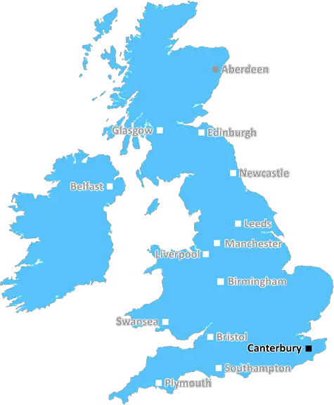
Canterbury (CT18)
The CT18 postcode area is located in the Canterbury postcode town region, within the county of Kent, and contains a total of 494 individual postcodes.
There are 45 electoral wards in the CT18 postcode area, including Birchington, Broadstairs, Canterbury, Deal, Dover, Folkestone, Herne Bay, Hythe, Margate, Ramsgate, Sandwich, Westgate-On-Sea, Whitstable which come under the local authority of the Shepway Council.
Combining the whole postcode region, 22% of people in CT18 are classed as having an AB social grade, (i.e. 'white-collar' middle-upper class), compared to 27% across the UK.
This does not mean that the people of CT18 are poorer than other areas, but it may give an indication that there are areas of deprivation.
CT18 is a postcode district in the Canterbury district of Kent. It is located in a long, narrow strip on the south east coast and stretches from Folkestone, in the east, to West Hythe in the west. It is bordered by postcode districts CT17, CT21, CT15 and TN28.
The town of Folkestone is the most populated town within the CT18 postcode district, with an estimated population of approximately 50,000. Other towns and villages in the area include Hythe, Capel-Le-Ferne and Dymchurch.
The postcode covers some of the most stunning scenery and popular tourist destinations in the area including The Leas, Camber Sands and Dymchurch Promenade. It is also home to the iconic Martello Towers, located along the coastline.
The area is made up of primarily residential properties, with a mix of detached, semi-detached and terraced homes, as well as several high-rise apartment blocks in central Folkestone. There are many shops, restaurants and other amenities located in the postcode, making it a popular area for tourists.
The postcode district is also home to a number of local schools, including primary and secondary schools as well as Folkestone Sports College and Highfield College. There are a number of churches located in the area, both traditional and non-denominational.
The economy of the postcode is largely based on tourism and retail, with other industries including light industrial, construction and finance. The area is serviced by the M20 motorway, HS1 high-speed rail line and Eurotunnel.
The climate of the postcode is characterised by mild winters and warm summers, and it is one of the sunniest areas in the country. The area is prone to coastal erosion but the local council is taking steps to prevent damaging the beautiful coastline.

Demographics

Kent

CT18 is located in the county of Kent, in England.
Kent has a total population of 1,820,400, making it the 6th largest county in the UK.
Kent has a total area of 1443 square miles, and a population density of 486 people per square kilometre. For comparison, Greater London has a density of 5,618 people/km2.
| Outward Code | CT18 |
| Postal Town | Canterbury |
| MSOA Name | Shepway 003 |
| LSOA Name | Shepway 003A |
| County | Kent |
| Region | Kent |
| Country | England |
| Local Authority | Shepway |
| Area Classification | Urban with Significant Rural (rural including hub towns 26-49%) |
CT18 Electoral Wards
The postal region of CT18, includes the local towns, villages, electoral wards and stations of:
Dig even deeper into the CT18 postcode by clicking on a postcode below:
Click on an outward postal code below for more information about the area. Each 'outward' postcode give you a comprehensive list of all postcodes within the outward code area (CT) and estimated address.
Click on an 'outward' code for more information. For example, the outward postcode page 'EC2M' will give you an alphabetical list covering all postcodes located in the region, from 'EC2M 1BB' through to 'EC2M 7YA'.
Chris H
Friday, April 12, 2024
We don't have any views of CT18 right now. If you live in CT18 or have visited it, please help us to help others by telling others what you think of this neighbourhood.
Add your view of CT18
People need your local expertise. If you live in CT18 or have first-hand knowledge of the neighbourhood, please consider sharing your views. It's completely anonymous - all we ask is for your initials.
Please tell us what you like about the CT18 postcode area, what you don't like, and what it's like to live or work here.
| LOCAL AMENITIES | |
| FAMILY FRIENDLY | |
| PARKING | |
| GREEN SPACES |
Local News Kent
Regal London signs Epson UK for 30,000 sq ft pre-let at Watford scheme
The grade-A The Clarendon Works office scheme will open in Q3.
Property WeekWork starts on new Tesco store
A supermarket chain is set to open another branch by the end of the year with the store currently under construction.
Kent OnlineEdmond de Rothschild REIM acquires Newbury resi scheme for 34m
The affordable housing project has already seen the development of almost 120 new homes.
Property WeekPictures show massive' fire in town
Plumes of smoke billowed across a town after a fire broke out this evening.
Kent OnlineMixed-use London freehold to lead Allsop's March residential auction
Thefreeholdbuilding in Hampstead is guided at 2.5m-plus.
Property WeekRecognition for double amputee who climbed Everest
Hari Budha Magar is presented with a certificate from Guinness World Records for his achievement.
BBC NewsStarbucks partner signs lease at Prologis Park Hemel Hempstead
Food Service Logisticshas agreed a 15-year lease at the161,134 sq ftdistribution centre.
Property WeekMirabaud buys Virgin Atlantic HQ in UK debut
Swiss investor snaps up grade-A office scheme let to Virgin Atlantic until 2032.
Property WeekFrom the Postcode Area blog

Deciphering Crime Rates - a Deep Dive Into UK Postcode Analysis
Ever wondered about the crime rate in your UK postcode? You're not alone. We've dug deep into the data, uncovering trends and patterns that'll make your head spin.

Death of the High Street?
The BBC reports that despite councils' attempts to kurb them, the UK's high streets have seen a huge growth in fast food outlets. Could this mark the death knell for the Great British high street, and what can we do about it to halt its decline?

Discrimination by Postcode
You really couldn't make it up, could you? Some of the country's most vulnerable people are missing out on their weekly £25 Cold Weather Payment, just because the system that's in operation is discriminating against them because payments are based on postcode, rather than geographic location.

The Redesign is Underway
Well, the current website was absolutely in dire need of a good redesign - from the ground up. So I set out to pull it all apart and get it up and running again to become the most comprehensive guide to every postcode in the UK. And it's been a long, tough job from start to finish - and quite possibly the biggest project I've ever undertaken.
SOCIAL GRADES
According to census records, 22% of people here have a social grade of AB (highest), compared to the national average of 27%.