bristol BS5 Postcodes
Spending a fortune on conveyancing?

Compare instant, low-cost online quotes from trusted conveyancing solicitors.
Backed by experts, our no-obligation service searches through the best conveyancing quotes on the market to save you time and money.
Bristol (BS5)
The BS5 postcode area is located in the Bristol postcode town region, within the county of Avon, and contains a total of 1490 individual postcodes.
There are 13 electoral wards in the BS5 postcode area, including Axbridge, Banwell, Bristol, Cheddar, Clevedon, Wedmore, Weston-Super-Mare, Winscombe which come under the local authority of the Bristol, City of Council.
Combining the whole postcode region, 17% of people in BS5 are classed as having an AB social grade, (i.e. 'white-collar' middle-upper class), compared to 27% across the UK.
This does not mean that the people of BS5 are poorer than other areas, but it may give an indication that there are areas of deprivation.
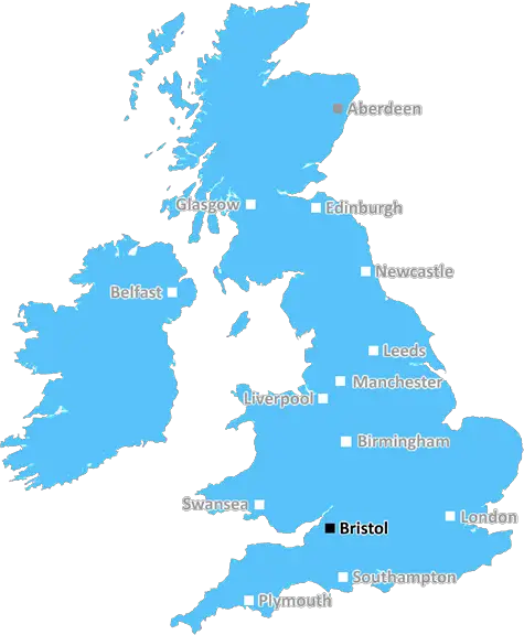
The BS5 postcode area is located in and around the city of Bristol, which is the largest city in the South West of England. It covers the area of St Pauls, Redfield, Easton, and St Philips, all of which are located in the east side of the city.
BS5 is a popular residential area, and houses are highly sought after due to its proximity to a wealth of amenities. It is a multicultural area, with a range of shops, places of worship, and cultural activities. It is home to some of Bristol's most vibrant cultural hotspots, such as the community centre in St Pauls, and is host to some of the city's best-loved cultural events, such as the St Pauls Carnival.
The area is well connected, with several bus routes running through it, as well as two major train stations in the vicinity, Montpelier train station and St Philips rail station. It is also a short drive or bus ride from Bristol's main transport hub, Bristol Temple Meads, enabling commuters to access the rest of the city with ease.
The area is home to a number of schools, including Fairfield High School, as well as a number of parks and green spaces, including St George's Park, Easton Cowpers, and Eastville Park. The area is also home to the famous The Arches, which is a large entertainment and music venue.
There are also several medical facilities located in the area, including a police station and Bristol Royal Infirmary, as well as a number of shops, bars, and restaurants.
The BS5 postcode area is an ideal area for families and individuals looking for a vibrant, safe place to live and work. Its close proximity to culture, transport links, and amenities make it an ideal base from which to explore Bristol and the wider region.

Demographics

Avon

BS5 is located in the county of Avon, in England.
Avon has a total population of 0, making it the largest county in the UK.
Avon has a total area of square miles, and a population density of people per square kilometre. For comparison, Greater London has a density of 5,618 people/km2.
| Outward Code | BS5 |
| Postal Town | Bristol |
| MSOA Name | Bristol 056 |
| LSOA Name | Bristol 056C |
| County | Avon |
| Region | Avon |
| Country | England |
| Local Authority | Bristol, City of |
| Area Classification | Urban with City and Town |
BS5 Electoral Wards
The postal region of BS5, includes the local towns, villages, electoral wards and stations of:
Dig even deeper into the BS5 postcode by clicking on a postcode below:
Click on an outward postal code below for more information about the area. Each 'outward' postcode give you a comprehensive list of all postcodes within the outward code area (BS) and estimated address.
Click on an 'outward' code for more information. For example, the outward postcode page 'EC2M' will give you an alphabetical list covering all postcodes located in the region, from 'EC2M 1BB' through to 'EC2M 7YA'.
SV, Bristol
Wednesday, October 4, 2023
it’s ghetto we beef the 2s (st paul’s) gang violence drugs poverty
Add your view of BS5
People need your local expertise. If you live in BS5 or have first-hand knowledge of the neighbourhood, please consider sharing your views. It's completely anonymous - all we ask is for your initials.
Please tell us what you like about the BS5 postcode area, what you don't like, and what it's like to live or work here.
| LOCAL AMENITIES | |
| FAMILY FRIENDLY | |
| PARKING | |
| GREEN SPACES |
Local News Gloucestershire
Jones and Lewis extend Gloucester-Hartpury deals
Ireland and Wales internationals Neve Jones and Bethan Lewis sign new deals to stay with Gloucester-Hartpury, along with Carmen Castelluci.
BBC NewsCan Surrey be beaten as County Championship returns?
With the new County Championship season starting on Friday, can anyone prevent Surrey winning a third straight title?
BBC NewsTalks ongoing to ban coaches in Cotswolds village
Local firms are worried they will forfeit "millions" in sales if a coach ban is introduced.
BBC NewsWarning ahead of fresh round of train strikes
Passengers told to plan ahead as rail and underground services to be hit by weekend walkouts.
BBC NewsDay one of County Championship season hit by rain
Day one of the County Championship season sees play abandoned at Derbyshire, Durham, Lancashire and Kent without a ball bowled.
BBC NewsRecord sewage spills in county - Environment Agency
Storm overflows spilled for thousands of hours into rivers across the county in 2023, data shows.
BBC NewsRoad closed after elderly woman hit by car
A woman is being treated for serious injuries after being struck by a car in Lechlade.
BBC NewsRise in abuse towards councillors 'has to stop'
A Gloucester councillor said he had received death threats over leisure centre closures.
BBC NewsFrom the Postcode Area blog

Deciphering Crime Rates - a Deep Dive Into UK Postcode Analysis
Ever wondered about the crime rate in your UK postcode? You're not alone. We've dug deep into the data, uncovering trends and patterns that'll make your head spin.

Death of the High Street?
The BBC reports that despite councils' attempts to kurb them, the UK's high streets have seen a huge growth in fast food outlets. Could this mark the death knell for the Great British high street, and what can we do about it to halt its decline?

Discrimination by Postcode
You really couldn't make it up, could you? Some of the country's most vulnerable people are missing out on their weekly £25 Cold Weather Payment, just because the system that's in operation is discriminating against them because payments are based on postcode, rather than geographic location.

The Redesign is Underway
Well, the current website was absolutely in dire need of a good redesign - from the ground up. So I set out to pull it all apart and get it up and running again to become the most comprehensive guide to every postcode in the UK. And it's been a long, tough job from start to finish - and quite possibly the biggest project I've ever undertaken.
SOCIAL GRADES
According to census records, 17% of people here have a social grade of AB (highest), compared to the national average of 27%.