bristol BS10 Postcodes
Spending a fortune on conveyancing?

Compare instant, low-cost online quotes from trusted conveyancing solicitors.
Backed by experts, our no-obligation service searches through the best conveyancing quotes on the market to save you time and money.
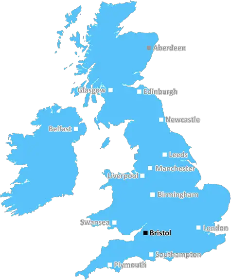
Bristol (BS10)
The BS10 postcode area is located in the Bristol postcode town region, within the county of Avon, and contains a total of 866 individual postcodes.
There are 19 electoral wards in the BS10 postcode area, including Axbridge, Banwell, Bristol, Cheddar, Clevedon, Wedmore, Weston-Super-Mare, Winscombe which come under the local authority of the Bristol, City of Council.
Combining the whole postcode region, 22% of people in BS10 are classed as having an AB social grade, (i.e. 'white-collar' middle-upper class), compared to 27% across the UK.
This does not mean that the people of BS10 are poorer than other areas, but it may give an indication that there are areas of deprivation.
BS10 is a postcode which lies in the south-west of Bristol city centre. It is an inner-city area which is close to shops, restaurants, and services such as hospitals and universities. It is bisected by two major routes � High Street and Whiteladies Road, allowing easy access to the city's rich cultural amenities.
The BS10 locality is home to numerous communities ranging from professionals to students, and also to a number of parks and open spaces. As such, the postcode offers an ideal balance between a vibrant city lifestyle and the peace and quiet of a neighbourhood. It is also well connected by regular buses and trains, making it easy to reach other locations in and around Bristol.
As far as educational institutions are concerned, BS10 has a good choice for families. It is home to eight primary schools, four secondary schools, two universities and one college, giving the postcode plenty of educational choices. Furthermore, much of the educational institutions in BS10 are 'outstanding', according to Ofsted.
Due to its close proximity to the city centre, BS10 enjoys easy access to many entertainment venues, restaurants, and other related amenities. Notable venues in the area include the Bristol Hippodrome Theatre, the Watershed Cinema, the Tobacco Factory, and the Brislington Hill. Quaint, independent pubs, cafes and restaurants such as The Grape & Grind, The Old Duke and The Earl of Suffolk, add to the vibrant atmosphere of the postcode.
Sports and recreation facilities are plentiful in the area as well. The Avon Community Stadium, home to Bristol Rovers F.C., is a prominent feature of the locality. Similarly, the Broadwalk Shopping Centre is close by and offers a variety of shops. Amongst some of the other leisure venues in BS10 are the Leckhampton Lane Park, Golden Hill Sports Centre and the Brislington Park.
Lifestyle amenities in the area are completed by the presence of two major hospitals - Southmead and the University Hospitals Bristol NHS Foundation Trust. The Southmead hospital in particular has long been an important landmark in the locality.
Notably, the postcode has traditionally had a comforting sense of safety and community spirit. This has enabled residents to make lifelong friends and colleagues, allowing for the postcode to remain family-oriented and friendly.

Demographics

Avon

BS10 is located in the county of Avon, in England.
Avon has a total population of 0, making it the largest county in the UK.
Avon has a total area of square miles, and a population density of people per square kilometre. For comparison, Greater London has a density of 5,618 people/km2.
| Outward Code | BS10 |
| Postal Town | Bristol |
| MSOA Name | Bristol 004 |
| LSOA Name | Bristol 004C |
| County | Avon |
| Region | Avon |
| Country | England |
| Local Authority | Bristol, City of |
| Area Classification | Urban with City and Town |
BS10 Electoral Wards
The postal region of BS10, includes the local towns, villages, electoral wards and stations of:
Dig even deeper into the BS10 postcode by clicking on a postcode below:
Click on an outward postal code below for more information about the area. Each 'outward' postcode give you a comprehensive list of all postcodes within the outward code area (BS) and estimated address.
Click on an 'outward' code for more information. For example, the outward postcode page 'EC2M' will give you an alphabetical list covering all postcodes located in the region, from 'EC2M 1BB' through to 'EC2M 7YA'.
Chris H
Saturday, April 6, 2024
We don't have any views of BS10 right now. If you live in BS10 or have visited it, please help us to help others by telling others what you think of this neighbourhood.
Add your view of BS10
People need your local expertise. If you live in BS10 or have first-hand knowledge of the neighbourhood, please consider sharing your views. It's completely anonymous - all we ask is for your initials.
Please tell us what you like about the BS10 postcode area, what you don't like, and what it's like to live or work here.
| LOCAL AMENITIES | |
| FAMILY FRIENDLY | |
| PARKING | |
| GREEN SPACES |
Local News Gloucestershire
Day one of County Championship season hit by rain
Day one of the County Championship season sees play abandoned at Derbyshire, Durham, Lancashire and Kent without a ball bowled.
BBC NewsHarlequins edge Glasgow in thriller to reach Champions Cup quarter-finals
Harlequins edge Glasgow 28-24 to reach Champions Cup quarter-finals while Gloucester see off Castres in the Challenge Cup.
BBC NewsTalks ongoing to ban coaches in Cotswolds village
Local firms are worried they will forfeit "millions" in sales if a coach ban is introduced.
BBC NewsWitness sought after dog killed by cyclist in park
A chihuahua was killed instantly in a park while it was off lead alongside a path, police said.
BBC NewsResidents oppose plans at stone crushing site
The firm Allstone wants to expand but residents say it could increase dust and noise levels.
BBC NewsWarning ahead of fresh round of train strikes
Passengers told to plan ahead as rail and underground services to be hit by weekend walkouts.
BBC NewsQuarry to increase exports despite dust concerns
Residents say they "cannot open their windows nor sit in their gardens" due to the dust levels.
BBC NewsProtected bird dies after being shot with air rifle
Gloucestershire Police are investigating after a goshawk was killed in the Forest of Dean.
BBC NewsFrom the Postcode Area blog

Deciphering Crime Rates - a Deep Dive Into UK Postcode Analysis
Ever wondered about the crime rate in your UK postcode? You're not alone. We've dug deep into the data, uncovering trends and patterns that'll make your head spin.

Death of the High Street?
The BBC reports that despite councils' attempts to kurb them, the UK's high streets have seen a huge growth in fast food outlets. Could this mark the death knell for the Great British high street, and what can we do about it to halt its decline?

Discrimination by Postcode
You really couldn't make it up, could you? Some of the country's most vulnerable people are missing out on their weekly £25 Cold Weather Payment, just because the system that's in operation is discriminating against them because payments are based on postcode, rather than geographic location.

The Redesign is Underway
Well, the current website was absolutely in dire need of a good redesign - from the ground up. So I set out to pull it all apart and get it up and running again to become the most comprehensive guide to every postcode in the UK. And it's been a long, tough job from start to finish - and quite possibly the biggest project I've ever undertaken.
SOCIAL GRADES
According to census records, 22% of people here have a social grade of AB (highest), compared to the national average of 27%.