brighton BN27 Postcodes
Spending a fortune on conveyancing?

Compare instant, low-cost online quotes from trusted conveyancing solicitors.
Backed by experts, our no-obligation service searches through the best conveyancing quotes on the market to save you time and money.
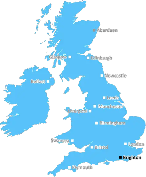
Brighton (BN27)
The BN27 postcode area is located in the Brighton postcode town region, within the county of East Sussex, and contains a total of 1311 individual postcodes.
There are 58 electoral wards in the BN27 postcode area, including Arundel, Brighton, Eastbourne, Hailsham, Hassocks, Henfield, Hove, Lancing, Lewes, Littlehampton, Newhaven, Peacehaven, Pevensey, Polegate, Seaford, Shoreham-By-Sea, Steyning, Worthing which come under the local authority of the Wealden Council.
Combining the whole postcode region, 22% of people in BN27 are classed as having an AB social grade, (i.e. 'white-collar' middle-upper class), compared to 27% across the UK.
This does not mean that the people of BN27 are poorer than other areas, but it may give an indication that there are areas of deprivation.
BN27 is a postcode district in the Brighton and Hove post town of East Sussex, England. It covers an area primarily in and around the towns of Lindfield and Haywards Heath, and includes outlying villages including Horsted Keynes, Ardingly, Balcome and Cuckfield. The local area code is 01444.
The BN27 postcode lies in the hilly mid-Sussex region, comprising the Weald and the High Weald. It is situated on the northern edge of the Ashdown Forest, a popular area for walking and horse riding. There are also a few sites of special scientific interest located within the boundaries of BN27.
The area is served by two railway lines and one bus service, with direct links to London, Brighton and Gatwick Airport. Other nearby transportation links include the M23 motorway and A23 road. The area is very well connected.
The district covers a wide range of postcodes, ranging from BN22 in the north to BN26 in the south, and includes both rural and urban areas. The urban areas have shops and other local amenities, while the rural areas offer many opportunities for outdoor activities and leisure.
BN27 is also home to several schools and colleges, including Cumnor House, Ardingley College, Lindfield Primary and Haywards Heath College, as well as a central library and leisure centre.
The area also contains a variety of attractions, including the Dewey Museum, the Ashdown Forest Centre and the Ardingly reservoir. The BN27 postcode is home to numerous leisure parks, country parks and nature reserves, providing an array of outdoor activities and experiences.
Residents benefit from numerous cultural and sports clubs, such as the Lindfield Arts Club, Haywards Heath Hockey Club and Wallrunners Basketball Club, as well as a wide array of outdoor activities, including aerobics, cricket and cycling. The stunning countryside makes BN27 the perfect place for a plethora of recreational activities, such as fishing and cycling.

Demographics

East Sussex

BN27 is located in the county of East Sussex, in England.
East Sussex has a total population of 837,000, making it the 29th largest county in the UK.
East Sussex has a total area of 692 square miles, and a population density of 467 people per square kilometre. For comparison, Greater London has a density of 5,618 people/km2.
| Outward Code | BN27 |
| Postal Town | Brighton |
| MSOA Name | Wealden 015 |
| LSOA Name | Wealden 015D |
| County | East Sussex |
| Region | East Sussex |
| Country | England |
| Local Authority | Wealden |
| Area Classification | Mainly Rural (rural including hub towns >=80%) |
BN27 Electoral Wards
The postal region of BN27, includes the local towns, villages, electoral wards and stations of:
Dig even deeper into the BN27 postcode by clicking on a postcode below:
Click on an outward postal code below for more information about the area. Each 'outward' postcode give you a comprehensive list of all postcodes within the outward code area (BN) and estimated address.
Click on an 'outward' code for more information. For example, the outward postcode page 'EC2M' will give you an alphabetical list covering all postcodes located in the region, from 'EC2M 1BB' through to 'EC2M 7YA'.
Chris H
Tuesday, April 9, 2024
We don't have any views of BN27 right now. If you live in BN27 or have visited it, please help us to help others by telling others what you think of this neighbourhood.
Add your view of BN27
People need your local expertise. If you live in BN27 or have first-hand knowledge of the neighbourhood, please consider sharing your views. It's completely anonymous - all we ask is for your initials.
Please tell us what you like about the BN27 postcode area, what you don't like, and what it's like to live or work here.
| LOCAL AMENITIES | |
| FAMILY FRIENDLY | |
| PARKING | |
| GREEN SPACES |
Local News Sussex
Critical incident at hospital stood down
Visiting at Chichester's St Richard's Hospital remains suspended following a norovirus outbreak.
BBC NewsNorthants hang on to deny Sussex an opening win
Northamptonshire, and bad light, deny Sussex an opening County Championship Division Two victory at Hove.
BBC News'Hardest Geezer' Cook completes run across Africa
Almost one year after starting, Russ Cook - more widely known as the Hardest Geezer - completes his challenge to run the length of Africa.
BBC NewsCharity making memories for sick children on stage
Forward Facing organises an event at Brighton Dome for children with life-limiting conditions.
BBC NewsFormer Brighton player Kinnear dies aged 77
Former Wimbledon and Newcastle United manager Joe Kinnear dies at the age of 77, his family announces.
BBC NewsProcter leads Northants batting effort at Sussex
Northamptonshire battle to 292-7 on the second day of their County Championship game against Sussex.
BBC NewsPolice officer denies hotel room sex attack
Sussex PC Daniel Julian is on trial accused of trying to rape female police officer in a hotel room.
BBC NewsArsenal beat Brighton to move top of Premier League
Arsenal maintained their pursuit of a first Premier League title for 20 years as they moved top of the table with an impressive away victory over Brighton.
BBC NewsFrom the Postcode Area blog

Deciphering Crime Rates - a Deep Dive Into UK Postcode Analysis
Ever wondered about the crime rate in your UK postcode? You're not alone. We've dug deep into the data, uncovering trends and patterns that'll make your head spin.

Death of the High Street?
The BBC reports that despite councils' attempts to kurb them, the UK's high streets have seen a huge growth in fast food outlets. Could this mark the death knell for the Great British high street, and what can we do about it to halt its decline?

Discrimination by Postcode
You really couldn't make it up, could you? Some of the country's most vulnerable people are missing out on their weekly £25 Cold Weather Payment, just because the system that's in operation is discriminating against them because payments are based on postcode, rather than geographic location.

The Redesign is Underway
Well, the current website was absolutely in dire need of a good redesign - from the ground up. So I set out to pull it all apart and get it up and running again to become the most comprehensive guide to every postcode in the UK. And it's been a long, tough job from start to finish - and quite possibly the biggest project I've ever undertaken.
SOCIAL GRADES
According to census records, 22% of people here have a social grade of AB (highest), compared to the national average of 27%.