bath BA12 Postcodes
Spending a fortune on conveyancing?

Compare instant, low-cost online quotes from trusted conveyancing solicitors.
Backed by experts, our no-obligation service searches through the best conveyancing quotes on the market to save you time and money.
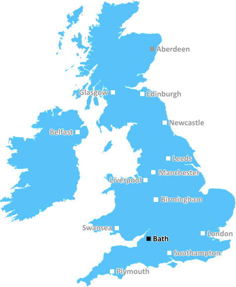
Bath (BA12)
The BA12 postcode area is located in the Bath postcode town region, within the county of Wiltshire, and contains a total of 1322 individual postcodes.
There are 150 electoral wards in the BA12 postcode area, including Bath, Bradford-On-Avon, Bruton, Castle Cary, Frome, Glastonbury, Radstock, Shepton Mallet, Street, Templecombe, Trowbridge, Warminster, Wells, Westbury, Wincanton, Yeovil which come under the local authority of the Wiltshire Council.
Combining the whole postcode region, 23% of people in BA12 are classed as having an AB social grade, (i.e. 'white-collar' middle-upper class), compared to 27% across the UK.
This does not mean that the people of BA12 are poorer than other areas, but it may give an indication that there are areas of deprivation.
The BA12 postcode area is a geographical district located in the region of Somerset, South West England. It includes the villages of Warminster, Codford, Sutton Veny, Longbridge Deverill, Upton Scudamore, Heytesbury, Westbury, Southwick, Standerwick, Norton Bavant, Trowle, and Crockerton.
Generation of postcodes began in the mid-1960s to help the sorting of mail and enable efficient delivery. The postcode assigned to Bath is BA12, with the first two letters representing Bath's postal district. BA12 is a 'combined postcode', which means it covers a larger area than a single delivery office, and may include multiple districts with a single postcode label.
The Bath district of BA12 is home to a variety of cultural and natural attractions. Warminster in BA12, for example, is a market town with its own visitor centre and historic features, such as medieval buildings and a parish church with parts dating back to the 12th century. Sutton Veny is an attractive village with picturesque cottages, and Longbridge Deverill is home to a 17th century manor house.
Upton Scudamore, located in BA12, is a former Royal Air Force station turned into a nature reserve. Featuring grass land, wetlands, and ancient woodlands, it is an important site for local wildlife, providing habitat and shelter for a number of species, including dragonflies, orange-tip butterflies, warblers, and lapwings.
Southwick, a village located in the BA12 postcode district, sits on the River Wylye and is home to an ancient hill fort, which is believed to be the site of an Iron Age fort and is now a Scheduled Ancient Monument.
Codford, also located in BA12, is a village with long rural history and many buildings of historic interest, including a church with parts dating back to the 12th century. On the outskirts of the village is a Theere is a memorial to the Battle of the Somme, which happened during World War I.
Standerwick in BA12 is a village making the most of its picturesque countryside setting. The village is close to Longleat, an estate boasting attractions such as a safari park and adventure theme park.
Westbury, located in the BA12 postcode district, is a picturesque village in the beautiful Wylye Valley, known for its 15th century church and attractive countryside. It is also home to Hawk's Close Nature Reserve, a delightful wood with wild flower meadows, and is an attractive spot for birdwatchers.
Finally, the BA12 postcode area includes the village of Trowle, which is situated in a valley containing an Iron Age hill fort known as Penn Hill. It also offers a variety of public footpaths, perfect for exploring the area's rolling hills.

Demographics
Wiltshire

BA12 is located in the county of Wiltshire, in England.
Wiltshire has a total population of 706,300, making it the 34th largest county in the UK.
Wiltshire has a total area of 1346 square miles, and a population density of 202 people per square kilometre. For comparison, Greater London has a density of 5,618 people/km2.
| Outward Code | BA12 |
| Postal Town | Bath |
| MSOA Name | Wiltshire 042 |
| LSOA Name | Wiltshire 042D |
| County | Wiltshire |
| Region | Wiltshire |
| Country | England |
| Local Authority | Wiltshire |
| Area Classification | Largely Rural (rural including hub towns 50-79%) |
BA12 Electoral Wards
The postal region of BA12, includes the local towns, villages, electoral wards and stations of:
Dig even deeper into the BA12 postcode by clicking on a postcode below:
Click on an outward postal code below for more information about the area. Each 'outward' postcode give you a comprehensive list of all postcodes within the outward code area (BA) and estimated address.
Click on an 'outward' code for more information. For example, the outward postcode page 'EC2M' will give you an alphabetical list covering all postcodes located in the region, from 'EC2M 1BB' through to 'EC2M 7YA'.
Chris H
Sunday, April 7, 2024
We don't have any views of BA12 right now. If you live in BA12 or have visited it, please help us to help others by telling others what you think of this neighbourhood.
Add your view of BA12
People need your local expertise. If you live in BA12 or have first-hand knowledge of the neighbourhood, please consider sharing your views. It's completely anonymous - all we ask is for your initials.
Please tell us what you like about the BA12 postcode area, what you don't like, and what it's like to live or work here.
| LOCAL AMENITIES | |
| FAMILY FRIENDLY | |
| PARKING | |
| GREEN SPACES |
Local News Wiltshire
Police witness appeal after suspected arson
Police would like to speak to anyone with information regarding a fire at a derelict cottage.
BBC NewsExhibition with photo from Led Zeppelin album opens
The original Victorian photograph behind the album artwork of Led Zeppelin IV goes on display.
BBC NewsEmpty town centre bar to be redeveloped
Planners give permission for the former nightspot to become shops and flats.
BBC NewsWhy are some people anti-plans for Lime Down Solar Park?
A 2,000 acre solar farm is proposed to stretch across countryside in several Wiltshire villages.
BBC NewsDriver disqualified after erratic motorway driving
Ion Tintiuc was arrested by police at his home in Swindon after being reported by a member of the public for "swerving all over the road".
BBC NewsSwindon Town 2-1 Notts County
Swindon break a four-match winless streak as they beat Notts County thanks to two pieces of comedic defending.
BBC NewsUkrainians risking air strikes to see a dentist
Natalia Nehriba returned to Ukraine despite the ongoing war after being left in "excruciating" pain.
BBC NewsMan charged with rape in town centre
Prinse Kessie was remanded in custody until 3 May when he will appear at Swindon Crown Court.
BBC NewsFrom the Postcode Area blog

Deciphering Crime Rates - a Deep Dive Into UK Postcode Analysis
Ever wondered about the crime rate in your UK postcode? You're not alone. We've dug deep into the data, uncovering trends and patterns that'll make your head spin.

Death of the High Street?
The BBC reports that despite councils' attempts to kurb them, the UK's high streets have seen a huge growth in fast food outlets. Could this mark the death knell for the Great British high street, and what can we do about it to halt its decline?

Discrimination by Postcode
You really couldn't make it up, could you? Some of the country's most vulnerable people are missing out on their weekly £25 Cold Weather Payment, just because the system that's in operation is discriminating against them because payments are based on postcode, rather than geographic location.

The Redesign is Underway
Well, the current website was absolutely in dire need of a good redesign - from the ground up. So I set out to pull it all apart and get it up and running again to become the most comprehensive guide to every postcode in the UK. And it's been a long, tough job from start to finish - and quite possibly the biggest project I've ever undertaken.
SOCIAL GRADES
According to census records, 23% of people here have a social grade of AB (highest), compared to the national average of 27%.