worcester WR8 Postcodes
Spending a fortune on conveyancing?

Compare instant, low-cost online quotes from trusted conveyancing solicitors.
Backed by experts, our no-obligation service searches through the best conveyancing quotes on the market to save you time and money.
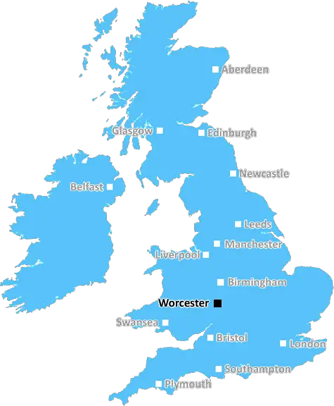
Worcester (WR8)
The WR8 postcode area is located in the Worcester postcode town region, within the county of Worcestershire, and contains a total of 421 individual postcodes.
There are 78 electoral wards in the WR8 postcode area, including Broadway, Droitwich, Evesham, Malvern, Pershore, Tenbury Wells, Worcester which come under the local authority of the Malvern Hills Council.
Combining the whole postcode region, 31% of people in WR8 are classed as having an AB social grade, (i.e. 'white-collar' middle-upper class), compared to 27% across the UK.
This does not mean that the people of WR8 are wealthier - or higher class - than average, but it can be an indication that the area may be prospering and desirable to live in.
The WR8 postcode in the Worcester district of the United Kingdom is a postal code that covers small villages and some rural areas in the South-West of Worcestershire. The postcode follows roughly a North-South line from Wychbold in the North to Romsley in the South and an East-West line from Crowle in the East to Astley in the West.
The WR8 postcode includes numerous villages and hamlets such as Wychbold, Hallow, Tibberton, Spetchley, Knighton-on-Teme, Holdfast, The Combes, Stoke Prior, Holt Fleet, Franche, Astley Cross, Pendock, Stoulton, Alfrick Pound, Rochford, and Romsley. Much of the area is rural and boasts stunning views across the adjacent River Severn.
The WR8 postcode serves to identify the seven electoral divisions of Worcester (Abbey, Barbourne, Bedwardine, Cathedral, Moor, Nunnery and St. John) which all have different geography and population sizes. These divisions have different levels of representation in the County Council, with some having larger voting blocks than others.
The WR8 postcode area is served extensively by a number of First and West Midlands buses, ensuring excellent access to nearby towns, cities and other attractions in the Warwickshire and Worcestershire areas. The postcode also boasts three railway stations � Droitwich Spa, Worcester Shrub Hill, and Worcester Foregate Street � which offer direct access to London, Birmingham, Hereford, Gloucester and other major towns and cities.
The WR8 postcode benefits from a good variety of tourist attractions and places of interest, including the British Wildlife Centre, Belfry Golf Club, Valley Stadium, St Peters Park, and several museums and National Trust-owned sites. Other features include the city of Worcester which boasts numerous shopping centres, entertainment venues, and multiple historical sites.
In terms of price comparison, the WR8 postcode area has been known to provide good value for money compared to some other areas in the Worcester District. It also provides access to a number of recreational activities and sports clubs, making it an attractive postcode for those looking to enjoy weekend activities and socialise with friends.

Demographics

Worcestershire

WR8 is located in the county of Worcestershire, in England.
Worcestershire has a total population of 583,100, making it the 38th largest county in the UK.
Worcestershire has a total area of 670 square miles, and a population density of 334 people per square kilometre. For comparison, Greater London has a density of 5,618 people/km2.
| Outward Code | WR8 |
| Postal Town | Worcester |
| MSOA Name | Malvern Hills 005 |
| LSOA Name | Malvern Hills 005D |
| County | Worcestershire |
| Region | Worcestershire |
| Country | England |
| Local Authority | Malvern Hills |
| Area Classification | Largely Rural (rural including hub towns 50-79%) |
WR8 Electoral Wards
The postal region of WR8, includes the local towns, villages, electoral wards and stations of:
Dig even deeper into the WR8 postcode by clicking on a postcode below:
Click on an outward postal code below for more information about the area. Each 'outward' postcode give you a comprehensive list of all postcodes within the outward code area (WR) and estimated address.
Click on an 'outward' code for more information. For example, the outward postcode page 'EC2M' will give you an alphabetical list covering all postcodes located in the region, from 'EC2M 1BB' through to 'EC2M 7YA'.
MT, worcester
Saturday, December 29, 2018
Wonderful area, very quiet and safe.
Add your view of WR8
People need your local expertise. If you live in WR8 or have first-hand knowledge of the neighbourhood, please consider sharing your views. It's completely anonymous - all we ask is for your initials.
Please tell us what you like about the WR8 postcode area, what you don't like, and what it's like to live or work here.
| LOCAL AMENITIES | |
| FAMILY FRIENDLY | |
| PARKING | |
| GREEN SPACES |
Local News Worcestershire
Museum revamp awarded 750,000
Councillor Harry Bramer said the funding would create a "high quality" cultural experience.
BBC NewsWomen accused of 'global monkey torture network'
Two women from Worcestershire are accused of being in a group torturing monkeys on video.
BBC NewsMan seriously injured in pub stabbing
West Mercia Police are urging witnesses to come forward after a man was stabbed in Worcestershire.
BBC NewsReward offered to catch attempted murder suspects
Eight people have already been arrested in connection to the incident in Redditch.
BBC NewsThousands enjoy flower show as temperatures soar
The RHS Malvern Spring Festival will include advice on saving rainwater and a plastic "pot amnesty".
BBC NewsHow Bromsgrove paved the way for champion boxer
Mark Chamberlain is to box on Tyson Fury's undercard, thanks to Worcestershire support.
BBC NewsVillage party for man who keeps Oscar next to bananas
Oscar winner James Price celebrates his win closer to home two months after the LA awards ceremony.
BBC NewsPolice officers to drive emergency vehicles to Africa
The journey for charity will take about two-and-a-half weeks from Spain to The Gambia.
BBC NewsFrom the Postcode Area blog

Deciphering Crime Rates - a Deep Dive Into UK Postcode Analysis
Ever wondered about the crime rate in your UK postcode? You're not alone. We've dug deep into the data, uncovering trends and patterns that'll make your head spin.

Death of the High Street?
The BBC reports that despite councils' attempts to kurb them, the UK's high streets have seen a huge growth in fast food outlets. Could this mark the death knell for the Great British high street, and what can we do about it to halt its decline?

Discrimination by Postcode
You really couldn't make it up, could you? Some of the country's most vulnerable people are missing out on their weekly £25 Cold Weather Payment, just because the system that's in operation is discriminating against them because payments are based on postcode, rather than geographic location.

The Redesign is Underway
Well, the current website was absolutely in dire need of a good redesign - from the ground up. So I set out to pull it all apart and get it up and running again to become the most comprehensive guide to every postcode in the UK. And it's been a long, tough job from start to finish - and quite possibly the biggest project I've ever undertaken.
SOCIAL GRADES
According to census records, 31% of people here have a social grade of AB (highest), compared to the national average of 27%.