worcester WR11 Postcodes
Spending a fortune on conveyancing?

Compare instant, low-cost online quotes from trusted conveyancing solicitors.
Backed by experts, our no-obligation service searches through the best conveyancing quotes on the market to save you time and money.
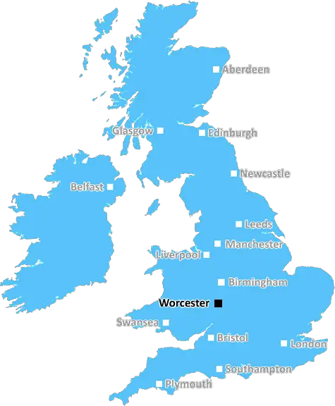
Worcester (WR11)
The WR11 postcode area is located in the Worcester postcode town region, within the county of Worcestershire, and contains a total of 2249 individual postcodes.
There are 85 electoral wards in the WR11 postcode area, including Broadway, Droitwich, Evesham, Malvern, Pershore, Tenbury Wells, Worcester which come under the local authority of the Wychavon Council.
Combining the whole postcode region, 24% of people in WR11 are classed as having an AB social grade, (i.e. 'white-collar' middle-upper class), compared to 27% across the UK.
This does not mean that the people of WR11 are poorer than other areas, but it may give an indication that there are areas of deprivation.
The WR11 postcode is one of the most diverse postcodes in the Worcester district, enveloping a large portion of the region including parts of Redditch, Evesham, Broadway and Moreton-in-Marsh. Located in the western edge of the Worcestershire county, the postcode is also home to the spa town of Royal Leamington Spa and other smaller villages such as Abbots Salford, Hinton-On-The-Green and Norton.
PNode WR11 is part of the WR postcode area and is centred on the historic town of Evesham, home to the picturesque 13th-century Abbey and the 18th-century All Saints Church. The surrounding countryside is characterised by beautiful rolling hills, pretty woodlands and lush orchards.
The popular towns of Broadway and Moreton-in-Marsh are also located in WR11. Broadway is known for its wide selection of independent boutiques, art galleries and quaint cafes and is a popular destination for tourists looking to explore the Cotswold Hills. Meanwhile, Moreton-in-Marsh boasts a vibrant market, historic buildings and nature reserves, making it a perfect destination for those looking for a peaceful stroll or picnic.
The postcode district is well-served by public transport networks, with regular buses and trains running through the area. By car, WR11 is easily accessible from both the M5 and M40 motorways and the Worcester and Birmingham airports.
Public and private schools are also plentiful in WR11, with a number of well-regarded establishments including Tudor Grange Academy Worcester, Hartlebury CE Primary School and Chipping Campden Secondary School. The postcode is also home to a number of leisure centres, such as the Pitcher and Piano in Whitminster for a bit of light entertainment, the Webbs of Wychbold shopping complex and the fully furnished Tudor Grange Leisure & Spa.
In WR11, there is something for everyone, with ample opportunities to explore the natural beauty of the region, shop till you drop, enjoy a delicious meal at one of the local restaurants or simply relax with friends in the picturesque spa town of Royal Leamington Spa.

Demographics

Worcestershire

WR11 is located in the county of Worcestershire, in England.
Worcestershire has a total population of 583,100, making it the 38th largest county in the UK.
Worcestershire has a total area of 670 square miles, and a population density of 334 people per square kilometre. For comparison, Greater London has a density of 5,618 people/km2.
| Outward Code | WR11 |
| Postal Town | Worcester |
| MSOA Name | Wychavon 015 |
| LSOA Name | Wychavon 015D |
| County | Worcestershire |
| Region | Worcestershire |
| Country | England |
| Local Authority | Wychavon |
| Area Classification | Mainly Rural (rural including hub towns >=80%) |
WR11 Electoral Wards
The postal region of WR11, includes the local towns, villages, electoral wards and stations of:
Dig even deeper into the WR11 postcode by clicking on a postcode below:
Click on an outward postal code below for more information about the area. Each 'outward' postcode give you a comprehensive list of all postcodes within the outward code area (WR) and estimated address.
Click on an 'outward' code for more information. For example, the outward postcode page 'EC2M' will give you an alphabetical list covering all postcodes located in the region, from 'EC2M 1BB' through to 'EC2M 7YA'.
Chris H
Friday, May 10, 2024
We don't have any views of WR11 right now. If you live in WR11 or have visited it, please help us to help others by telling others what you think of this neighbourhood.
Add your view of WR11
People need your local expertise. If you live in WR11 or have first-hand knowledge of the neighbourhood, please consider sharing your views. It's completely anonymous - all we ask is for your initials.
Please tell us what you like about the WR11 postcode area, what you don't like, and what it's like to live or work here.
| LOCAL AMENITIES | |
| FAMILY FRIENDLY | |
| PARKING | |
| GREEN SPACES |
Local News Worcestershire
Scrivens' century lifts Sunrisers to top spot
Sunrisers top the Rachael Heyhoe Flint Trophy table after defeating Central Sparks by five wickets at Kidderminster.
BBC NewsFamily pays tribute to 'irreplaceable' daughter
The investigation into Grace Gardner's death is ongoing, according to West Mercia Police.
BBC NewsOlly Alexander gives students at old college 'hope'
Students studying the same course as Eurovision hopeful Olly Alexander say it gives them "hope".
BBC NewsJones 136 leads Sparks to victory at Thunder
Eve Jones makes an unbeaten 136 to lead Central Sparks to victory over Thunder in the Rachael Heyhoe Flint Trophy.
BBC NewsThousands enjoy flower show as temperatures soar
The RHS Malvern Spring Festival will include advice on saving rainwater and a plastic "pot amnesty".
BBC NewsSocial media users warned over 'pet monkey' videos
The warning from conservationists comes as a woman admits her role in a monkey torture network.
BBC NewsMotorcyclist airlifted to hospital after A49 crash
The man is being treated in Queen Elizabeth Hospital after a crash in Ashton about 06:30 BST.
BBC NewsMP wants more protection for assistance dog users
Sir Bill Wiggin says "no shop, no restaurant, no supermarket" should turn away assistance dogs.
BBC NewsFrom the Postcode Area blog

Deciphering Crime Rates - a Deep Dive Into UK Postcode Analysis
Ever wondered about the crime rate in your UK postcode? You're not alone. We've dug deep into the data, uncovering trends and patterns that'll make your head spin.

Death of the High Street?
The BBC reports that despite councils' attempts to kurb them, the UK's high streets have seen a huge growth in fast food outlets. Could this mark the death knell for the Great British high street, and what can we do about it to halt its decline?

Discrimination by Postcode
You really couldn't make it up, could you? Some of the country's most vulnerable people are missing out on their weekly £25 Cold Weather Payment, just because the system that's in operation is discriminating against them because payments are based on postcode, rather than geographic location.

The Redesign is Underway
Well, the current website was absolutely in dire need of a good redesign - from the ground up. So I set out to pull it all apart and get it up and running again to become the most comprehensive guide to every postcode in the UK. And it's been a long, tough job from start to finish - and quite possibly the biggest project I've ever undertaken.
SOCIAL GRADES
According to census records, 24% of people here have a social grade of AB (highest), compared to the national average of 27%.