worcester WR1 Postcodes
Spending a fortune on conveyancing?

Compare instant, low-cost online quotes from trusted conveyancing solicitors.
Backed by experts, our no-obligation service searches through the best conveyancing quotes on the market to save you time and money.
Worcester (WR1)
The WR1 postcode area is located in the Worcester postcode town region, within the county of Worcestershire, and contains a total of 835 individual postcodes.
There are 1 electoral wards in the WR1 postcode area, including Broadway, Droitwich, Evesham, Malvern, Pershore, Tenbury Wells, Worcester which come under the local authority of the Worcester Council.
Combining the whole postcode region, 27% of people in WR1 are classed as having an AB social grade, (i.e. 'white-collar' middle-upper class), compared to 27% across the UK.
This does not mean that the people of WR1 are wealthier - or higher class - than average, but it can be an indication that the area may be prospering and desirable to live in.
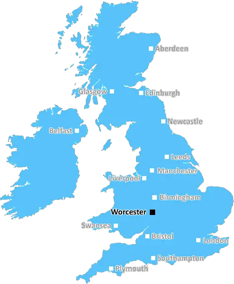
WR1 postcode is a postcode district of the postcode area of Worcester, located in the West Midlands in England. It covers the north-eastern and the north-western parts of Worcester city, as well as parts of the parishes of Kempsey, Powick and Claines.
WR1 postcode area includes areas such as Barbourne, Bath Road, Claines, Diglis, The Estons, Lower Wick, Sandfields, Tunnel Hill and Tything. The centre of the Worcester postcode area is located near Barbourne, close to the centre of the city.
WR1 postcode has some notable landmarks including the Tudor architecture of Diglis House, the 13th century St Andrew's Church and the Royal Worcester Porcelain Works. The area is home to a number of popular attractions such as the Worcester Racecourse, Worcester Cathedral and Avoncroft Museum of Historic Buildings.
WR1 postcode district is served by three railway stations - Kempsey, Worcester Shrub Hill and Worcester Foregate Street. It has good transport links to other parts of the UK, with frequent trains to Birmingham, Bristol and London.
WR1 postcode area is also home to Worcester University, one of the oldest universities in the UK. It is located in the city centre and has been a major force in the city's economy for over 170 years.
The area has plenty of shopping and leisure facilities, including a number of high-street shops, cafes, theatres, restaurants and bars. The area is also well served by schools, ranging from primary schools to universities.
WR1 postcode is well known for its diverse community and thriving multicultural population. It has established a strong sense of camaraderie among its locals and is often considered as the cosmopolitan corner of the city.

Demographics

Worcestershire

WR1 is located in the county of Worcestershire, in England.
Worcestershire has a total population of 583,100, making it the 38th largest county in the UK.
Worcestershire has a total area of 670 square miles, and a population density of 334 people per square kilometre. For comparison, Greater London has a density of 5,618 people/km2.
| Outward Code | WR1 |
| Postal Town | Worcester |
| MSOA Name | Worcester 011 |
| LSOA Name | Worcester 011E |
| County | Worcestershire |
| Region | Worcestershire |
| Country | England |
| Local Authority | Worcester |
| Area Classification | Urban with City and Town |
WR1 Electoral Wards
The postal region of WR1, includes the local towns, villages, electoral wards and stations of:
Dig even deeper into the WR1 postcode by clicking on a postcode below:
Click on an outward postal code below for more information about the area. Each 'outward' postcode give you a comprehensive list of all postcodes within the outward code area (WR) and estimated address.
Click on an 'outward' code for more information. For example, the outward postcode page 'EC2M' will give you an alphabetical list covering all postcodes located in the region, from 'EC2M 1BB' through to 'EC2M 7YA'.
MP, worcester
Tuesday, May 21, 2019
A lovely area to live I have fantastic views over the race course, it like living in the country side, but only 20 min walk to the city centre, good neighbours and quiet,
Add your view of WR1
People need your local expertise. If you live in WR1 or have first-hand knowledge of the neighbourhood, please consider sharing your views. It's completely anonymous - all we ask is for your initials.
Please tell us what you like about the WR1 postcode area, what you don't like, and what it's like to live or work here.
| LOCAL AMENITIES | |
| FAMILY FRIENDLY | |
| PARKING | |
| GREEN SPACES |
Local News Worcestershire
Why is Ross 'on Wye' but Upton 'upon Severn'?
We find the definitive answer to hyphenated British town, village and place names.
BBC NewsTown to turn blue for fallen Royal Navy sailor
A fundraiser has helped generate 14,000 for the family of Josh Gayton.
BBC NewsHow to watch Worcester's peregrines in person
Hundreds of thousands of people have already seen the four healthy chicks hatch online.
BBC NewsNo sentence review for Cody Fisher's killers
Two men are serving life sentences after the footballer was fatally stabbed in a nightclub.
BBC NewsKen doll, false teeth and cutlery found in sewers
Severn Trent has said while the finds are "entertaining", they cause "messy and costly problems".
BBC NewsYour pictures across the West Midlands
Some stunning views from around the West Midlands show spring is definitely in the air.
BBC NewsScrivens' century lifts Sunrisers to top spot
Sunrisers top the Rachael Heyhoe Flint Trophy table after defeating Central Sparks by five wickets at Kidderminster.
BBC NewsWoman 'fifty-fifty' following gastric surgery
Chloe Quick was left fighting for her life, after surgery to help her lose weight went wrong.
BBC NewsFrom the Postcode Area blog

Deciphering Crime Rates - a Deep Dive Into UK Postcode Analysis
Ever wondered about the crime rate in your UK postcode? You're not alone. We've dug deep into the data, uncovering trends and patterns that'll make your head spin.

Death of the High Street?
The BBC reports that despite councils' attempts to kurb them, the UK's high streets have seen a huge growth in fast food outlets. Could this mark the death knell for the Great British high street, and what can we do about it to halt its decline?

Discrimination by Postcode
You really couldn't make it up, could you? Some of the country's most vulnerable people are missing out on their weekly £25 Cold Weather Payment, just because the system that's in operation is discriminating against them because payments are based on postcode, rather than geographic location.

The Redesign is Underway
Well, the current website was absolutely in dire need of a good redesign - from the ground up. So I set out to pull it all apart and get it up and running again to become the most comprehensive guide to every postcode in the UK. And it's been a long, tough job from start to finish - and quite possibly the biggest project I've ever undertaken.
SOCIAL GRADES
According to census records, 27% of people here have a social grade of AB (highest), compared to the national average of 27%.