wolverhampton WV2 Postcodes
Spending a fortune on conveyancing?

Compare instant, low-cost online quotes from trusted conveyancing solicitors.
Backed by experts, our no-obligation service searches through the best conveyancing quotes on the market to save you time and money.
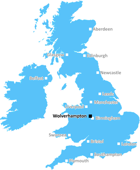
Wolverhampton (WV2)
The WV2 postcode area is located in the Wolverhampton postcode town region, within the county of West Midlands, and contains a total of 722 individual postcodes.
There are 6 electoral wards in the WV2 postcode area, including Bilston, Bridgnorth, Willenhall, Wolverhampton which come under the local authority of the Wolverhampton Council.
Combining the whole postcode region, 10% of people in WV2 are classed as having an AB social grade, (i.e. 'white-collar' middle-upper class), compared to 27% across the UK.
This does not mean that the people of WV2 are poorer than other areas, but it may give an indication that there are areas of deprivation.
The WV2 postcode is a post town within the Wolverhampton district of the West Midlands, England.
Located in the city itself, the WV2 postcode comprises several parts, including parts of the Darlaston, Wednesfield, and Wednesbury wards. It covers an area from Wednesfield to Bradley, and is bordered by the WV4 (Willenhall) postcode and the WV13 (Bilston) postcode.
WV2 contains a number of residential areas and places of interest, including the Hatherton Lake Nature Reserve, New Cross Hospital, Park Hall and Owlsmoor shopping areas, Bentley Bridge Park, the City of Wolverhampton College, and various schools, churches, and parks. It is also home to a range of industrial and commercial enterprises, such as the Coronation Drive estate, St Modwen's Trade Park, and the Jam Industries factory.
The local public transport network is well-developed, with a range of buses, trams, and trains connecting the area to the rest of the city. The WV2 postcode is served by the Wolverhampton Bus Station, and is connected to the local Wolverhampton train station.
The WV2 postcode also features a number of pubs and restaurants, such as the WV2 Bar and Grill, The Railway, The Roof Garden, and The Horse and Jockey. In addition, it is home to a variety of supermarkets, such as Asda, Tesco, and Sainsbury's, as well as convenience stores like Costcutter and One Stop.
Finally, the WV2 postcode is known for its diverse and vibrant community, with a range of religious denominations, a diverse cultural scene, and a wide array of recreational activities, events, and groups active in the area.

Demographics

West Midlands

WV2 is located in the county of West Midlands, in England.
West Midlands has a total population of 2,864,900, making it the 2nd largest county in the UK.
West Midlands has a total area of 348 square miles, and a population density of 3177 people per square kilometre. For comparison, Greater London has a density of 5,618 people/km2.
| Outward Code | WV2 |
| Postal Town | Wolverhampton |
| MSOA Name | Wolverhampton 020 |
| LSOA Name | Wolverhampton 020F |
| County | West Midlands |
| Region | West Midlands |
| Country | England |
| Local Authority | Wolverhampton |
| Area Classification | Urban with Major Conurbation |
WV2 Electoral Wards
The postal region of WV2, includes the local towns, villages, electoral wards and stations of:
Dig even deeper into the WV2 postcode by clicking on a postcode below:
Click on an outward postal code below for more information about the area. Each 'outward' postcode give you a comprehensive list of all postcodes within the outward code area (WV) and estimated address.
Click on an 'outward' code for more information. For example, the outward postcode page 'EC2M' will give you an alphabetical list covering all postcodes located in the region, from 'EC2M 1BB' through to 'EC2M 7YA'.
MID, Wolverhampton
Sunday, August 28, 2022
Good access to city center and shops, also very good public transport network. Renting prices are pretty good, similar or lower than most other cities I've lived in, just make sure you get a hakf-decent landlord. Fairly quiet compared to most inner-city areas, even at nights and weekends. Green areas like West Park are pretty cool and chill, well within walking distance.
Add your view of WV2
People need your local expertise. If you live in WV2 or have first-hand knowledge of the neighbourhood, please consider sharing your views. It's completely anonymous - all we ask is for your initials.
Please tell us what you like about the WV2 postcode area, what you don't like, and what it's like to live or work here.
| LOCAL AMENITIES | |
| FAMILY FRIENDLY | |
| PARKING | |
| GREEN SPACES |
Local News Staffordshire
Masterchef contender serves 'deconstructed lobby' to judges here's how she did
Judges John Torode and Gregg Wallace loved the dish
Stoke SentinelStoke-on-Trent set for 45mph winds as Storm Kathleen triggers weather warnings
The latest storm will bring heavy rain, snow and strong gusts to various parts of the UK
Stoke SentinelCorrie star Colson Smith dines in Burslem curry house
And Robbie Benson, from The Hitmix, was at India Cottage too!
Stoke SentinelPeople urged to give the gift of independence this Mothers Day
This Mother's Day, Staffordshire County Council is urging people to explore a world of thoughtful and practical gift ideas, through its assistive technology campaign.
Staffordshire County CouncilWoman bitten on head and arm in dog attack
The victim, in her 50s, is taken to hospital after she is bitten on the head and arm in the attack.
BBC NewsHospice plans orange floral memorial for spring
People are being asked to dedicate a gerbera at the charity's memorial gardens.
BBC NewsNatalie, 34, sees hot date end in drink-drive arrest and three weeks in hospital
Natalie Haynes drove 42 miles for her date - only to crash into a wall after three glasses of wine
Stoke SentinelRoad scheme review 'yet another casualty' of HS2
A scheme to turn a section of the A500 in Cheshire is dropped by councillors.
BBC NewsFrom the Postcode Area blog

Deciphering Crime Rates - a Deep Dive Into UK Postcode Analysis
Ever wondered about the crime rate in your UK postcode? You're not alone. We've dug deep into the data, uncovering trends and patterns that'll make your head spin.

Death of the High Street?
The BBC reports that despite councils' attempts to kurb them, the UK's high streets have seen a huge growth in fast food outlets. Could this mark the death knell for the Great British high street, and what can we do about it to halt its decline?

Discrimination by Postcode
You really couldn't make it up, could you? Some of the country's most vulnerable people are missing out on their weekly £25 Cold Weather Payment, just because the system that's in operation is discriminating against them because payments are based on postcode, rather than geographic location.

The Redesign is Underway
Well, the current website was absolutely in dire need of a good redesign - from the ground up. So I set out to pull it all apart and get it up and running again to become the most comprehensive guide to every postcode in the UK. And it's been a long, tough job from start to finish - and quite possibly the biggest project I've ever undertaken.
SOCIAL GRADES
According to census records, 10% of people here have a social grade of AB (highest), compared to the national average of 27%.