wolverhampton WV10 Postcodes
Spending a fortune on conveyancing?

Compare instant, low-cost online quotes from trusted conveyancing solicitors.
Backed by experts, our no-obligation service searches through the best conveyancing quotes on the market to save you time and money.
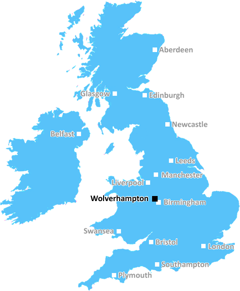
Wolverhampton (WV10)
The WV10 postcode area is located in the Wolverhampton postcode town region, within the county of West Midlands, and contains a total of 1429 individual postcodes.
There are 38 electoral wards in the WV10 postcode area, including Bilston, Bridgnorth, Willenhall, Wolverhampton which come under the local authority of the Wolverhampton Council.
Combining the whole postcode region, 12% of people in WV10 are classed as having an AB social grade, (i.e. 'white-collar' middle-upper class), compared to 27% across the UK.
This does not mean that the people of WV10 are poorer than other areas, but it may give an indication that there are areas of deprivation.
The WV10 postcode covers the area of Wednesfield, in the western suburbs of Wolverhampton, in the Metropolitan Borough of the city. It is situated in the Black Country within the West Midlands county of England. Wednesfield dates back to the Anglo-Saxon period and is made up of a mix of residential and commercial areas, with homes ranging from nineteenth century terraced housing to modern estates.
The WV10 postcode area is home to a range of amenities and landmarks, including the open space of Wednesfield Wood, Gibbons Forge Park, the Pennine Way, Wolverhampton Race Course, Augusta Golf Course, Childs Works Museum and the Wednesfield Shopping Centre. This vibrant community also offers regular markets, annual fairs and celebrations, and a vibrant array of pubs, bars, and restaurants.
Wednesfield is well served by public transport, including regular bus services and mainline rail links to Wolverhampton, Birmingham and beyond. This, coupled with its proximity to the M54 and M6 motorways, makes it an attractive and convenient area for commuters.
Wednesfield is home to a noteworthy education sector, including live Oaks Primary School, St Edmund's Church of England Primary School, Holly Grove Primary School, Holy Trinity Catholic School, and Penn Hall School.
The area boasts three hospitals � New Cross Hospital, New Cross Healthcare Centre, and Dudley Road Hospital, which offers a range of specialist services as well as a 24 hour emergency department. Wednesfield is also home to a range of business and professional services, including solicitors, accountants, surveyors, architects, and IT companies.
Wednesfield is believed to be the most nuclear-powered district in England, with a power station next to it, and is the birthplace of Aron Gunnarsson (Iceland international footballer). Finally, WV10 postcode area is the home of the Wednesfield Wolves football club, which play in the West Midlands Regional League.

Demographics

West Midlands

WV10 is located in the county of West Midlands, in England.
West Midlands has a total population of 2,864,900, making it the 2nd largest county in the UK.
West Midlands has a total area of 348 square miles, and a population density of 3177 people per square kilometre. For comparison, Greater London has a density of 5,618 people/km2.
| Outward Code | WV10 |
| Postal Town | Wolverhampton |
| MSOA Name | Wolverhampton 020 |
| LSOA Name | Wolverhampton 020F |
| County | West Midlands |
| Region | West Midlands |
| Country | England |
| Local Authority | Wolverhampton |
| Area Classification | Urban with Major Conurbation |
WV10 Electoral Wards
The postal region of WV10, includes the local towns, villages, electoral wards and stations of:
Dig even deeper into the WV10 postcode by clicking on a postcode below:
Click on an outward postal code below for more information about the area. Each 'outward' postcode give you a comprehensive list of all postcodes within the outward code area (WV) and estimated address.
Click on an 'outward' code for more information. For example, the outward postcode page 'EC2M' will give you an alphabetical list covering all postcodes located in the region, from 'EC2M 1BB' through to 'EC2M 7YA'.
Chris H
Sunday, April 7, 2024
We don't have any views of WV10 right now. If you live in WV10 or have visited it, please help us to help others by telling others what you think of this neighbourhood.
Add your view of WV10
People need your local expertise. If you live in WV10 or have first-hand knowledge of the neighbourhood, please consider sharing your views. It's completely anonymous - all we ask is for your initials.
Please tell us what you like about the WV10 postcode area, what you don't like, and what it's like to live or work here.
| LOCAL AMENITIES | |
| FAMILY FRIENDLY | |
| PARKING | |
| GREEN SPACES |
Local News Staffordshire
Shini from Stafford becomes Blue Peter's 43rd presenter
Shini Muthukrishnan on her new Blue Peter role and what it means to her at the age of 22.
BBC NewsElectric vehicle charging network in Staffordshire set to progress with 4.6million backing
Development and growth of an electric charging network in Staffordshire is set to begin imminently with the release of 4.6million Government funding.
Staffordshire County CouncilTown centre transport improvement scheme moves to next phase
A regeneration project to improve roads and routes for cycling and walking in Cannock town centre moves to its final phase on Monday April 8.
Staffordshire County CouncilNine out of 10 parents allocated their first choice secondary school
Nine out of 10 parents will learn today that they have been allocated their first choice secondary school in Staffordshire. Of the 8,482 offers made for a Staffordshire secondary school at age 11, 90.&hellip
Staffordshire County CouncilJo Gideon MP on regeneration in Stoke town
Stoke on Trent Central MP, Jo Gideon talking about the regeneration of Stoke town.
BBC NewsSchool refurbishments could be given the green light
A total of 56 million will be spent on building new schools, and maintaining and improving existing ones in Staffordshire over the coming year.
Staffordshire County CouncilPlanning approval granted for top grade electric vehicle charging facility at i54
Planning approval has been granted for a GRIDSERVE Electric Forecourt at i54 South Staffordshire.
Staffordshire County CouncilSuspended jail sentences for Staffordshire farmers
Three Staffordshire farmers have been given suspended prison sentences for breaching cattle identification and movement rules to stop the spread of Bovine Tuberculosis.
Staffordshire County CouncilFrom the Postcode Area blog

Deciphering Crime Rates - a Deep Dive Into UK Postcode Analysis
Ever wondered about the crime rate in your UK postcode? You're not alone. We've dug deep into the data, uncovering trends and patterns that'll make your head spin.

Death of the High Street?
The BBC reports that despite councils' attempts to kurb them, the UK's high streets have seen a huge growth in fast food outlets. Could this mark the death knell for the Great British high street, and what can we do about it to halt its decline?

Discrimination by Postcode
You really couldn't make it up, could you? Some of the country's most vulnerable people are missing out on their weekly £25 Cold Weather Payment, just because the system that's in operation is discriminating against them because payments are based on postcode, rather than geographic location.

The Redesign is Underway
Well, the current website was absolutely in dire need of a good redesign - from the ground up. So I set out to pull it all apart and get it up and running again to become the most comprehensive guide to every postcode in the UK. And it's been a long, tough job from start to finish - and quite possibly the biggest project I've ever undertaken.
SOCIAL GRADES
According to census records, 12% of people here have a social grade of AB (highest), compared to the national average of 27%.