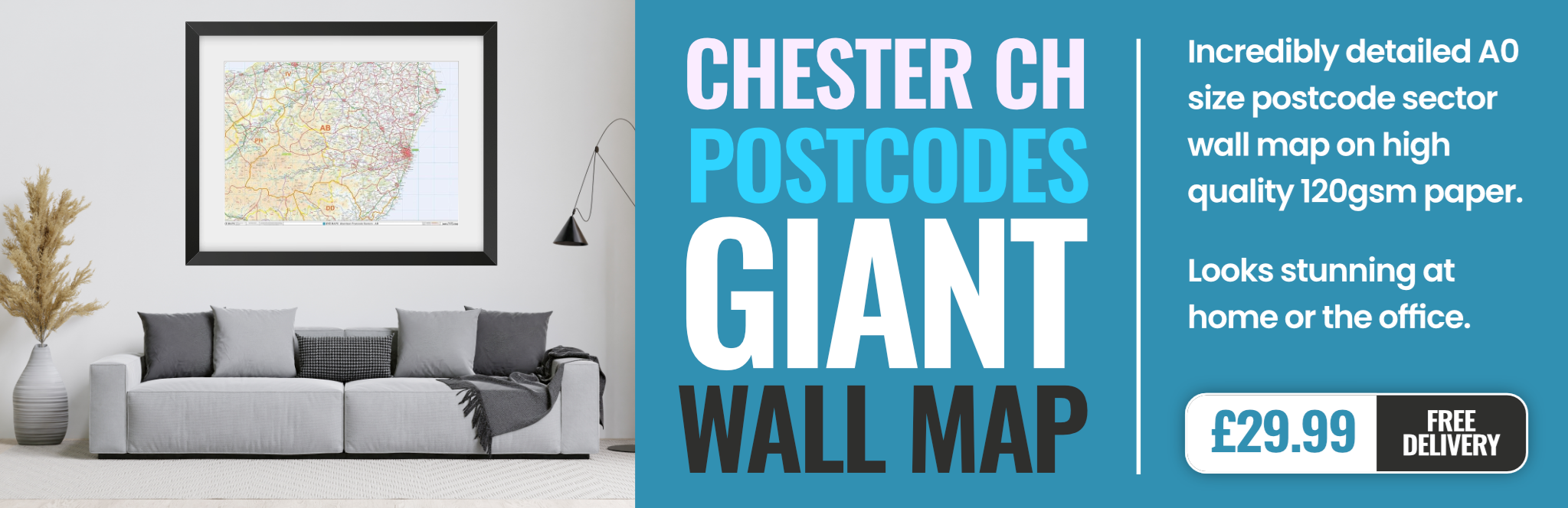
chester CH47 Postcodes
Spending a fortune on conveyancing?

Compare instant, low-cost online quotes from trusted conveyancing solicitors.
Backed by experts, our no-obligation service searches through the best conveyancing quotes on the market to save you time and money.
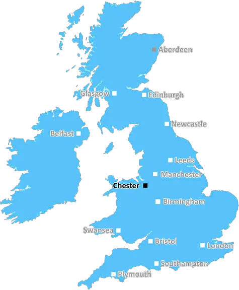
Chester (CH47)
The CH47 postcode area is located in the Chester postcode town region, within the county of Merseyside, and contains a total of 427 individual postcodes.
There are 2 electoral wards in the CH47 postcode area, including Bagillt, Birkenhead, Buckley, Chester, Deeside, Ellesmere Port, Flint, Holywell, Mold, Neston, Prenton, Wallasey, Wirral which come under the local authority of the Wirral Council.
Combining the whole postcode region, 35% of people in CH47 are classed as having an AB social grade, (i.e. 'white-collar' middle-upper class), compared to 27% across the UK.
This does not mean that the people of CH47 are wealthier - or higher class - than average, but it can be an indication that the area may be prospering and desirable to live in.
The CH47 postcode in the UK is located in the Wirral borough of Merseyside, England. It covers the area outside of the main city centre of Birkenhead in the north, including parts of the nearby neighbourhoods of Wallasey, Tranmere, Oxton, and New Chester.
In terms of demographic, CH47 has a higher percentage of residents aged 65 and over than Wirral and England as a whole. Alongside this, it has a lower percentage of children aged 0 to 15 and of working age population (16-64). The weekly earnings of CH47 residents are generally lower than those in Wirral and England too.
When looking at the number of businesses in the postcode and the number of different types of business classifications, CH47 lags behind the averages for Wirral and England.
In terms of education, the area performs below the average for Wirral and England in terms of the proportion of people with qualifications. Furthermore, 81.3% of the population in CH47 reported in the most recent Census as having no qualifications.
When looking at the housing of CH47, the majority of households are in owner-occupied accommodation (76.7%), which is higher than the averages in Wirral (71.0%) and England (62.9%). Furthermore, 62.3% of the housing is made up of detached and semi-detached dwellings compared to the area of Wirral (53.2%) and England (62.2%).
Public transport is accessible from CH47 due to its close proximity to the city centre of Birkenhead. It is well served by the Merseyrail Wirral Line, which links to the Liverpool Lime Street station, as well as multiple bus routes.
When considering the health of CH47 residents, the statistics revealed that the area lags behind Wirral and England in respect to the proportion of people with long-term health problems. Additionally, CH47 is in the top 10% of areas within England for the number of cases of long-term ill health.
Furthermore, CH47 is in the bottom cohort of postcodes for access to health services. This means that a larger proportion of the population have difficulty accessing health services when needed.

Demographics
Merseyside

CH47 is located in the county of Merseyside, in England.
Merseyside has a total population of 1,406,400, making it the 9th largest county in the UK.
Merseyside has a total area of 250 square miles, and a population density of 2174 people per square kilometre. For comparison, Greater London has a density of 5,618 people/km2.
| Outward Code | CH47 |
| Postal Town | Chester |
| MSOA Name | Wirral 014 |
| LSOA Name | Wirral 014D |
| County | Merseyside |
| Region | Merseyside |
| Country | England |
| Local Authority | Wirral |
| Area Classification | Urban with Major Conurbation |
CH47 Electoral Wards
The postal region of CH47, includes the local towns, villages, electoral wards and stations of:
Dig even deeper into the CH47 postcode by clicking on a postcode below:
Click on an outward postal code below for more information about the area. Each 'outward' postcode give you a comprehensive list of all postcodes within the outward code area (CH) and estimated address.
Click on an 'outward' code for more information. For example, the outward postcode page 'EC2M' will give you an alphabetical list covering all postcodes located in the region, from 'EC2M 1BB' through to 'EC2M 7YA'.
Chris H
Wednesday, April 17, 2024
We don't have any views of CH47 right now. If you live in CH47 or have visited it, please help us to help others by telling others what you think of this neighbourhood.
Add your view of CH47
People need your local expertise. If you live in CH47 or have first-hand knowledge of the neighbourhood, please consider sharing your views. It's completely anonymous - all we ask is for your initials.
Please tell us what you like about the CH47 postcode area, what you don't like, and what it's like to live or work here.
| LOCAL AMENITIES | |
| FAMILY FRIENDLY | |
| PARKING | |
| GREEN SPACES |
Local News Merseyside
Woman in court over death of baby found in 1998
The boy, who was given the name Callum by detectives, was discovered in a bin bag 26 years ago.
BBC NewsSuperb Palmer scores four as Chelsea thrash Everton
Chelsea midfielder Cole Palmer scores four goals, which includes a hat-trick inside the first 29 minutes, as his side thrash sorry Everton.
BBC NewsPolice commissioner role 'a Tory retirement home'
A Liberal Democrat candidate criticises the role of police and crime commissioner in Cheshire.
BBC NewsPrincess Anne visits centre she opened 30 years ago
The Princess Royal opened the centre in Sefton in 1994 and returned earlier to mark the anniversary.
BBC NewsCan I take a selfie at a polling station?
The rules on everything from dogs, children, ID and selfies to voting while drunk.
BBC NewsMan's fall from nursing home window linked to death
The Care Quality Commission says Joseph Leighton should have been safe in his nursing home.
BBC NewsThe elections taking place in Cheshire this year
Council and Police and Crime Commissioner elections are taking place in Cheshire in May 2024.
BBC NewsEverton points appeal case to be heard 'urgently'
Everton's appeal against their second points deduction for breaching the Premier League's financial rules will be heard "urgently" and an outcome will come before the end of the season.
BBC NewsFrom the Postcode Area blog

Deciphering Crime Rates - a Deep Dive Into UK Postcode Analysis
Ever wondered about the crime rate in your UK postcode? You're not alone. We've dug deep into the data, uncovering trends and patterns that'll make your head spin.

Death of the High Street?
The BBC reports that despite councils' attempts to kurb them, the UK's high streets have seen a huge growth in fast food outlets. Could this mark the death knell for the Great British high street, and what can we do about it to halt its decline?

Discrimination by Postcode
You really couldn't make it up, could you? Some of the country's most vulnerable people are missing out on their weekly £25 Cold Weather Payment, just because the system that's in operation is discriminating against them because payments are based on postcode, rather than geographic location.

The Redesign is Underway
Well, the current website was absolutely in dire need of a good redesign - from the ground up. So I set out to pull it all apart and get it up and running again to become the most comprehensive guide to every postcode in the UK. And it's been a long, tough job from start to finish - and quite possibly the biggest project I've ever undertaken.
SOCIAL GRADES
According to census records, 35% of people here have a social grade of AB (highest), compared to the national average of 27%.