lancaster LA23 Postcodes
Spending a fortune on conveyancing?

Compare instant, low-cost online quotes from trusted conveyancing solicitors.
Backed by experts, our no-obligation service searches through the best conveyancing quotes on the market to save you time and money.
Lancaster (LA23)
The LA23 postcode area is located in the Lancaster postcode town region, within the county of Cumbria, and contains a total of 625 individual postcodes.
There are 21 electoral wards in the LA23 postcode area, including Ambleside, Askam-In-Furness, Barrow-In-Furness, Broughton-In-Furness, Carnforth, Coniston, Dalton-In-Furness, Grange-Over-Sands, Kendal, Kirkby-In-Furness, Lancaster, Millom, Milnthorpe, Morecambe, Sedbergh, Ulverston, Windermere which come under the local authority of the South Lakeland Council.
Combining the whole postcode region, 23% of people in LA23 are classed as having an AB social grade, (i.e. 'white-collar' middle-upper class), compared to 27% across the UK.
This does not mean that the people of LA23 are poorer than other areas, but it may give an indication that there are areas of deprivation.
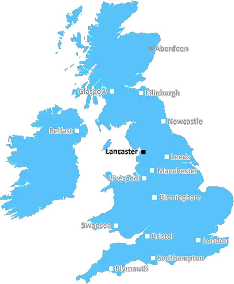
The LA23 postcode is located in the town of Windermere in the South Lakeland area of Cumbria, England. The postcode covers the Windermere town centre, villages such as Bowness-on-Windermere, and the local countryside including some of the lake side villages such as Lancaster Wood and Wood Howe.
The LA23 postcode has a population of just over 15,900 split across 8,925 households. It includes Windermere railway station, which provides direct access to Manchester Airport and other cities in the North West. This postcode has a high proportions of properties that are owned outright and the lowest proportion of people aged over 85.
Education is also very significant, with six primary schools and three secondary schools falling within the LA23 postcode. These schools include Windermere C. of E School, Brathay Hall School, and Clitheroe Royal Grammar School.
The Windermere marina is also part of the LA23 area, making it popular with holidaymakers, water sports enthusiasts and fishing visitors alike. From this marina you can take pleasure cruises with the Lakeland Motor Museum as well as trips to the islands of High Wray and Belle Isle.
LA23 is known for its rich culture, beautiful local parks such as Stagshaw Gardens, Claife Viewing station and Millerground Park, and popular local attractions including Beatrix Potter's, World of Beatrix Potter, Windermere Lake Cruises and the Lakes Aquarium.
There are a variety of shops and restaurants located in LA23 for visitors and locals alike. Shops include independent stores such as Penwortham, Hallmark Cards, and Queen Street Gallery, as well as major stores such as Marks and Spencer. The restaurant scene is just as varied, offering food from a range of international cuisines.
LA23 postcode provides a wide range of facilities including leisure centres, gyms, libraries, theatres, and cinemas. The community is well served by a variety of transport options, including a direct London to Windermere railway line, access to motorways and bus links to other towns and villages in the local area.

Demographics
Cumbria

LA23 is located in the county of Cumbria, in England.
Cumbria has a total population of 497,900, making it the 41st largest county in the UK.
Cumbria has a total area of 2612 square miles, and a population density of 73 people per square kilometre. For comparison, Greater London has a density of 5,618 people/km2.
| Outward Code | LA23 |
| Postal Town | Lancaster |
| MSOA Name | South Lakeland 001 |
| LSOA Name | South Lakeland 001D |
| County | Cumbria |
| Region | Cumbria |
| Country | England |
| Local Authority | South Lakeland |
| Area Classification | Mainly Rural (rural including hub towns >=80%) |
LA23 Electoral Wards
The postal region of LA23, includes the local towns, villages, electoral wards and stations of:
Dig even deeper into the LA23 postcode by clicking on a postcode below:
Click on an outward postal code below for more information about the area. Each 'outward' postcode give you a comprehensive list of all postcodes within the outward code area (LA) and estimated address.
Click on an 'outward' code for more information. For example, the outward postcode page 'EC2M' will give you an alphabetical list covering all postcodes located in the region, from 'EC2M 1BB' through to 'EC2M 7YA'.
Chris H
Wednesday, April 17, 2024
We don't have any views of LA23 right now. If you live in LA23 or have visited it, please help us to help others by telling others what you think of this neighbourhood.
Add your view of LA23
People need your local expertise. If you live in LA23 or have first-hand knowledge of the neighbourhood, please consider sharing your views. It's completely anonymous - all we ask is for your initials.
Please tell us what you like about the LA23 postcode area, what you don't like, and what it's like to live or work here.
| LOCAL AMENITIES | |
| FAMILY FRIENDLY | |
| PARKING | |
| GREEN SPACES |
From the Postcode Area blog

Deciphering Crime Rates - a Deep Dive Into UK Postcode Analysis
Ever wondered about the crime rate in your UK postcode? You're not alone. We've dug deep into the data, uncovering trends and patterns that'll make your head spin.

Death of the High Street?
The BBC reports that despite councils' attempts to kurb them, the UK's high streets have seen a huge growth in fast food outlets. Could this mark the death knell for the Great British high street, and what can we do about it to halt its decline?

Discrimination by Postcode
You really couldn't make it up, could you? Some of the country's most vulnerable people are missing out on their weekly £25 Cold Weather Payment, just because the system that's in operation is discriminating against them because payments are based on postcode, rather than geographic location.

The Redesign is Underway
Well, the current website was absolutely in dire need of a good redesign - from the ground up. So I set out to pull it all apart and get it up and running again to become the most comprehensive guide to every postcode in the UK. And it's been a long, tough job from start to finish - and quite possibly the biggest project I've ever undertaken.
SOCIAL GRADES
According to census records, 23% of people here have a social grade of AB (highest), compared to the national average of 27%.