wigan WN5 Postcodes
Spending a fortune on conveyancing?

Compare instant, low-cost online quotes from trusted conveyancing solicitors.
Backed by experts, our no-obligation service searches through the best conveyancing quotes on the market to save you time and money.
Wigan (WN5)
The WN5 postcode area is located in the Wigan postcode town region, within the county of Greater Manchester, and contains a total of 1059 individual postcodes.
There are 30 electoral wards in the WN5 postcode area, including Leigh, Skelmersdale, Wigan which come under the local authority of the Wigan Council.
Combining the whole postcode region, 16% of people in WN5 are classed as having an AB social grade, (i.e. 'white-collar' middle-upper class), compared to 27% across the UK.
This does not mean that the people of WN5 are poorer than other areas, but it may give an indication that there are areas of deprivation.
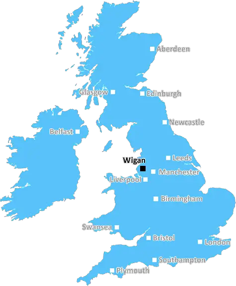
WN5 is a postcode district located in the Wigan district of Greater Manchester, England. It covers parts of the town of Wigan and the surrounding areas of Ashton-in-Makerfield, Golborne and Abram. The postcode covers an area to the west of Wigan town centre and to the north of Warrington.
The WN5 postcode has a total population of roughly 27,000 people, with a mean age of 41.4 according to the 2011 Census. The area is predominantly residential in nature, with a large number of terraced housing being the most prominent type of housing in the area.
The postcode has good transportation links with a main line rail station providing between four and eight services per hour to Manchester, Liverpool, Bolton and Warrington. The M6 motorway is within easy reach, providing road links to Manchester, Preston and beyond and the nearby M61 motorway provides access to Bolton and Manchester Airports. There are also a number of bus routes providing access to the rest of Wigan, as well as a number of smaller local buses running into Warrington, Manchester and beyond.
The WN5 area is served by a number of primary and secondary schools, such as All Saints Catholic Primary School and St Peter's Catholic College, as well as a range of post-16 education options. Healthcare is provided by the nearby Wigan Infirmary and Wrightington Hospital. Wigan North Western station is the only station serving the WN5 postcode with a local train service. The area has a variety of shops and supermarkets, as well as other leisure activities such as a local theatre, cinemas, bowling alleys and golf courses. It has two local parks; Moss Bank Park and Robin Park, and is located close to open countryside with leisure activities catered for.
The postcode has a diverse array of businesses located within it, predominantly offering a range of professional and business services. The area is home to a range of large companies such as BT, British Gas and EE. There are a variety of restaurants, takeaways and pubs, as well as the Robin Park Shopping Centre, which is a large retail park offering specialised shops, a leisure centre and a range of eateries.

Demographics
Greater Manchester

WN5 is located in the county of Greater Manchester, in England.
Greater Manchester has a total population of 2,782,100, making it the 3rd largest county in the UK.
Greater Manchester has a total area of 492 square miles, and a population density of 2180 people per square kilometre. For comparison, Greater London has a density of 5,618 people/km2.
| Outward Code | WN5 |
| Postal Town | Wigan |
| MSOA Name | Wigan 011 |
| LSOA Name | Wigan 011E |
| County | Greater Manchester |
| Region | Greater Manchester |
| Country | England |
| Local Authority | Wigan |
| Area Classification | Urban with Major Conurbation |
WN5 Electoral Wards
The postal region of WN5, includes the local towns, villages, electoral wards and stations of:
Dig even deeper into the WN5 postcode by clicking on a postcode below:
Click on an outward postal code below for more information about the area. Each 'outward' postcode give you a comprehensive list of all postcodes within the outward code area (WN) and estimated address.
Click on an 'outward' code for more information. For example, the outward postcode page 'EC2M' will give you an alphabetical list covering all postcodes located in the region, from 'EC2M 1BB' through to 'EC2M 7YA'.
GU, wigan
Sunday, April 7, 2019
Car crime rate on the rise, high volume of traffic as it's quite near saddle junction and parking is poor on match days due to being close to the stadium.
Add your view of WN5
People need your local expertise. If you live in WN5 or have first-hand knowledge of the neighbourhood, please consider sharing your views. It's completely anonymous - all we ask is for your initials.
Please tell us what you like about the WN5 postcode area, what you don't like, and what it's like to live or work here.
| LOCAL AMENITIES | |
| FAMILY FRIENDLY | |
| PARKING | |
| GREEN SPACES |
From the Postcode Area blog

Deciphering Crime Rates - a Deep Dive Into UK Postcode Analysis
Ever wondered about the crime rate in your UK postcode? You're not alone. We've dug deep into the data, uncovering trends and patterns that'll make your head spin.

Death of the High Street?
The BBC reports that despite councils' attempts to kurb them, the UK's high streets have seen a huge growth in fast food outlets. Could this mark the death knell for the Great British high street, and what can we do about it to halt its decline?

Discrimination by Postcode
You really couldn't make it up, could you? Some of the country's most vulnerable people are missing out on their weekly £25 Cold Weather Payment, just because the system that's in operation is discriminating against them because payments are based on postcode, rather than geographic location.

The Redesign is Underway
Well, the current website was absolutely in dire need of a good redesign - from the ground up. So I set out to pull it all apart and get it up and running again to become the most comprehensive guide to every postcode in the UK. And it's been a long, tough job from start to finish - and quite possibly the biggest project I've ever undertaken.
SOCIAL GRADES
According to census records, 16% of people here have a social grade of AB (highest), compared to the national average of 27%.