tonbridge TN16 Postcodes
Spending a fortune on conveyancing?

Compare instant, low-cost online quotes from trusted conveyancing solicitors.
Backed by experts, our no-obligation service searches through the best conveyancing quotes on the market to save you time and money.
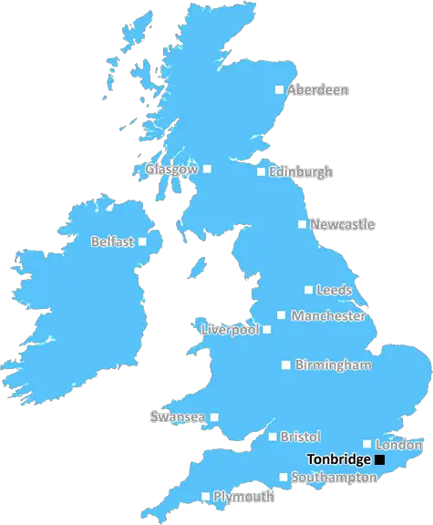
Tonbridge (TN16)
The TN16 postcode area is located in the Tonbridge postcode town region, within the county of Kent, and contains a total of 888 individual postcodes.
There are 32 electoral wards in the TN16 postcode area, including Ashford, Battle, Bexhill-On-Sea, Cranbrook, Crowborough, Edenbridge, Etchingham, Hartfield, Hastings, Heathfield, Mayfield, New Romney, Robertsbridge, Romney Marsh, Rye, Sevenoaks, St Leonards-On-Sea, Tenterden, Tonbridge, Tunbridge Wells, Uckfield, Wadhurst, Westerham, Winchelsea which come under the local authority of the Sevenoaks Council.
Combining the whole postcode region, 29% of people in TN16 are classed as having an AB social grade, (i.e. 'white-collar' middle-upper class), compared to 27% across the UK.
This does not mean that the people of TN16 are wealthier - or higher class - than average, but it can be an indication that the area may be prospering and desirable to live in.
TN16 is a postcode district located in the borough of Tonbridge and Malling in the county of Kent, England. It covers the town of Edenbridge and surrounding villages such as Ide Hill, Four Elms, Chevening, Hever, Marsh Green and Langton Green. It does not include Tonbridge itself, which is in a different postcode district.
TN16 is the 43rd most populous postcode district in the UK, with an estimated population of 16,247. It is located to the south west of Sevenoaks, east of Oxted and Godstone and north of Edenbridge.
The area has a good transport infrastructure, with Edenbridge railway station providing services to London. Edenbridge bus station is served by key routes to Sevenoaks, Tunbridge Wells, Oxted, Godstone, Redhill and further afield such as Sevenoaks and Maidstone.
For shopping, the area is served by a variety of popular supermarkets such as Aldi, Lidl and Tesco. There are also several local stores, cafes and independent retailers. It is home to many leisure facilities such as golf clubs, parks and sports clubs. The area has a number of schools, including two grammar schools - Tonbridge Grammar and the Weald of Kent Grammar.
The area has a rich cultural and architectural heritage, with numerous houses, churches and monuments of historic interest. The region also hosts a variety of regular events such as the Eden Valley and High Weald Country Fairs, held in July and August each year at Edenbridge Town Football Ground.
The area is also known for being home to many artists, musicians, writers and authors. Edenbridge hosts an annual festival every June, which celebrates a range of art, music and culture.
Despite having a large population, the area is mostly agricultural, with large parts of TN16 designated as Areas of Outstanding Natural Beauty, including the High Weald, Greensand Hills and Kent Downs. The area is also home to many popular visitor attractions, such as Hever Castle, Chartwell House, Emmetts Garden and Knole Park.

Demographics

Kent

TN16 is located in the county of Kent, in England.
Kent has a total population of 1,820,400, making it the 6th largest county in the UK.
Kent has a total area of 1443 square miles, and a population density of 486 people per square kilometre. For comparison, Greater London has a density of 5,618 people/km2.
| Outward Code | TN16 |
| Postal Town | Tonbridge |
| MSOA Name | Sevenoaks 013 |
| LSOA Name | Sevenoaks 013C |
| County | Kent |
| Region | Kent |
| Country | England |
| Local Authority | Sevenoaks |
| Area Classification | Largely Rural (rural including hub towns 50-79%) |
TN16 Electoral Wards
The postal region of TN16, includes the local towns, villages, electoral wards and stations of:
Dig even deeper into the TN16 postcode by clicking on a postcode below:
Click on an outward postal code below for more information about the area. Each 'outward' postcode give you a comprehensive list of all postcodes within the outward code area (TN) and estimated address.
Click on an 'outward' code for more information. For example, the outward postcode page 'EC2M' will give you an alphabetical list covering all postcodes located in the region, from 'EC2M 1BB' through to 'EC2M 7YA'.
Chris H
Sunday, April 7, 2024
We don't have any views of TN16 right now. If you live in TN16 or have visited it, please help us to help others by telling others what you think of this neighbourhood.
Add your view of TN16
People need your local expertise. If you live in TN16 or have first-hand knowledge of the neighbourhood, please consider sharing your views. It's completely anonymous - all we ask is for your initials.
Please tell us what you like about the TN16 postcode area, what you don't like, and what it's like to live or work here.
| LOCAL AMENITIES | |
| FAMILY FRIENDLY | |
| PARKING | |
| GREEN SPACES |
Local News Kent
UK Space Agency primed for Harwell Campus landing
The government agency has taken around 10,500 sq ft of space in the Quad Two building.
Property WeekSikh community prepares for Vaisakhi celebrations
Preparations have begun for the parade next weekend, which is expecting about 10,000 participants.
BBC NewsFirst-time buyers account for record third of all housing sales
Hamptons' research also showsthe most popular area to a buy home for first-time buyers is Slough.
Property WeekStarbucks partner signs lease at Prologis Park Hemel Hempstead
Food Service Logisticshas agreed a 15-year lease at the161,134 sq ftdistribution centre.
Property WeekMilton Keynes seeks developer for 174-home scheme
The Milton Keynes site occupies 15.6 acres of land with an additional 7.2 acres of green space.
Property WeekMirabaud buys Virgin Atlantic HQ in UK debut
Swiss investor snaps up grade-A office scheme let to Virgin Atlantic until 2032.
Property WeekBruntwood SciTech gets go ahead for 250m revamp of Cambridgeshire life science park
The masterplan for the site includes nearly 400,000 sq ft of space and six new buildings.
Property WeekHospital site with permission for 19 homes on market for 2.4m
Land surrounding a former hospital, which has planning permission for 19 townhouses, has hit the market at £2.4 million.
Kent OnlineFrom the Postcode Area blog

Deciphering Crime Rates - a Deep Dive Into UK Postcode Analysis
Ever wondered about the crime rate in your UK postcode? You're not alone. We've dug deep into the data, uncovering trends and patterns that'll make your head spin.

Death of the High Street?
The BBC reports that despite councils' attempts to kurb them, the UK's high streets have seen a huge growth in fast food outlets. Could this mark the death knell for the Great British high street, and what can we do about it to halt its decline?

Discrimination by Postcode
You really couldn't make it up, could you? Some of the country's most vulnerable people are missing out on their weekly £25 Cold Weather Payment, just because the system that's in operation is discriminating against them because payments are based on postcode, rather than geographic location.

The Redesign is Underway
Well, the current website was absolutely in dire need of a good redesign - from the ground up. So I set out to pull it all apart and get it up and running again to become the most comprehensive guide to every postcode in the UK. And it's been a long, tough job from start to finish - and quite possibly the biggest project I've ever undertaken.
SOCIAL GRADES
According to census records, 29% of people here have a social grade of AB (highest), compared to the national average of 27%.