oxford OX49 Postcodes
Spending a fortune on conveyancing?

Compare instant, low-cost online quotes from trusted conveyancing solicitors.
Backed by experts, our no-obligation service searches through the best conveyancing quotes on the market to save you time and money.
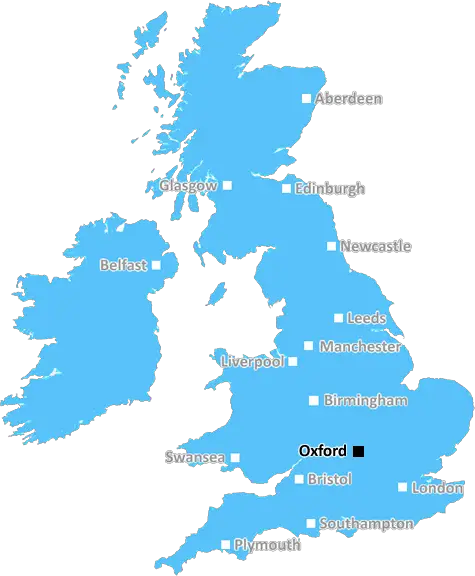
Oxford (OX49)
The OX49 postcode area is located in the Oxford postcode town region, within the county of Oxfordshire, and contains a total of 287 individual postcodes.
There are 22 electoral wards in the OX49 postcode area, including Abingdon, Bampton, Banbury, Bicester, Burford, Carterton, Chinnor, Chipping Norton, Didcot, Kidlington, Oxford, Thame, Wallingford, Wantage, Watlington, Witney, Woodstock which come under the local authority of the South Oxfordshire Council.
Combining the whole postcode region, 38% of people in OX49 are classed as having an AB social grade, (i.e. 'white-collar' middle-upper class), compared to 27% across the UK.
This does not mean that the people of OX49 are wealthier - or higher class - than average, but it can be an indication that the area may be prospering and desirable to live in.
OX49 is a postcode district in the Oxford region of the United Kingdom. It stretches from a small portion of southwest Oxford to covers the northernmost points of the Vale of White Horse, and it consists of some of the most popular villages and towns in the area.
The district covers parts of Benson, Berrick Salome, Warborough, Dorchester, Wallingford, Aston Tirrold, Cholsey, Crowmarsh Gifford, Ewelme, Goring, Ipsden, Stadhampton, and Watlington, as well as the surrounding rural land. These villages are known for their rural beauty and traditional feel.
Shopping opportunities in OX49 are quite diverse, ranging from big-name supermarkets like Tesco and Waitrose, to independent stores in individual villages. There are also a number of local businesses, which offer a wide range of items, including pet, garden and leisure products, and locally-produced food and drink.
The schools in OX49 are some of the best in the area. Generally, these are small rural schools with a good ranking, although they're near to two larger primary schools in Henley-on-Thames and Wallingford, as well as secondary schools in Oxford.
Having its own separate police station, OX49 is served by Thames Valley Police's Oxford South division. The area is unique in covering two separate local authorities, including South Oxfordshire District Council and Vale of White Horse District Council.
Recreational opportunities in OX49 abound. It has a wide range of public parks, golf courses, and outdoor activities, as well as two regional national parks: the Chilterns and the North Wessex Downs. Some of the villages also boast arts centres, historical buildings, and wonderful countryside walks.
Finally, it's worth noting that OX49 is part of the Oxford City Transport Zone, which means that public transport is frequent and of a high quality. There are buses straight into Oxford City Centre, with connections to larger towns and cities, while some of its villages boast rail connections running into London.

Demographics

Oxfordshire

OX49 is located in the county of Oxfordshire, in England.
Oxfordshire has a total population of 683,200, making it the 35th largest county in the UK.
Oxfordshire has a total area of 1005 square miles, and a population density of 262 people per square kilometre. For comparison, Greater London has a density of 5,618 people/km2.
| Outward Code | OX49 |
| Postal Town | Oxford |
| MSOA Name | South Oxfordshire 008 |
| LSOA Name | South Oxfordshire 008A |
| County | Oxfordshire |
| Region | Oxfordshire |
| Country | England |
| Local Authority | South Oxfordshire |
| Area Classification | Mainly Rural (rural including hub towns >=80%) |
OX49 Electoral Wards
The postal region of OX49, includes the local towns, villages, electoral wards and stations of:
Dig even deeper into the OX49 postcode by clicking on a postcode below:
Click on an outward postal code below for more information about the area. Each 'outward' postcode give you a comprehensive list of all postcodes within the outward code area (OX) and estimated address.
Click on an 'outward' code for more information. For example, the outward postcode page 'EC2M' will give you an alphabetical list covering all postcodes located in the region, from 'EC2M 1BB' through to 'EC2M 7YA'.
Chris H
Tuesday, April 16, 2024
We don't have any views of OX49 right now. If you live in OX49 or have visited it, please help us to help others by telling others what you think of this neighbourhood.
Add your view of OX49
People need your local expertise. If you live in OX49 or have first-hand knowledge of the neighbourhood, please consider sharing your views. It's completely anonymous - all we ask is for your initials.
Please tell us what you like about the OX49 postcode area, what you don't like, and what it's like to live or work here.
| LOCAL AMENITIES | |
| FAMILY FRIENDLY | |
| PARKING | |
| GREEN SPACES |
Local News Oxfordshire
Homes England acquires Worthing site to deliver 250 homes
The acquisition forms part of the body's plans to regenerate challenging brownfield areas.
Property WeekImpact of floods still felt four months on
Both Oxfordshire Mind and The Mill Arts Centre are still recovering from heavy flooding in January.
BBC NewsGove rejects 12-storey hotel and energy park plan for Bucks village
Developer Adveneco had proposed an exemplar of sustainable development for the site in Dorney.
Property WeekL&G acquires Cambridgeshire BTR scheme from Stonebond
The 41-unit development comprises 10 flats and 31 houses.
Property WeekSavills bolsters Chelmsford office with return of senior development director
Kibblewhite originally joined the agency in 1990 and spent 16 years working there.
Property WeekNorthern lights put on spectacular surprise display
Northern lights give spectacular surprise display
BBC NewsSellar gets green light for Hertfordshire media facility
The developer has designed the scheme to appeal to the media sector, as well as being appropriate for logistics, warehousing and data centre uses.
Property WeekAbri and Vistry partner to develop 1,500 homes in West Sussex
The 50/50 joint venture will develop the scheme on a former airfield site in Arundel.
Property WeekFrom the Postcode Area blog

Deciphering Crime Rates - a Deep Dive Into UK Postcode Analysis
Ever wondered about the crime rate in your UK postcode? You're not alone. We've dug deep into the data, uncovering trends and patterns that'll make your head spin.

Death of the High Street?
The BBC reports that despite councils' attempts to kurb them, the UK's high streets have seen a huge growth in fast food outlets. Could this mark the death knell for the Great British high street, and what can we do about it to halt its decline?

Discrimination by Postcode
You really couldn't make it up, could you? Some of the country's most vulnerable people are missing out on their weekly £25 Cold Weather Payment, just because the system that's in operation is discriminating against them because payments are based on postcode, rather than geographic location.

The Redesign is Underway
Well, the current website was absolutely in dire need of a good redesign - from the ground up. So I set out to pull it all apart and get it up and running again to become the most comprehensive guide to every postcode in the UK. And it's been a long, tough job from start to finish - and quite possibly the biggest project I've ever undertaken.
SOCIAL GRADES
According to census records, 38% of people here have a social grade of AB (highest), compared to the national average of 27%.