watford WD4 Postcodes
Spending a fortune on conveyancing?

Compare instant, low-cost online quotes from trusted conveyancing solicitors.
Backed by experts, our no-obligation service searches through the best conveyancing quotes on the market to save you time and money.
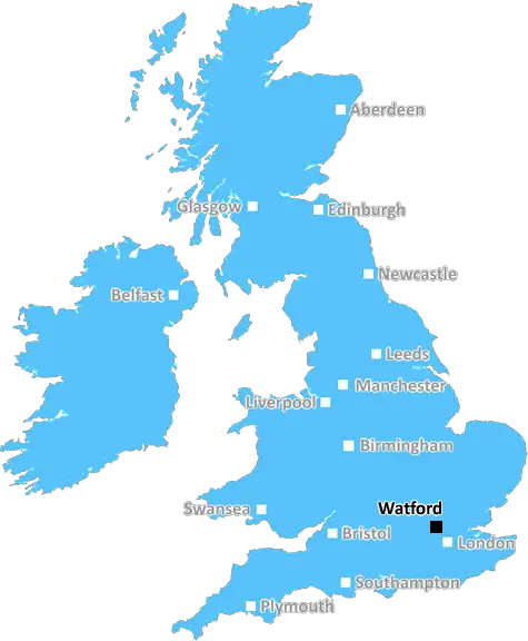
Watford (WD4)
The WD4 postcode area is located in the Watford postcode town region, within the county of Hertfordshire, and contains a total of 553 individual postcodes.
There are 16 electoral wards in the WD4 postcode area, including Abbots Langley, Borehamwood, Bushey, Kings Langley, Radlett, Rickmansworth, Watford which come under the local authority of the Dacorum Council.
Combining the whole postcode region, 36% of people in WD4 are classed as having an AB social grade, (i.e. 'white-collar' middle-upper class), compared to 27% across the UK.
This does not mean that the people of WD4 are wealthier - or higher class - than average, but it can be an indication that the area may be prospering and desirable to live in.
WD4 (Watford District 4) is an area of Watford, Hertfordshire, England. It comprises the eastern and northern parts of Watford borough, including Kings Langley and Apsley. The area is located in the West Hertfordshire local government district.
WD4 is a mainly residential area, with some businesses and limited industrial areas. The area is served by Watford Junction railway station. The nearest tube station to WD4 is Watford High Street.
WD4 contains a mix of modern developments, plus some Victorian terraced houses. The area has had a great deal of development in recent years and many green spaces and parks can be found in the area, such as King George V Playing Fields.
The area of WD4 is very safe and is home to many families and local professionals. There is a mix of nationalities, including Asian and Black British. The area has a number of excellent local amenities, such as shops, restaurants and cafes.
Local schools in the WD4 area are popular and include Kings' School, Watford Grammar School for Boys and St Clement Danes School. Health Services are provided by Watford General Hospital and Watford Health Centre.
The Kings Langley bus stop is located in the centre of WD4, serving routes to Watford, St. Albans and Hemel Hempstead. Buses run frequently and an extensive network of buses and trains ensures easy access to London and surrounding areas.
WD4 is a great place to live for those seeking a safe environment away from the hustle and bustle of London. It provides a peaceful ambience, great local transport links, excellent schools and plenty of opportunities for leisure activities.

Demographics
Hertfordshire

WD4 is located in the county of Hertfordshire, in England.
Hertfordshire has a total population of 1,176,700, making it the 12th largest county in the UK.
Hertfordshire has a total area of 634 square miles, and a population density of 716 people per square kilometre. For comparison, Greater London has a density of 5,618 people/km2.
| Outward Code | WD4 |
| Postal Town | Watford |
| MSOA Name | Dacorum 022 |
| LSOA Name | Dacorum 022A |
| County | Hertfordshire |
| Region | Hertfordshire |
| Country | England |
| Local Authority | Dacorum |
| Area Classification | Urban with Significant Rural (rural including hub towns 26-49%) |
WD4 Electoral Wards
The postal region of WD4, includes the local towns, villages, electoral wards and stations of:
Dig even deeper into the WD4 postcode by clicking on a postcode below:
Click on an outward postal code below for more information about the area. Each 'outward' postcode give you a comprehensive list of all postcodes within the outward code area (WD) and estimated address.
Click on an 'outward' code for more information. For example, the outward postcode page 'EC2M' will give you an alphabetical list covering all postcodes located in the region, from 'EC2M 1BB' through to 'EC2M 7YA'.
Chris H
Sunday, May 12, 2024
We don't have any views of WD4 right now. If you live in WD4 or have visited it, please help us to help others by telling others what you think of this neighbourhood.
Add your view of WD4
People need your local expertise. If you live in WD4 or have first-hand knowledge of the neighbourhood, please consider sharing your views. It's completely anonymous - all we ask is for your initials.
Please tell us what you like about the WD4 postcode area, what you don't like, and what it's like to live or work here.
| LOCAL AMENITIES | |
| FAMILY FRIENDLY | |
| PARKING | |
| GREEN SPACES |
Local News Hertfordshire
New roundabout branded 'white elephant'
People living near the upgraded roundabout in Clophill say it is a waste of money.
BBC NewsColdplay to headline Radio 1's Big Weekend
Becky Hill, Aitch, Sabrina Carpenter and Rudimental will also perform at the three-day festival.
BBC NewsStudent 'overwhelmed' to compose music for orchestra
The 22-year-old is hoping for a future career as a video game soundtrack composer.
BBC News'I'll thank my grandmother's killer if her body is found'
The family of Muriel McKay are waiting to hear if another search will be carried out at Stockings Farm.
BBC NewsTribute to 'bubbly' woman found dead in house
A man has been arrested on suspicion of the murder of Tarnjeet Riaz, 44, after her body was found.
BBC NewsMade in Hertfordshire: The catalytic converter
It's 50 years since Johnson Matthey in Royston developed a way to reduce car emissions.
BBC NewsHow can I get to Radio 1's Big Weekend?
More than 10,000 music fans are expected to attend the sell-out three-day event.
BBC NewsPub arsonist given suspended prison sentence
A second man denies starting the fire and will stand trial in June.
BBC NewsFrom the Postcode Area blog

Deciphering Crime Rates - a Deep Dive Into UK Postcode Analysis
Ever wondered about the crime rate in your UK postcode? You're not alone. We've dug deep into the data, uncovering trends and patterns that'll make your head spin.

Death of the High Street?
The BBC reports that despite councils' attempts to kurb them, the UK's high streets have seen a huge growth in fast food outlets. Could this mark the death knell for the Great British high street, and what can we do about it to halt its decline?

Discrimination by Postcode
You really couldn't make it up, could you? Some of the country's most vulnerable people are missing out on their weekly £25 Cold Weather Payment, just because the system that's in operation is discriminating against them because payments are based on postcode, rather than geographic location.

The Redesign is Underway
Well, the current website was absolutely in dire need of a good redesign - from the ground up. So I set out to pull it all apart and get it up and running again to become the most comprehensive guide to every postcode in the UK. And it's been a long, tough job from start to finish - and quite possibly the biggest project I've ever undertaken.
SOCIAL GRADES
According to census records, 36% of people here have a social grade of AB (highest), compared to the national average of 27%.