walsall WS2 Postcodes
Spending a fortune on conveyancing?

Compare instant, low-cost online quotes from trusted conveyancing solicitors.
Backed by experts, our no-obligation service searches through the best conveyancing quotes on the market to save you time and money.
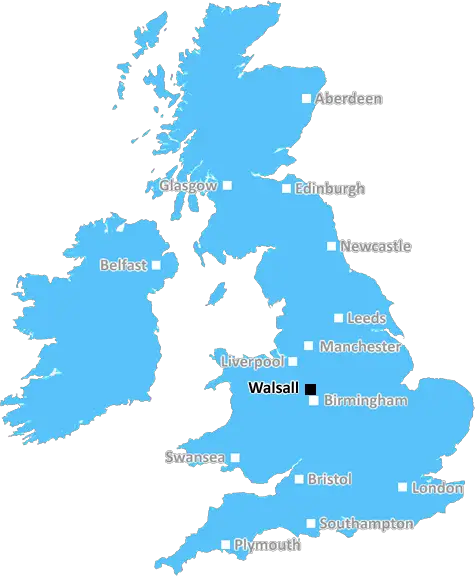
Walsall (WS2)
The WS2 postcode area is located in the Walsall postcode town region, within the county of West Midlands, and contains a total of 970 individual postcodes.
There are 12 electoral wards in the WS2 postcode area, including Burntwood, Cannock, Lichfield, Rugeley, Walsall, Wednesbury which come under the local authority of the Walsall Council.
Combining the whole postcode region, 8% of people in WS2 are classed as having an AB social grade, (i.e. 'white-collar' middle-upper class), compared to 27% across the UK.
This does not mean that the people of WS2 are poorer than other areas, but it may give an indication that there are areas of deprivation.
WS2 is a postcode in the UK for the city of Walsall, located in the West Midlands. It has an approximate population of around 257,000. Its main areas include Bloxwich, Palfrey, Pleck, Birchills, Leamore, Bentley, Darlaston and Willenhall.
It is served by several A roads that link it with other areas in Walsall, as well as the M6 motorway. The town centre is in the centre of the case area, with the area to the east known as Bloxwich and the area to the west known as Bentley and Leamore.
WS2 is home to a number of popular tourist attractions such as Walsall Arboretum, the Black Country Living Museum, and the Blue Planet Aquarium. It also has several shopping centres, including the Walsall Arboretum Shopping Village and the Arboretum Retail Park.
Education in the WS2 area is provided by a range of primary, secondary and further education institutions. There are four primary schools, one secondary school and sixth form college, and three specialist colleges.
Connectivity is good in the area with a number of local bus services, as well as some national services. There are also a number of railway stations in the WS2 area, including Willenhall, Darlaston and Bloxwich.
The local economy is largely based on manufacturing, with high-street stores, supermarkets and other retail outlets providing other sources of employment. There is also a range of smaller businesses and local services in the area.
The area of WS2 is generally considered to be a safe and pleasant place to live, with a range of amenities and attractions. Walsall is one of the largest towns in the West Midlands and is well worth a visit.

Demographics

West Midlands

WS2 is located in the county of West Midlands, in England.
West Midlands has a total population of 2,864,900, making it the 2nd largest county in the UK.
West Midlands has a total area of 348 square miles, and a population density of 3177 people per square kilometre. For comparison, Greater London has a density of 5,618 people/km2.
| Outward Code | WS2 |
| Postal Town | Walsall |
| MSOA Name | Walsall 023 |
| LSOA Name | Walsall 023B |
| County | West Midlands |
| Region | West Midlands |
| Country | England |
| Local Authority | Walsall |
| Area Classification | Urban with Major Conurbation |
WS2 Electoral Wards
The postal region of WS2, includes the local towns, villages, electoral wards and stations of:
Dig even deeper into the WS2 postcode by clicking on a postcode below:
Click on an outward postal code below for more information about the area. Each 'outward' postcode give you a comprehensive list of all postcodes within the outward code area (WS) and estimated address.
Click on an 'outward' code for more information. For example, the outward postcode page 'EC2M' will give you an alphabetical list covering all postcodes located in the region, from 'EC2M 1BB' through to 'EC2M 7YA'.
Chris H
Monday, May 6, 2024
We don't have any views of WS2 right now. If you live in WS2 or have visited it, please help us to help others by telling others what you think of this neighbourhood.
Add your view of WS2
People need your local expertise. If you live in WS2 or have first-hand knowledge of the neighbourhood, please consider sharing your views. It's completely anonymous - all we ask is for your initials.
Please tell us what you like about the WS2 postcode area, what you don't like, and what it's like to live or work here.
| LOCAL AMENITIES | |
| FAMILY FRIENDLY | |
| PARKING | |
| GREEN SPACES |
Local News Staffordshire
Crewe content to be underdogs in play-off semi
Rival managers Lee Bell and Grant McCann are looking for positive vibes as Crewe Alexandra face Doncaster Rovers in the League Two play-off semi-final.
BBC NewsPlanning approval granted for top grade electric vehicle charging facility at i54
Planning approval has been granted for a GRIDSERVE Electric Forecourt at i54 South Staffordshire.
Staffordshire County CouncilNew Director of Finance Appointed
A new Director of Finance has been appointed by Staffordshire County Council.
Staffordshire County CouncilClosed! 'Unviable' Staffordshire pub battered by soaring costs and competition
The Eagle Inn, in Eccleshall, has been closed since December
Stoke SentinelCancer-hit drink-driving businessman jailed after nipping to buy dog food
Karim Noorani, 53, of Stone, was more than three times the legal limit
Stoke SentinelStaffordshire receives electric bus boost for county towns
New electric buses will be running in Tamworth and Burton thanks to 3.1million government funding and investment from the transport providers.
Staffordshire County CouncilA special dance to celebrate Staffordshire
How the children of Baldwin's Gate Primary School are celebrating Staffordshire Day.
BBC NewsPerton Library Science Fair & Spring Festival is back
People in Perton are being invited to the library's annual science fair, taking place on Saturday 11 May from 10am to 3pm.
Staffordshire County CouncilFrom the Postcode Area blog

Deciphering Crime Rates - a Deep Dive Into UK Postcode Analysis
Ever wondered about the crime rate in your UK postcode? You're not alone. We've dug deep into the data, uncovering trends and patterns that'll make your head spin.

Death of the High Street?
The BBC reports that despite councils' attempts to kurb them, the UK's high streets have seen a huge growth in fast food outlets. Could this mark the death knell for the Great British high street, and what can we do about it to halt its decline?

Discrimination by Postcode
You really couldn't make it up, could you? Some of the country's most vulnerable people are missing out on their weekly £25 Cold Weather Payment, just because the system that's in operation is discriminating against them because payments are based on postcode, rather than geographic location.

The Redesign is Underway
Well, the current website was absolutely in dire need of a good redesign - from the ground up. So I set out to pull it all apart and get it up and running again to become the most comprehensive guide to every postcode in the UK. And it's been a long, tough job from start to finish - and quite possibly the biggest project I've ever undertaken.
SOCIAL GRADES
According to census records, 8% of people here have a social grade of AB (highest), compared to the national average of 27%.