oxford OX10 Postcodes
Spending a fortune on conveyancing?

Compare instant, low-cost online quotes from trusted conveyancing solicitors.
Backed by experts, our no-obligation service searches through the best conveyancing quotes on the market to save you time and money.
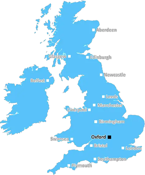
Oxford (OX10)
The OX10 postcode area is located in the Oxford postcode town region, within the county of Oxfordshire, and contains a total of 1365 individual postcodes.
There are 50 electoral wards in the OX10 postcode area, including Abingdon, Bampton, Banbury, Bicester, Burford, Carterton, Chinnor, Chipping Norton, Didcot, Kidlington, Oxford, Thame, Wallingford, Wantage, Watlington, Witney, Woodstock which come under the local authority of the South Oxfordshire Council.
Combining the whole postcode region, 36% of people in OX10 are classed as having an AB social grade, (i.e. 'white-collar' middle-upper class), compared to 27% across the UK.
This does not mean that the people of OX10 are wealthier - or higher class - than average, but it can be an indication that the area may be prospering and desirable to live in.
The OX10 postcode relates to areas within a certain radius of the town of Wallingford in Oxfordshire. It's a predominantly rural area known for its rolling hills, picturesque villages, and bustling market towns. The postcode covers areas such as Aston Tirrold, Aston Upthorpe, Brightwell-cum-Sotwell, Cholsey, Dorchester, North Stoke, Preston Crowmarsh, and South Stoke.
Its proximity to Oxford makes it a popular area for commuters who want to live among green rolling hills, without having to be too far from Oxford and the amenities that come with living close to a city. It has good transport links, being just a 30-minute drive of London, and only 15 minutes from Oxford.
The landscape of the OX10 postcode is moistly dominated by an agricultural base, with several farms, orchards, and pastures. This makes it a scenic rural area with good birds' eye views, where you can appreciate the natural beauty all around you. Nature enthusiasts can visit Wittenham Clumps, National Trust properties such as Shotover, Nuneham Park, and Hill Wood, or visit the Badgemore Nature Reserve.
You'll find a variety of activities available in OX10 postcode, from gyms and spas, to pubs and restaurants. There are some good shops in the Cholsey and Morrisons. Wallingford Market and the Saturday Farmers Market are great places to pick up locally grown produce and craft goods. There are also some lovely independent shops in the area.
The schools in OX10 postcode are generally considered to be of a good standard. Wallingford's primary schools, including Wolsey and St Martin's, have both achieved Outstanding ratings from Ofsted. The Wallingford School is a highly rated secondary school, whilst the Wallingford Tutor Centre also provides private tutoring for those needing help with exams.
If you're an art lover, you'll be spoilt for choice with the many galleries and art centres in the area. The shops in these centres showcase the works of local artists and craft makers. For theatre-goers, there are plenty of local venues around, including the Corney Theatre and the Corn Exchange.
To sum up, the OX10 postcode is a beautiful and welcoming rural area that has a lot to offer. It is quickly becoming a desirable location due to its proximity to Oxford, excellent transport links, good schools, and a variety of leisure activities and cultural experiences.

Demographics

Oxfordshire

OX10 is located in the county of Oxfordshire, in England.
Oxfordshire has a total population of 683,200, making it the 35th largest county in the UK.
Oxfordshire has a total area of 1005 square miles, and a population density of 262 people per square kilometre. For comparison, Greater London has a density of 5,618 people/km2.
| Outward Code | OX10 |
| Postal Town | Oxford |
| MSOA Name | South Oxfordshire 012 |
| LSOA Name | South Oxfordshire 012F |
| County | Oxfordshire |
| Region | Oxfordshire |
| Country | England |
| Local Authority | South Oxfordshire |
| Area Classification | Mainly Rural (rural including hub towns >=80%) |
OX10 Electoral Wards
The postal region of OX10, includes the local towns, villages, electoral wards and stations of:
Dig even deeper into the OX10 postcode by clicking on a postcode below:
Click on an outward postal code below for more information about the area. Each 'outward' postcode give you a comprehensive list of all postcodes within the outward code area (OX) and estimated address.
Click on an 'outward' code for more information. For example, the outward postcode page 'EC2M' will give you an alphabetical list covering all postcodes located in the region, from 'EC2M 1BB' through to 'EC2M 7YA'.
Chris H
Monday, April 8, 2024
We don't have any views of OX10 right now. If you live in OX10 or have visited it, please help us to help others by telling others what you think of this neighbourhood.
Add your view of OX10
People need your local expertise. If you live in OX10 or have first-hand knowledge of the neighbourhood, please consider sharing your views. It's completely anonymous - all we ask is for your initials.
Please tell us what you like about the OX10 postcode area, what you don't like, and what it's like to live or work here.
| LOCAL AMENITIES | |
| FAMILY FRIENDLY | |
| PARKING | |
| GREEN SPACES |
Local News Berkshire
Tesco introduces new 10p charge at the checkout in trial
Tesco has introduced a new 10p charge at some of its UK stores
Local BerkshireReading College culinary students serve up first service - how to book
Culinary Arts students at Reading College and University Centre haven taken part in their first restaurant service.
Local BerkshireSunningdale named on Telegraph's list of poshest villages in UK
A peaceful countryside village in Berkshire has been named as one of the poshest places in the UK, according to The Telegraph.
Local Berkshiremydentist Tilehurst three year wait list according to patients
mydentist at Meadway Precincthas allegedly been telling patients that their waiting list is over three years long.
Local BerkshireHow is your constituency changing?
Analysis shows the effect of the new election boundaries. Use our tool to look up your constituency.
BBC NewsChanges made to flats plans for The Oracle Reading
Height changes for the site of hundreds of flats to be built as part of a transformative plan at The Oracle in Reading have been put forward.
Local BerkshireWycombe purchase of Reading training ground 'on hold'
Reading's sale of their Bearwood Park training ground to League One rivals Wycombe is put "on hold".
BBC NewsRaze the Roof charity event celebrates launch in Purple Turtle
A charity music event taking place across Reading over the next year celebrated its launch.
Local BerkshireFrom the Postcode Area blog

Deciphering Crime Rates - a Deep Dive Into UK Postcode Analysis
Ever wondered about the crime rate in your UK postcode? You're not alone. We've dug deep into the data, uncovering trends and patterns that'll make your head spin.

Death of the High Street?
The BBC reports that despite councils' attempts to kurb them, the UK's high streets have seen a huge growth in fast food outlets. Could this mark the death knell for the Great British high street, and what can we do about it to halt its decline?

Discrimination by Postcode
You really couldn't make it up, could you? Some of the country's most vulnerable people are missing out on their weekly £25 Cold Weather Payment, just because the system that's in operation is discriminating against them because payments are based on postcode, rather than geographic location.

The Redesign is Underway
Well, the current website was absolutely in dire need of a good redesign - from the ground up. So I set out to pull it all apart and get it up and running again to become the most comprehensive guide to every postcode in the UK. And it's been a long, tough job from start to finish - and quite possibly the biggest project I've ever undertaken.
SOCIAL GRADES
According to census records, 36% of people here have a social grade of AB (highest), compared to the national average of 27%.