wakefield WF10 Postcodes
Spending a fortune on conveyancing?

Compare instant, low-cost online quotes from trusted conveyancing solicitors.
Backed by experts, our no-obligation service searches through the best conveyancing quotes on the market to save you time and money.
Wakefield (WF10)
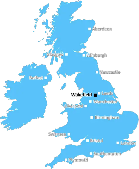
The WF10 postcode area is located in the Wakefield postcode town region, within the county of West Yorkshire, and contains a total of 1402 individual postcodes.
There are 21 electoral wards in the WF10 postcode area, including Batley, Castleford, Dewsbury, Heckmondwike, Knottingley, Liversedge, Mirfield, Normanton, Ossett, Pontefract, Wakefield which come under the local authority of the Wakefield Council.
Combining the whole postcode region, 10% of people in WF10 are classed as having an AB social grade, (i.e. 'white-collar' middle-upper class), compared to 27% across the UK.
This does not mean that the people of WF10 are poorer than other areas, but it may give an indication that there are areas of deprivation.
WF10 is a postcode located in the Wakefield district in West Yorkshire, England. It covers several small villages and towns, including Crigglestone, Newmillerdam, Sandal and Walton, Oversal, Agbrigg, and Altofts. The WF10 postcode is located just east of Wakefield city centre, about 9 miles south-east of Leeds, and around 16 miles west of Doncaster.
WF10 is a diverse residential area made up of a mix of housing. This range includes modern terraced and semi-detached housing, large detached homes, as well as council and housing association accommodation. Property prices in the area are typically lower than both Wakefield city centre and those of surrounding suburbs, making the WF10 postcodeone an attractive and affordable option for homebuyers.
WF10 is home to a number of amenities and attractions. Popular shopping areas for local residents are situated around Newmillerdam and Crigglestone, with a broad range of shops and restaurants. Other facilities include local schools, churches, health care facilities, and recreational activities. Wakefield's retail park, Trinity Walk Shopping Centre, is located just north of the postcode, a short 5-minute drive away.
The area is a favourite amongst families, couples and dog walkers due to its nearby parks and natural beauty spots. Newmillerdam Country Park is located right in the centre of WF10, with its million year old lake offering walking trails, fishing, picnic areas and woodlandspans. Several other parks can be found around the postcode, including Walton Fields, Agbrigg Park, Altofts Park, and Oversal Rocks.
Furthermore, WF10 offers good transport connections within and beyond the Wakefield district. The area is served by a several bus routes, and is only a few minutes drive from junction 39 of the M1 motorway. Wakefield Westgate station is easily reachable by car, and provides direct services to Leeds, Sheffield, Hull, York and London.

Demographics
West Yorkshire

WF10 is located in the county of West Yorkshire, in England.
West Yorkshire has a total population of 2,299,700, making it the 4th largest county in the UK.
West Yorkshire has a total area of 783 square miles, and a population density of 1133 people per square kilometre. For comparison, Greater London has a density of 5,618 people/km2.
| Outward Code | WF10 |
| Postal Town | Wakefield |
| MSOA Name | Wakefield 002 |
| LSOA Name | Wakefield 002D |
| County | West Yorkshire |
| Region | West Yorkshire |
| Country | England |
| Local Authority | Wakefield |
| Area Classification | Urban with City and Town |
WF10 Electoral Wards
The postal region of WF10, includes the local towns, villages, electoral wards and stations of:
Dig even deeper into the WF10 postcode by clicking on a postcode below:
Click on an outward postal code below for more information about the area. Each 'outward' postcode give you a comprehensive list of all postcodes within the outward code area (WF) and estimated address.
Click on an 'outward' code for more information. For example, the outward postcode page 'EC2M' will give you an alphabetical list covering all postcodes located in the region, from 'EC2M 1BB' through to 'EC2M 7YA'.
Chris H
Tuesday, May 7, 2024
We don't have any views of WF10 right now. If you live in WF10 or have visited it, please help us to help others by telling others what you think of this neighbourhood.
Add your view of WF10
People need your local expertise. If you live in WF10 or have first-hand knowledge of the neighbourhood, please consider sharing your views. It's completely anonymous - all we ask is for your initials.
Please tell us what you like about the WF10 postcode area, what you don't like, and what it's like to live or work here.
| LOCAL AMENITIES | |
| FAMILY FRIENDLY | |
| PARKING | |
| GREEN SPACES |
Local News West Yorkshire
Wakefield council tax rise agreed amid angry scenes at meeting
A Wakefield Council budget meeting is adjourned after a heated debate over spending cuts.
BBC NewsHorbury: Plans to convert WW2 gas site into caf rejected
Objectors say the project would "fail to preserve the special historic interest" of the structure.
BBC NewsPrincess Anne praises Rob Burrow for MND fundraising
The Princess Royal meets the ex-rugby league player at an event at Headingley Stadium in Leeds.
BBC NewsLeeds United fan injured during FA Cup tie at Chelsea
A Leeds United supporter is "in the hands of the emergency services" after appearing to fall from the stand in their FA Cup tie at Chelsea.
BBC NewsNational Coal Mining Museum hosts miners' memories of 1980s strike
Memories of the 1984 miners' strike at centre of 40th anniversary exhibition.
BBC NewsElland waste tip to close for up to two weeks
The waste recycling centre's closure is to allow "essential drainage works" to take place.
BBC NewsRapper Ja Rule denied UK entry ahead of Cardiff gig
The musician says his criminal record was the reason he has to shelve the British leg of his tour.
BBC NewsRoot leads calls for changes to domestic schedule
Joe Root is leading calls from players to reduce the amount of domestic cricket and review a schedule that is not fit for purpose.
BBC NewsFrom the Postcode Area blog

Deciphering Crime Rates - a Deep Dive Into UK Postcode Analysis
Ever wondered about the crime rate in your UK postcode? You're not alone. We've dug deep into the data, uncovering trends and patterns that'll make your head spin.

Death of the High Street?
The BBC reports that despite councils' attempts to kurb them, the UK's high streets have seen a huge growth in fast food outlets. Could this mark the death knell for the Great British high street, and what can we do about it to halt its decline?

Discrimination by Postcode
You really couldn't make it up, could you? Some of the country's most vulnerable people are missing out on their weekly £25 Cold Weather Payment, just because the system that's in operation is discriminating against them because payments are based on postcode, rather than geographic location.

The Redesign is Underway
Well, the current website was absolutely in dire need of a good redesign - from the ground up. So I set out to pull it all apart and get it up and running again to become the most comprehensive guide to every postcode in the UK. And it's been a long, tough job from start to finish - and quite possibly the biggest project I've ever undertaken.
SOCIAL GRADES
According to census records, 10% of people here have a social grade of AB (highest), compared to the national average of 27%.