wakefield W1F Postcodes
Spending a fortune on conveyancing?

Compare instant, low-cost online quotes from trusted conveyancing solicitors.
Backed by experts, our no-obligation service searches through the best conveyancing quotes on the market to save you time and money.
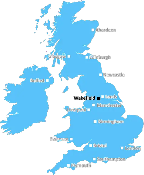
Wakefield (W1F)
The W1F postcode area is located in the Wakefield postcode town region, within the county of Greater London, and contains a total of 987 individual postcodes.
There are 1 electoral wards in the W1F postcode area, including London which come under the local authority of the City of London,Westminster Council.
Combining the whole postcode region, 47% of people in W1F are classed as having an AB social grade, (i.e. 'white-collar' middle-upper class), compared to 27% across the UK.
This does not mean that the people of W1F are wealthier - or higher class - than average, but it can be an indication that the area may be prospering and desirable to live in.
The W1F postcode covers a large area in London, running from Oxford Street in the north to Marylebone in the south, Pimlico in the east and Hyde Park and Marylebone in the west. It is composed of 12 different postcode districts, including Mayfair, Soho, Charing Cross, Westminster and Pimlico. Around 87,000 residents live in this postcode area, with a mix of businesses, restaurants, shops and residential homes.
The area is home to some of London's most iconic sites and landmarks, including Buckingham Palace, the Royal Opera House, Downing Street, The Houses of Parliament, Whitehall and Piccadilly Circus. It is a bustling area with a characteristic blend of old and new architecture, from the grand historical buildings to the new apartment blocks and shopping centres.
Homes in the W1F postcode are sought after, thanks to their great location, and prices are high. Mayfair and Soho, for example, are two of the most expensive places to live in all of the UK. For this reason, many wealthy people from all over the world have purchased properties in the area. The postcode is also known for its boutique stores, luxurious restaurants, and its vibrant nightlife.
The W1F postcode includes several green spaces, which is rare for such a large urban area. Green Park, Hyde Park and St. James Park are the main three, and they offer a peaceful retreat away from the hustle and bustle of the city.
The area is well-connected to the rest of London, with numerous underground and overground train stations and several bus stops. It is also home to Paddington Station which serves Heathrow Airport.
W1F is the perfect postcode for those who want to be at the heart of London's culture and lifestyle. With its luxury apartments, stunning architecture, great transit and wonderful green spaces, it is an area well-worth investing in.

Demographics
Greater London

W1F is located in the county of Greater London, in England.
Greater London has a total population of 8,778,500, making it the 1st largest county in the UK.
Greater London has a total area of 606 square miles, and a population density of 5594 people per square kilometre. For comparison, Greater London has a density of 5,618 people/km2.
| Outward Code | W1F |
| Postal Town | Wakefield |
| MSOA Name | Westminster 013 |
| LSOA Name | Westminster 013F |
| County | Greater London |
| Region | Greater London |
| Country | England |
| Local Authority | City of London,Westminster |
| Area Classification | Urban with Major Conurbation |
W1F Electoral Wards
The postal region of W1F, includes the local towns, villages, electoral wards and stations of:
Dig even deeper into the W1F postcode by clicking on a postcode below:
Click on an outward postal code below for more information about the area. Each 'outward' postcode give you a comprehensive list of all postcodes within the outward code area (WF) and estimated address.
Click on an 'outward' code for more information. For example, the outward postcode page 'EC2M' will give you an alphabetical list covering all postcodes located in the region, from 'EC2M 1BB' through to 'EC2M 7YA'.
Chris H
Monday, April 8, 2024
We don't have any views of W1F right now. If you live in W1F or have visited it, please help us to help others by telling others what you think of this neighbourhood.
Add your view of W1F
People need your local expertise. If you live in W1F or have first-hand knowledge of the neighbourhood, please consider sharing your views. It's completely anonymous - all we ask is for your initials.
Please tell us what you like about the W1F postcode area, what you don't like, and what it's like to live or work here.
| LOCAL AMENITIES | |
| FAMILY FRIENDLY | |
| PARKING | |
| GREEN SPACES |
Local News London
Rowdown Fields Croydon human remains found: Crime scene lifted
A crime scene that had been put in place after human remains were found at a park in Croydon has now been lifted.
This is Local LondonCamberwell couple's 'flat doesn't exist' on Kimpton Road
A Camberwell couple can't order takeaways, always miss deliveries and have even had tradesman do work on the WRONG house because their 'flat doesn't exist'.
This is Local LondonMixed-use London freehold to lead Allsop's March residential auction
Thefreeholdbuilding in Hampstead is guided at 2.5m-plus.
Property WeekEdmond de Rothschild REIM acquires Newbury resi scheme for 34m
The affordable housing project has already seen the development of almost 120 new homes.
Property WeekHavering Council ups wedding charges at Langtons, Hornchurch
Charges for wedding packagesat Langtons in Hornchurch have been hiked by Havering Council.
This is Local LondonHavering schools to gain teaching assistants through scheme
Schools in Collier Row, Hornchurch and Upminster are set to benefit from incoming teaching assistants in a bid to address a skills shortage in the sector.
This is Local LondonCrawley's The Create Building lands British Airways Holidays as tenant
The company has signed a lease for the top floor of the nine-storey tower.
Property WeekGirlguide appeal for leaders in Elstree and Borehamwood
Girl guides are appealing for parents to become leaders in Borehamwood, where there aren't enough volunteers to organise groups for youngsters.
This is Local LondonFrom the Postcode Area blog

Deciphering Crime Rates - a Deep Dive Into UK Postcode Analysis
Ever wondered about the crime rate in your UK postcode? You're not alone. We've dug deep into the data, uncovering trends and patterns that'll make your head spin.

Death of the High Street?
The BBC reports that despite councils' attempts to kurb them, the UK's high streets have seen a huge growth in fast food outlets. Could this mark the death knell for the Great British high street, and what can we do about it to halt its decline?

Discrimination by Postcode
You really couldn't make it up, could you? Some of the country's most vulnerable people are missing out on their weekly £25 Cold Weather Payment, just because the system that's in operation is discriminating against them because payments are based on postcode, rather than geographic location.

The Redesign is Underway
Well, the current website was absolutely in dire need of a good redesign - from the ground up. So I set out to pull it all apart and get it up and running again to become the most comprehensive guide to every postcode in the UK. And it's been a long, tough job from start to finish - and quite possibly the biggest project I've ever undertaken.
SOCIAL GRADES
According to census records, 47% of people here have a social grade of AB (highest), compared to the national average of 27%.