portsmouth PO38 Postcodes
Spending a fortune on conveyancing?

Compare instant, low-cost online quotes from trusted conveyancing solicitors.
Backed by experts, our no-obligation service searches through the best conveyancing quotes on the market to save you time and money.
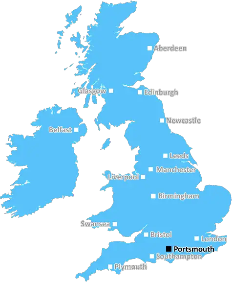
Portsmouth (PO38)
The PO38 postcode area is located in the Portsmouth postcode town region, within the county of Isle of Wight, and contains a total of 712 individual postcodes.
There are 48 electoral wards in the PO38 postcode area, including Bembridge, Bognor Regis, Chichester, Cowes, East Cowes, Emsworth, Fareham, Freshwater, Gosport, Havant, Hayling Island, Lee-On-The-Solent, Newport, Portsmouth, Rowland's Castle, Ryde, Sandown, Seaview, Shanklin, Southsea, Totland Bay, Ventnor, Waterlooville, Yarmouth which come under the local authority of the Isle of Wight Council.
Combining the whole postcode region, 21% of people in PO38 are classed as having an AB social grade, (i.e. 'white-collar' middle-upper class), compared to 27% across the UK.
This does not mean that the people of PO38 are poorer than other areas, but it may give an indication that there are areas of deprivation.
The PO38 postcode is in the Portsmouth district, located in the South East of England. It is a traditional coastal area and is home to a range of beautiful scenery and popular attractions. It is also home to both a thriving business community and a number of well-regarded schools.
The area is centred around Freshwater, a small hamlet located on the west side of the Isle of Wight, which is a well known holiday destination thanks to its sandy beaches and stunning coastal views. Nearby, Bembridge Harbour is a popular spot for sailing and fishing, and is well worth a visit. The coast in this area is renowned for its natural beauty, with visitors often taking in impressive views from The Needles to the south and The Solent and Isle of Wight to the north. It is also home to a range of steps, coves, and bays which offer even more beautiful scenery.
Away from the coastline, the area is dominated by some of the finest countryside that Hampshire has to offer. This includes the New and Testwood Forests which are both popular for outdoor activities including walking, climbing, and mountain biking as well as picnicking and bird watching.
The postcode area is also made up of desirable residential areas such as Brook with its fantastic golf course, Shalfleet with its charming village centre and Upton with stunning views over the Solent. In addition, there are a number of bustling towns here such as Yarmouth, Newport, and Ryde which are all within close proximity.
The PO38 postcode is home to a range of native wildlife such as badgers, red squirrels, deer, and foxes. There are also plenty of sheltered coves and cliffs making it a great place for a spot of rock pooling.
The area has some fantastic amenities, including a number of top-notch schools and shops. There are also many local pubs, restaurants, and online businesses which make it an ideal location for living and for visiting.
The postcode is extremely proud of its vibrant and friendly community, evident by its diverse range of events and activities throughout the year, such as the annual Seafood Festival, the Cowes Week sailing event, and the much-loved Isle of Wight walking festival.

Demographics
Isle of Wight

PO38 is located in the county of Isle of Wight, in England.
Isle of Wight has a total population of 139,800, making it the 46th largest county in the UK.
Isle of Wight has a total area of 150 square miles, and a population density of 367 people per square kilometre. For comparison, Greater London has a density of 5,618 people/km2.
| Outward Code | PO38 |
| Postal Town | Portsmouth |
| MSOA Name | Isle of Wight 018 |
| LSOA Name | Isle of Wight 018D |
| County | Isle of Wight |
| Region | Isle of Wight |
| Country | England |
| Local Authority | Isle of Wight |
| Area Classification | Mainly Rural (rural including hub towns >=80%) |
PO38 Electoral Wards
The postal region of PO38, includes the local towns, villages, electoral wards and stations of:
Dig even deeper into the PO38 postcode by clicking on a postcode below:
Click on an outward postal code below for more information about the area. Each 'outward' postcode give you a comprehensive list of all postcodes within the outward code area (PO) and estimated address.
Click on an 'outward' code for more information. For example, the outward postcode page 'EC2M' will give you an alphabetical list covering all postcodes located in the region, from 'EC2M 1BB' through to 'EC2M 7YA'.
Chris H
Wednesday, April 17, 2024
We don't have any views of PO38 right now. If you live in PO38 or have visited it, please help us to help others by telling others what you think of this neighbourhood.
Add your view of PO38
People need your local expertise. If you live in PO38 or have first-hand knowledge of the neighbourhood, please consider sharing your views. It's completely anonymous - all we ask is for your initials.
Please tell us what you like about the PO38 postcode area, what you don't like, and what it's like to live or work here.
| LOCAL AMENITIES | |
| FAMILY FRIENDLY | |
| PARKING | |
| GREEN SPACES |
From the Postcode Area blog

Deciphering Crime Rates - a Deep Dive Into UK Postcode Analysis
Ever wondered about the crime rate in your UK postcode? You're not alone. We've dug deep into the data, uncovering trends and patterns that'll make your head spin.

Death of the High Street?
The BBC reports that despite councils' attempts to kurb them, the UK's high streets have seen a huge growth in fast food outlets. Could this mark the death knell for the Great British high street, and what can we do about it to halt its decline?

Discrimination by Postcode
You really couldn't make it up, could you? Some of the country's most vulnerable people are missing out on their weekly £25 Cold Weather Payment, just because the system that's in operation is discriminating against them because payments are based on postcode, rather than geographic location.

The Redesign is Underway
Well, the current website was absolutely in dire need of a good redesign - from the ground up. So I set out to pull it all apart and get it up and running again to become the most comprehensive guide to every postcode in the UK. And it's been a long, tough job from start to finish - and quite possibly the biggest project I've ever undertaken.
SOCIAL GRADES
According to census records, 21% of people here have a social grade of AB (highest), compared to the national average of 27%.