uxbridge UB9 Postcodes
Spending a fortune on conveyancing?

Compare instant, low-cost online quotes from trusted conveyancing solicitors.
Backed by experts, our no-obligation service searches through the best conveyancing quotes on the market to save you time and money.
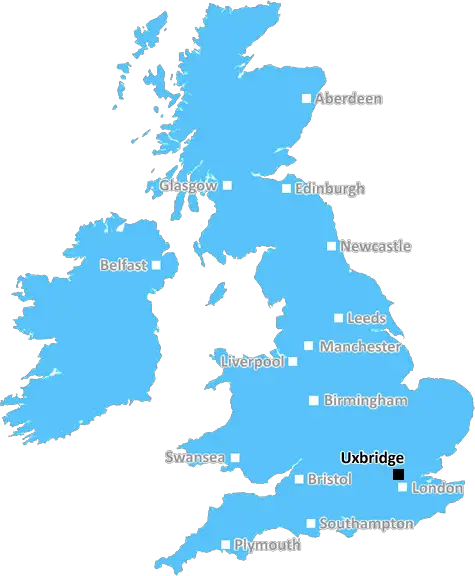
Uxbridge (UB9)
The UB9 postcode area is located in the Uxbridge postcode town region, within the county of Buckinghamshire, and contains a total of 605 individual postcodes.
There are 17 electoral wards in the UB9 postcode area, including Greenford, Hayes, Northolt, Southall, Uxbridge, West Drayton which come under the local authority of the South Bucks Council.
Combining the whole postcode region, 28% of people in UB9 are classed as having an AB social grade, (i.e. 'white-collar' middle-upper class), compared to 27% across the UK.
This does not mean that the people of UB9 are wealthier - or higher class - than average, but it can be an indication that the area may be prospering and desirable to live in.
UB9 is a postcode in the Uxbridge district of London in the UK. It covers areas of the Uxbridge town such as Hillingdon, Cowley, West Drayton, Yiewsley and Ickenham.
The postcode district UB9 is bounded by postcode districts UB7 to the west, UB10 to the east, UB8 to the south, and across the London Borough of Hillingdon to the north.
The area around the UB9 postcode is mostly residential, but there are some commercial and industrial areas, including businesses such as the Hillingdon Hospital. The area is also home to some of the Uxbridge Golf Club, the Uxbridge and Hillingdon Tennis Club and the Uxbridge Common.
The UB9 postcode is served by Uxbridge Station, on the Metropolitan and Piccadilly lines on the London Underground network, as well as Yiewsley Station and West Drayton Station, both on the Great Western Railway mainline.
UB9 is a popular area for those looking to relocate to London, as it is outside of the busy Central London areas, yet has great transport links to the city, with Uxbridge Station only being 20 minutes away from Paddington Station. In addition, the nearby airport, Heathrow Airport, is well served by buses, coaches and trains with several routes running from the Uxbridge district.
The UB9 postcode is a culturally diverse region, with around 20% of residents coming from an ethnic minority background (mostly Indian and Pakistani). It has a large shopping centre, Intu Uxbridge, which serves the many local residents. Uxbridge High Street also has a variety of eateries, bars, coffee shops and small businesses.
The UB9 postcode has several primary and secondary schools, including the Ickenham Primary School, Hillingdon Primary School and Bishopshalt School. There are also several universities & colleges in the area, including Brunel University London, the University of West London and the University of Buckinghamshire.
As the postcode is in the outskirts of London, there are many large parks and green open spaces in and around the UB9 postcode. Frays Farm Meadows, Colne Valley Regional Park, Carlyle's Roundabout Pond and Hermitage Park are all nearby and are popular places for walks and outdoor activities.

Demographics
Buckinghamshire

UB9 is located in the county of Buckinghamshire, in England.
Buckinghamshire has a total population of 799,200, making it the 30th largest county in the UK.
Buckinghamshire has a total area of 723 square miles, and a population density of 426 people per square kilometre. For comparison, Greater London has a density of 5,618 people/km2.
| Outward Code | UB9 |
| Postal Town | Uxbridge |
| MSOA Name | South Bucks 003 |
| LSOA Name | South Bucks 003C |
| County | Buckinghamshire |
| Region | Buckinghamshire |
| Country | England |
| Local Authority | South Bucks |
| Area Classification | Urban with Significant Rural (rural including hub towns 26-49%) |
UB9 Electoral Wards
The postal region of UB9, includes the local towns, villages, electoral wards and stations of:
Dig even deeper into the UB9 postcode by clicking on a postcode below:
Click on an outward postal code below for more information about the area. Each 'outward' postcode give you a comprehensive list of all postcodes within the outward code area (UB) and estimated address.
Click on an 'outward' code for more information. For example, the outward postcode page 'EC2M' will give you an alphabetical list covering all postcodes located in the region, from 'EC2M 1BB' through to 'EC2M 7YA'.
Chris H
Tuesday, April 9, 2024
We don't have any views of UB9 right now. If you live in UB9 or have visited it, please help us to help others by telling others what you think of this neighbourhood.
Add your view of UB9
People need your local expertise. If you live in UB9 or have first-hand knowledge of the neighbourhood, please consider sharing your views. It's completely anonymous - all we ask is for your initials.
Please tell us what you like about the UB9 postcode area, what you don't like, and what it's like to live or work here.
| LOCAL AMENITIES | |
| FAMILY FRIENDLY | |
| PARKING | |
| GREEN SPACES |
From the Postcode Area blog

Deciphering Crime Rates - a Deep Dive Into UK Postcode Analysis
Ever wondered about the crime rate in your UK postcode? You're not alone. We've dug deep into the data, uncovering trends and patterns that'll make your head spin.

Death of the High Street?
The BBC reports that despite councils' attempts to kurb them, the UK's high streets have seen a huge growth in fast food outlets. Could this mark the death knell for the Great British high street, and what can we do about it to halt its decline?

Discrimination by Postcode
You really couldn't make it up, could you? Some of the country's most vulnerable people are missing out on their weekly £25 Cold Weather Payment, just because the system that's in operation is discriminating against them because payments are based on postcode, rather than geographic location.

The Redesign is Underway
Well, the current website was absolutely in dire need of a good redesign - from the ground up. So I set out to pull it all apart and get it up and running again to become the most comprehensive guide to every postcode in the UK. And it's been a long, tough job from start to finish - and quite possibly the biggest project I've ever undertaken.
SOCIAL GRADES
According to census records, 28% of people here have a social grade of AB (highest), compared to the national average of 27%.