romford RM14 Postcodes
Spending a fortune on conveyancing?

Compare instant, low-cost online quotes from trusted conveyancing solicitors.
Backed by experts, our no-obligation service searches through the best conveyancing quotes on the market to save you time and money.
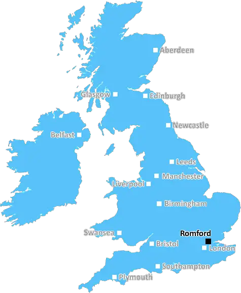
Romford (RM14)
The RM14 postcode area is located in the Romford postcode town region, within the county of Greater London, and contains a total of 862 individual postcodes.
There are 17 electoral wards in the RM14 postcode area, including Dagenham, Grays, Hornchurch, Purfleet, Rainham, Romford, South Ockendon, Tilbury, Upminster which come under the local authority of the Havering Council.
Combining the whole postcode region, 28% of people in RM14 are classed as having an AB social grade, (i.e. 'white-collar' middle-upper class), compared to 27% across the UK.
This does not mean that the people of RM14 are wealthier - or higher class - than average, but it can be an indication that the area may be prospering and desirable to live in.
The RM14 postcode in the Romford district (UK English) is located in the London borough of Havering and is within the bounds of the M25 motorway.
RM14 is known to be a bustling area with a variety of shops, restaurants and businesses. It stretches from Dagenham and Romford northwards to Rainham, Ingrave and Havering-atte-Bower. Residents of the RM14 area have access to the nearby Romford Shopping Centre, which houses a total of 47 high street outlets.
The area has experiences tremendous growth in recent years, and shows no signs of slowing down. New housing projects have been developed in and around the area. In 2020, new retail outlets are expected to open up as part of the ongoing regeneration programme, which will increase the local economy.
Transport links to the RM14 postcode are good, with regular trains from Romford to London and beyond. It is also served by London Buses routes 248, 256, and 346.The transport links make it an ideal location for commuters.
When it comes to academic facilities, RM14 postcode is served by excellent local schools. Primary schools such as Nelmes Primary School, Damson Wood Primary School, Squirrels Heath Infant School and Squirrels Heath Junior School, all serve RM14, with the latter two achieving 'outstanding' Ofsted ratings.
When it comes to leisure and entertainment, RM14 is just a short drive away from the major attractions of Essex such as Bluewater, London Aquarium or Thorndon Park. It is also just a short drive away from buzzing metropolises such as Canary Wharf and Stratford City. Other places of interest nearby include National Trust's Havering atte Bower House, Warley Place, Hilly Fields Country Park, and the many lakes of Havering-atte-Bower.
Finally, the area is home to a vibrant nightlife, which includes a plethora of pubs, bars and clubs. The Royal George Pub and Tootsies Bar are two popular local hotspots.

Demographics

Greater London

RM14 is located in the county of Greater London, in England.
Greater London has a total population of 8,778,500, making it the 1st largest county in the UK.
Greater London has a total area of 606 square miles, and a population density of 5594 people per square kilometre. For comparison, Greater London has a density of 5,618 people/km2.
| Outward Code | RM14 |
| Postal Town | Romford |
| MSOA Name | Havering 019 |
| LSOA Name | Havering 019C |
| County | Greater London |
| Region | Greater London |
| Country | England |
| Local Authority | Havering |
| Area Classification | Urban with Major Conurbation |
RM14 Electoral Wards
The postal region of RM14, includes the local towns, villages, electoral wards and stations of:
Dig even deeper into the RM14 postcode by clicking on a postcode below:
Click on an outward postal code below for more information about the area. Each 'outward' postcode give you a comprehensive list of all postcodes within the outward code area (RM) and estimated address.
Click on an 'outward' code for more information. For example, the outward postcode page 'EC2M' will give you an alphabetical list covering all postcodes located in the region, from 'EC2M 1BB' through to 'EC2M 7YA'.
Chris H
Saturday, April 6, 2024
We don't have any views of RM14 right now. If you live in RM14 or have visited it, please help us to help others by telling others what you think of this neighbourhood.
Add your view of RM14
People need your local expertise. If you live in RM14 or have first-hand knowledge of the neighbourhood, please consider sharing your views. It's completely anonymous - all we ask is for your initials.
Please tell us what you like about the RM14 postcode area, what you don't like, and what it's like to live or work here.
| LOCAL AMENITIES | |
| FAMILY FRIENDLY | |
| PARKING | |
| GREEN SPACES |
Local News Essex
Colchester mother raising funds for her son battling cancer
A LOVING mother has discussed her child's cancer battle after being diagnosed at the age of 2 whilst fundraising to create some family memories for him.
Daily GazetteEssex woman Diane Jones murder to be explored in Channel 5 show
A Channel 5 show, Prime Suspect: Murder in Suburbia, will examine the murder of Diane Jones
Daily GazetteEssex fuel shortage possible as tanker drivers strike
Essex could face fuel shortages as tanker drivers vote for strike action.
Daily GazetteColchester whistleblower speaks about Royal Mail chaos
A ROYAL Mail whistleblower has claimed residents in Colchester are suffering postal delays due to "poor"decisionmaking by the company.
Daily GazetteHatfield Peverel 'fake asbestos investigator' burglary probe
Essex Police is investigating a distraction burglary in which a man claimed to be checking for asbestos.
Daily GazetteColchester baby death sees councillors pay tribute
The five-month-old infant was rushed to hospital after emergency services were called to Seatrade House in North Station Road.
Daily GazetteRegal London signs Epson UK for 30,000 sq ft pre-let at Watford scheme
The grade-A The Clarendon Works office scheme will open in Q3.
Property WeekFace of Brentwood drug dealer jailed for stabbing man to death near Finsbury Park
Brian Edwards, 53, was stabbed three times after an argument between him and David Odunuga near Finsbury Park
Essex LiveFrom the Postcode Area blog

Deciphering Crime Rates - a Deep Dive Into UK Postcode Analysis
Ever wondered about the crime rate in your UK postcode? You're not alone. We've dug deep into the data, uncovering trends and patterns that'll make your head spin.

Death of the High Street?
The BBC reports that despite councils' attempts to kurb them, the UK's high streets have seen a huge growth in fast food outlets. Could this mark the death knell for the Great British high street, and what can we do about it to halt its decline?

Discrimination by Postcode
You really couldn't make it up, could you? Some of the country's most vulnerable people are missing out on their weekly £25 Cold Weather Payment, just because the system that's in operation is discriminating against them because payments are based on postcode, rather than geographic location.

The Redesign is Underway
Well, the current website was absolutely in dire need of a good redesign - from the ground up. So I set out to pull it all apart and get it up and running again to become the most comprehensive guide to every postcode in the UK. And it's been a long, tough job from start to finish - and quite possibly the biggest project I've ever undertaken.
SOCIAL GRADES
According to census records, 28% of people here have a social grade of AB (highest), compared to the national average of 27%.