tweed TD14 Postcodes
Spending a fortune on conveyancing?

Compare instant, low-cost online quotes from trusted conveyancing solicitors.
Backed by experts, our no-obligation service searches through the best conveyancing quotes on the market to save you time and money.
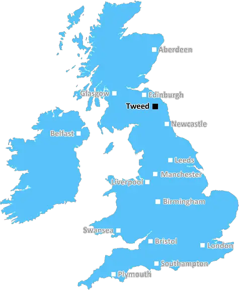
Tweed (TD14)
The TD14 postcode area is located in the Tweed postcode town region, within the county of Borders, and contains a total of 274 individual postcodes.
There are 14 electoral wards in the TD14 postcode area, including Berwick-Upon-Tweed, Cockburnspath, Coldstream, Cornhill-On-Tweed, Duns, Earlston, Eyemouth, Galashiels, Gordon, Hawick, Jedburgh, Kelso, Lauder, Melrose, Mindrum, Newcastleton, Selkirk which come under the local authority of the Scottish Borders Council.
Combining the whole postcode region, 0% of people in TD14 are classed as having an AB social grade, (i.e. 'white-collar' middle-upper class), compared to 27% across the UK.
This does not mean that the people of TD14 are poorer than other areas, but it may give an indication that there are areas of deprivation.
The TD14 postcode covers the small rural market town of Tweedmouth, located in the Tweed district of Northumberland. The town is situated along the south bank of the River Tweed, and is home to an old fishing harbour.
Historically, the town was developed along the old A1 coaching route, and is mentioned in the Domesday Book of 1086. Despite its small size, the town has an impressive array of amenities, including a local market, two churches, two banks, a post office, several pubs and shops, and a range of local services.
In terms of transport links, the town is accessible by bus or train, with the nearest train station being Berwick-upon-Tweed. Furthermore, the town also boasts annual festivals, such as the Tweedmouth International Festival, and the summer music festival, Summer by the River.
The ancient borough of Tweedmouth lies within the TD14 postcode and is located between the main towns of Spittal and Berwick-upon-Tweed. The local population of the town is approximately 3,000 people, which is relatively small, indicating that the town has managed to retain its character and independent identity.
The Tweed district covers an area that stretches from the River Wansbeck in the south, to the border with Scotland in the north, and includes the towns of Berwick-upon-Tweed, Spittal, and Tweedmouth. The TD14 postcode encompasses a range of smaller towns and villages, including Scremerston, East Ord, and Norham. All these settlements are bordered by the North Sea and the River Tweed.
The TD14 postcode area also contains numerous coastal locations that are a haven for wildlife, including the Lindisfarne National Nature Reserve, which is a registered Historic Monument and Site of Special Scientific Interest. The area also offers a range of recreational activities, such as kayaking, sailing, birdwatching, rockpooling, and walking.
TheTD14 postcode area is a beautiful, rural part of the Tweed district, with its fishing harbour, variety of amenities, transport links, festivals, and its range of coastal wildlife and recreational activities.

Demographics
Borders

TD14 is located in the county of Borders, in Scotland.
Borders has a total population of 0, making it the largest county in the UK.
Borders has a total area of square miles, and a population density of people per square kilometre. For comparison, Greater London has a density of 5,618 people/km2.
| Outward Code | TD14 |
| Postal Town | Tweed |
| MSOA Name | Eyemouth |
| LSOA Name | |
| County | Borders |
| Region | Borders |
| Country | Scotland |
| Local Authority | Scottish Borders |
| Area Classification | Unclassified |
TD14 Electoral Wards
The postal region of TD14, includes the local towns, villages, electoral wards and stations of:
Dig even deeper into the TD14 postcode by clicking on a postcode below:
Click on an outward postal code below for more information about the area. Each 'outward' postcode give you a comprehensive list of all postcodes within the outward code area (TD) and estimated address.
Click on an 'outward' code for more information. For example, the outward postcode page 'EC2M' will give you an alphabetical list covering all postcodes located in the region, from 'EC2M 1BB' through to 'EC2M 7YA'.
Chris H
Sunday, April 14, 2024
We don't have any views of TD14 right now. If you live in TD14 or have visited it, please help us to help others by telling others what you think of this neighbourhood.
Add your view of TD14
People need your local expertise. If you live in TD14 or have first-hand knowledge of the neighbourhood, please consider sharing your views. It's completely anonymous - all we ask is for your initials.
Please tell us what you like about the TD14 postcode area, what you don't like, and what it's like to live or work here.
| LOCAL AMENITIES | |
| FAMILY FRIENDLY | |
| PARKING | |
| GREEN SPACES |
From the Postcode Area blog

Deciphering Crime Rates - a Deep Dive Into UK Postcode Analysis
Ever wondered about the crime rate in your UK postcode? You're not alone. We've dug deep into the data, uncovering trends and patterns that'll make your head spin.

Death of the High Street?
The BBC reports that despite councils' attempts to kurb them, the UK's high streets have seen a huge growth in fast food outlets. Could this mark the death knell for the Great British high street, and what can we do about it to halt its decline?

Discrimination by Postcode
You really couldn't make it up, could you? Some of the country's most vulnerable people are missing out on their weekly £25 Cold Weather Payment, just because the system that's in operation is discriminating against them because payments are based on postcode, rather than geographic location.

The Redesign is Underway
Well, the current website was absolutely in dire need of a good redesign - from the ground up. So I set out to pull it all apart and get it up and running again to become the most comprehensive guide to every postcode in the UK. And it's been a long, tough job from start to finish - and quite possibly the biggest project I've ever undertaken.
SOCIAL GRADES
According to census records, 0% of people here have a social grade of AB (highest), compared to the national average of 27%.