tonbridge TN2 Postcodes
Spending a fortune on conveyancing?

Compare instant, low-cost online quotes from trusted conveyancing solicitors.
Backed by experts, our no-obligation service searches through the best conveyancing quotes on the market to save you time and money.
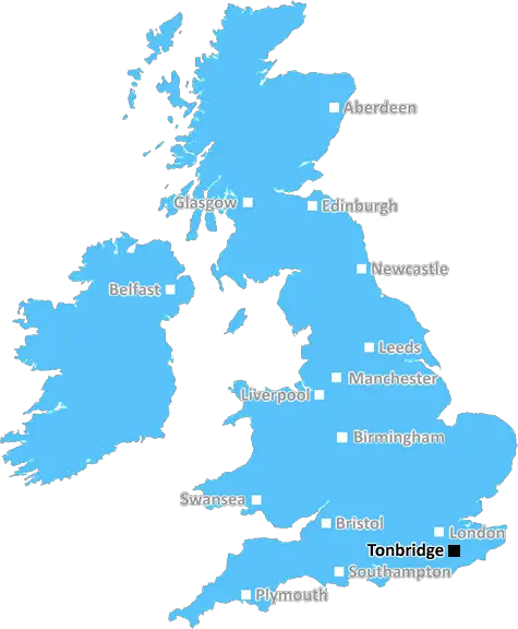
Tonbridge (TN2)
The TN2 postcode area is located in the Tonbridge postcode town region, within the county of Kent, and contains a total of 1342 individual postcodes.
There are 19 electoral wards in the TN2 postcode area, including Ashford, Battle, Bexhill-On-Sea, Cranbrook, Crowborough, Edenbridge, Etchingham, Hartfield, Hastings, Heathfield, Mayfield, New Romney, Robertsbridge, Romney Marsh, Rye, Sevenoaks, St Leonards-On-Sea, Tenterden, Tonbridge, Tunbridge Wells, Uckfield, Wadhurst, Westerham, Winchelsea which come under the local authority of the Tunbridge Wells Council.
Combining the whole postcode region, 32% of people in TN2 are classed as having an AB social grade, (i.e. 'white-collar' middle-upper class), compared to 27% across the UK.
This does not mean that the people of TN2 are wealthier - or higher class - than average, but it can be an indication that the area may be prospering and desirable to live in.
TN2 is a postcode within the Tunbridge Wells area of the Borough of Tonbridge and Malling in Kent, England. The TN2 postcode district encompasses an area than includes the town of Southborough, the village of High Brooms, Broadwater Down, Tunbridge Wells town centre, and parts of Blackhall and Mount Ephraim.
The TN2 area is well-connected, with several train lines running from Tunbridge Wells station and London Bridge station located just an hour away. The A21 runs through the area, meaning travelling by car to London is an hour's drive away and other UK cities are equally accessible. Areas such as Hastings, Gatwick, Ashford and Maidstone can all be reached by car in an hour or less.
Culinary delights abound in the TN2 postcode, with an array of international restaurants, cafes and independent food shops filling the town centre and surrounding areas. There is no shortage of pubs, bars and nightlife, offering something for everyone.
Culture is a way of life in the TN2 postcode. Highlights include The Assembly Hall Theatre, home to a wide mix of music, events, comedy and theatre performances; the historic Pantiles area of the town, with its open-air market and bustling shops; and Calverley Grounds, an 11-acre area with a skate park, basketball court, bowling green and boating lake.
Families of the TN2 postcode have no shortage of schools to choose from. Primary schools such as St James', St John's and Rose Hill are all within the area. High schools and colleges include The Skinner's School, Tunbridge Wells Girls' Grammar School, Weald of Kent Grammar School, and Tunbridge Wells College.
Healthcare in the TN2 postcode is provided by hospitals such as the Tunbridge Wells Hospital and the Pembury Community Hospital. Local GP practices include The Skinners Practice, The Royal Wells Practice and the Chequers Practice, and there are a number of dentists in the area.
TN2 is a great place to live, work and play, and offers something for everyone. With excellent transport connections, culturally diverse restaurants and shops, and an abundance of parks and open spaces, this area is an ideal place to call home.

Demographics

Kent

TN2 is located in the county of Kent, in England.
Kent has a total population of 1,820,400, making it the 6th largest county in the UK.
Kent has a total area of 1443 square miles, and a population density of 486 people per square kilometre. For comparison, Greater London has a density of 5,618 people/km2.
| Outward Code | TN2 |
| Postal Town | Tonbridge |
| MSOA Name | Tunbridge Wells 005 |
| LSOA Name | Tunbridge Wells 005A |
| County | Kent |
| Region | Kent |
| Country | England |
| Local Authority | Tunbridge Wells |
| Area Classification | Urban with Significant Rural (rural including hub towns 26-49%) |
TN2 Electoral Wards
The postal region of TN2, includes the local towns, villages, electoral wards and stations of:
Dig even deeper into the TN2 postcode by clicking on a postcode below:
Click on an outward postal code below for more information about the area. Each 'outward' postcode give you a comprehensive list of all postcodes within the outward code area (TN) and estimated address.
Click on an 'outward' code for more information. For example, the outward postcode page 'EC2M' will give you an alphabetical list covering all postcodes located in the region, from 'EC2M 1BB' through to 'EC2M 7YA'.
Chris H
Wednesday, May 8, 2024
We don't have any views of TN2 right now. If you live in TN2 or have visited it, please help us to help others by telling others what you think of this neighbourhood.
Add your view of TN2
People need your local expertise. If you live in TN2 or have first-hand knowledge of the neighbourhood, please consider sharing your views. It's completely anonymous - all we ask is for your initials.
Please tell us what you like about the TN2 postcode area, what you don't like, and what it's like to live or work here.
| LOCAL AMENITIES | |
| FAMILY FRIENDLY | |
| PARKING | |
| GREEN SPACES |
Local News Kent
Portsmouth NHS trust takes offices at Lakeside North Harbour
The trust has signed a 10-year lease for space at the business park.
Property WeekWalk across Kent beauty spot took my breath away - there's so much to see'
We visited a tranquil beauty spot with such a stunning array of wildlife that experts say it is like a service station for birds.
Kent OnlineL&G acquires Cambridgeshire BTR scheme from Stonebond
The 41-unit development comprises 10 flats and 31 houses.
Property WeekKnight Frank reports 25% leap in Golden Triangle life sciences take-up
Around 186,000 sq ft of space in London, Oxford and Cambridge was let in Q1 2024.
Property WeekDevelopers reveal new plans for 180 homes and wetland
New details of a wetland accompanying a new housing estate on the outskirts of a town have been revealed.
Kent OnlineWarburtons signs pre-let at Symmetry Park Biggleswade
The bakery brand has agreed a 25-year lease withTritax Symmetry for65,847 sq ft.
Property WeekPlaces for People acquires Rosewood Housing
The affordable homes provider was previously owned by housing developer Inland Homes.
Property WeekA rare look inside one of the modern wonders of the world
As the Channel Tunnel celebrates its 30th anniversary today, here is what we saw during a rare look behind the scenes.
Kent OnlineFrom the Postcode Area blog

Deciphering Crime Rates - a Deep Dive Into UK Postcode Analysis
Ever wondered about the crime rate in your UK postcode? You're not alone. We've dug deep into the data, uncovering trends and patterns that'll make your head spin.

Death of the High Street?
The BBC reports that despite councils' attempts to kurb them, the UK's high streets have seen a huge growth in fast food outlets. Could this mark the death knell for the Great British high street, and what can we do about it to halt its decline?

Discrimination by Postcode
You really couldn't make it up, could you? Some of the country's most vulnerable people are missing out on their weekly £25 Cold Weather Payment, just because the system that's in operation is discriminating against them because payments are based on postcode, rather than geographic location.

The Redesign is Underway
Well, the current website was absolutely in dire need of a good redesign - from the ground up. So I set out to pull it all apart and get it up and running again to become the most comprehensive guide to every postcode in the UK. And it's been a long, tough job from start to finish - and quite possibly the biggest project I've ever undertaken.
SOCIAL GRADES
According to census records, 32% of people here have a social grade of AB (highest), compared to the national average of 27%.