truro TR9 Postcodes
Spending a fortune on conveyancing?

Compare instant, low-cost online quotes from trusted conveyancing solicitors.
Backed by experts, our no-obligation service searches through the best conveyancing quotes on the market to save you time and money.
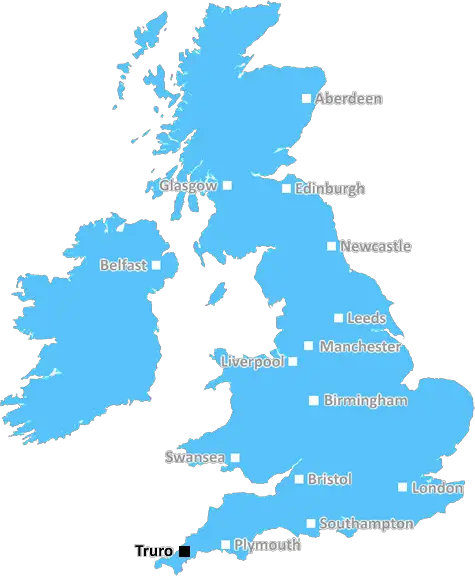
Truro (TR9)
The TR9 postcode area is located in the Truro postcode town region, within the county of Cornwall, and contains a total of 299 individual postcodes.
There are 31 electoral wards in the TR9 postcode area, including Camborne, Falmouth, Hayle, Helston, Isles Of Scilly, Marazion, Newquay, Penryn, Penzance, Perranporth, Redruth, St Agnes, St Columb, St Ives, Truro which come under the local authority of the Cornwall,Isles of Scilly Council.
Combining the whole postcode region, 14% of people in TR9 are classed as having an AB social grade, (i.e. 'white-collar' middle-upper class), compared to 27% across the UK.
This does not mean that the people of TR9 are poorer than other areas, but it may give an indication that there are areas of deprivation.
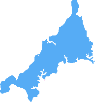
TR9 is a postcode district in the Truro post town, which is the largest town in Cornwall, England. The postcode district is centred on Indian Queens to the west, and includes the Tesco Extra and Marsh Lane Retail Park, as well as the town of Newquay to the northeast.
The TR9 postcode covers a large area of around 105 square miles, starting in the Polgooth area near St Austell and extending west as far as St Dennis. To the north it reaches St Columb Minor as far as the A39 and covers the full length of the North coast to Padstow. The southern boundary of the TR9 postcode is the River Fal which is crossed by the King Harry Chain ferry at Tunmarsh.
TR9 is a predominantly rural area with farming and fishing being some of the main industries of the area. However, there are also a number of small towns and villages such as Portloe, Veryan, St Mawes, Mevagissey, Fowey and Newquay, which all form part of the postcode district. TR9 also has a number of popular tourist attractions such as The Eden Project and the Lost Gardens of Heligan which are both within a 20 minute drive of the TR9 postcode.
The TR9 postcode is served by three railway stations; St Columb Road (on the Cornwall Branch Line), Newquay on the Atlantic Coast Line and Par on the Maritime Line. In addition, there is a regular bus service from Truro to Newquay.
The TR9 postcode has a population of approximately 59,000 as of the 2011 census, with a larger percentage of the population aged 25-44 than the UK average. The predominant religions in TR9 are Christian and No Religion, with the majority of the population declaring themselves as either Church of England or Non-Conformist.
The TR9 postcode is served by a number of schools, the nearest being Newquay Tretherras School, which is located in Newquay and is rated Good by Ofsted. There are also a number of private schools in the area, as well as the Truro and Penwith College, which offers a range of post-16 courses and higher education courses.
Despite most of the TR9 postcode being rural, there are a number of small to medium sized businesses that operate in the area, including farming, retail, hospitality, engineering and software companies. The closest large shopping centres to the TR9 postcode are the Newquay Retail Park and the out-of-town Marsh Lane Shopping Centre, both of which are located in Newquay.
The TR9 postcode also has a number of health services, with the main hospital being the Royal Cornwall Hospital in Truro, which is approx 15 miles away from the centre of the postcode. There is also the Mount Edgcumbe Hospice in St Austell, which is a charity that provides specialist palliative care for those facing terminal illness.

Demographics

Cornwall
TR9 is located in the county of Cornwall, in England.
Cornwall has a total population of 556,000, making it the 40th largest county in the UK.
Cornwall has a total area of 1375 square miles, and a population density of 156 people per square kilometre. For comparison, Greater London has a density of 5,618 people/km2.
| Outward Code | TR9 |
| Postal Town | Truro |
| MSOA Name | Cornwall 019 |
| LSOA Name | Cornwall 019B |
| County | Cornwall |
| Region | Cornwall |
| Country | England |
| Local Authority | Cornwall,Isles of Scilly |
| Area Classification | Mainly Rural (rural including hub towns >=80%) |
TR9 Electoral Wards
The postal region of TR9, includes the local towns, villages, electoral wards and stations of:
Dig even deeper into the TR9 postcode by clicking on a postcode below:
Click on an outward postal code below for more information about the area. Each 'outward' postcode give you a comprehensive list of all postcodes within the outward code area (TR) and estimated address.
Click on an 'outward' code for more information. For example, the outward postcode page 'EC2M' will give you an alphabetical list covering all postcodes located in the region, from 'EC2M 1BB' through to 'EC2M 7YA'.
Chris H
Wednesday, March 27, 2024
We don't have any views of TR9 right now. If you live in TR9 or have visited it, please help us to help others by telling others what you think of this neighbourhood.
Add your view of TR9
People need your local expertise. If you live in TR9 or have first-hand knowledge of the neighbourhood, please consider sharing your views. It's completely anonymous - all we ask is for your initials.
Please tell us what you like about the TR9 postcode area, what you don't like, and what it's like to live or work here.
| LOCAL AMENITIES | |
| FAMILY FRIENDLY | |
| PARKING | |
| GREEN SPACES |
Local News Cornwall
Man suffers 'significant head injury' after attack
Devon and Cornwall Police said a man in his 40s was arrested over the incident and has been bailed.
BBC NewsMotorists in Falmouth blasted by firefighters for blocking the road with parked cars
Every second counts, and when fire engines struggle to pass through a road due to parked cars there could be dire consequences
Cornwall LiveAward-winning Crowlas pub the Star Inn up for sale after tragic loss
It follows the death of publican Pete Elvin last Christmas
Cornwall LiveResident takes to the road in a kayak as flash floods strike
Six motorists had to be rescued from the water
Cornwall LiveTower moved inland to escape coastal erosion
The pepperpot tower in Cornwall reopens after being moved piece by piece 100m (330ft) inland.
BBC NewsMan hospitalised with 'significant' head injury after vicious attack
A man in his 40s was arrested following the attack in Bude on Sunday, March 17
Cornwall LiveLive: Search for missing Newquay woman ramps up after hat found
Tara Norveil, 52, has been missing since Thursday, March 14
Cornwall LiveDevastating aftermath of Looe house fire in pictures and video
Six fire engines were called to battle the blaze in Cornwall yesterday evening, Monday, March 25
Cornwall LiveFrom the Postcode Area blog

Deciphering Crime Rates - a Deep Dive Into UK Postcode Analysis
Ever wondered about the crime rate in your UK postcode? You're not alone. We've dug deep into the data, uncovering trends and patterns that'll make your head spin.

Death of the High Street?
The BBC reports that despite councils' attempts to kurb them, the UK's high streets have seen a huge growth in fast food outlets. Could this mark the death knell for the Great British high street, and what can we do about it to halt its decline?

Discrimination by Postcode
You really couldn't make it up, could you? Some of the country's most vulnerable people are missing out on their weekly £25 Cold Weather Payment, just because the system that's in operation is discriminating against them because payments are based on postcode, rather than geographic location.

The Redesign is Underway
Well, the current website was absolutely in dire need of a good redesign - from the ground up. So I set out to pull it all apart and get it up and running again to become the most comprehensive guide to every postcode in the UK. And it's been a long, tough job from start to finish - and quite possibly the biggest project I've ever undertaken.
SOCIAL GRADES
According to census records, 14% of people here have a social grade of AB (highest), compared to the national average of 27%.