tonbridge TN5 Postcodes
Spending a fortune on conveyancing?

Compare instant, low-cost online quotes from trusted conveyancing solicitors.
Backed by experts, our no-obligation service searches through the best conveyancing quotes on the market to save you time and money.
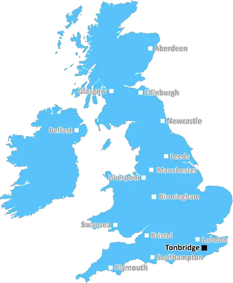
Tonbridge (TN5)
The TN5 postcode area is located in the Tonbridge postcode town region, within the county of East Sussex, and contains a total of 531 individual postcodes.
There are 37 electoral wards in the TN5 postcode area, including Ashford, Battle, Bexhill-On-Sea, Cranbrook, Crowborough, Edenbridge, Etchingham, Hartfield, Hastings, Heathfield, Mayfield, New Romney, Robertsbridge, Romney Marsh, Rye, Sevenoaks, St Leonards-On-Sea, Tenterden, Tonbridge, Tunbridge Wells, Uckfield, Wadhurst, Westerham, Winchelsea which come under the local authority of the Wealden Council.
Combining the whole postcode region, 35% of people in TN5 are classed as having an AB social grade, (i.e. 'white-collar' middle-upper class), compared to 27% across the UK.
This does not mean that the people of TN5 are wealthier - or higher class - than average, but it can be an indication that the area may be prospering and desirable to live in.
TN5 is a postcode district of the Tonbridge post town located within the Sevenoaks postcode area. This district is bordered by the postcode districts of TN4 (Royal Tunbridge Wells) to the west and TN6 (Crowborough) to the east.
It was created in 1971 and consists of parts of the civil parishes of Horsmonden, Goudhurst and Kilndown, which have a collective population of 8,348. This population is made up of 2,180 households, with an average household size of 3.81 people.
TN5 covers an area of 30.28 square miles and is made up of small villages and hamlets. These villages include Brenchley, Goudhurst, Kilndown, Kingswood and Matfield. The district also contains the Earl of Cranbrook's 2,000 acre estate but the estate itself is not included in the postcode district boundaries.
The major transport links into TN5 are the A21 and M20 motorways, both of which are approximately 10 miles away. The closest railway station is Paddock Wood which is located 5 miles away.
The area has a range of amenities, including a number of pubs, cafes, shops, and sports facilities. There are also three major house building developments in the district, including a retirement village, business park and a new housing estate.
Education in TN5 is provided by several schools, including two primary schools, a secondary school and a sixth form college. There is also a Sixth Form Centre in the centre of Horsmonden serving the nearby adjoinder post towns.
TN5 is a well-connected and growing area of Tonbridge with a good mix of amenities for the population. The area is popular for tourists due to its proximity to the cities of Tunbridge Wells and Crowborough, and its rural setting provides a peaceful environment to work and rest.

Demographics

East Sussex

TN5 is located in the county of East Sussex, in England.
East Sussex has a total population of 837,000, making it the 29th largest county in the UK.
East Sussex has a total area of 692 square miles, and a population density of 467 people per square kilometre. For comparison, Greater London has a density of 5,618 people/km2.
| Outward Code | TN5 |
| Postal Town | Tonbridge |
| MSOA Name | Wealden 005 |
| LSOA Name | Wealden 005E |
| County | East Sussex |
| Region | East Sussex |
| Country | England |
| Local Authority | Wealden |
| Area Classification | Mainly Rural (rural including hub towns >=80%) |
TN5 Electoral Wards
The postal region of TN5, includes the local towns, villages, electoral wards and stations of:
Dig even deeper into the TN5 postcode by clicking on a postcode below:
Click on an outward postal code below for more information about the area. Each 'outward' postcode give you a comprehensive list of all postcodes within the outward code area (TN) and estimated address.
Click on an 'outward' code for more information. For example, the outward postcode page 'EC2M' will give you an alphabetical list covering all postcodes located in the region, from 'EC2M 1BB' through to 'EC2M 7YA'.
JC , Tonbridge
Monday, December 12, 2022
we love it here
Add your view of TN5
People need your local expertise. If you live in TN5 or have first-hand knowledge of the neighbourhood, please consider sharing your views. It's completely anonymous - all we ask is for your initials.
Please tell us what you like about the TN5 postcode area, what you don't like, and what it's like to live or work here.
| LOCAL AMENITIES | |
| FAMILY FRIENDLY | |
| PARKING | |
| GREEN SPACES |
Local News Sussex
Tailbacks and homes without water after pipe burst
Hellingly Community Primary School has been closed but some pupils attend to sit their Sats.
BBC NewsDe Zerbi 'speaks with his heart on his sleeve'
Brighton chief executive Paul Barber talks Roberto De Zerbi future; a successful season; fans expectations and 'New Deal'.
BBC NewsGatwick Express marks 40 years with waistcoats
Mark Thake, Gatwick Express supervisor, says he is proud to be on board for the anniversary.
BBC NewsNew Dean of Chichester appointed by King Charles
The Venerable Dr Edward Dowler will take over the position in September.
BBC NewsMother wins 1,600 payout in council tuition row
The mother complained her child missed schooling at various times from 2022 to 2023.
BBC NewsMidfielder Lallana to leave Brighton this summer
Adam Lallana says he "needs time to reflect" before deciding on his future after choosing to leave Brighton at the end of this season.
BBC NewsLaws strengthened after mortuary sex abuse case
The government says it will increase sentences for those convicted of abusing dead bodies.
BBC NewsPlans to restore waterways discussed by council
Plans to spend 180,000 to restore and protect three waterways in Chichester are discussed.
BBC NewsFrom the Postcode Area blog

Deciphering Crime Rates - a Deep Dive Into UK Postcode Analysis
Ever wondered about the crime rate in your UK postcode? You're not alone. We've dug deep into the data, uncovering trends and patterns that'll make your head spin.

Death of the High Street?
The BBC reports that despite councils' attempts to kurb them, the UK's high streets have seen a huge growth in fast food outlets. Could this mark the death knell for the Great British high street, and what can we do about it to halt its decline?

Discrimination by Postcode
You really couldn't make it up, could you? Some of the country's most vulnerable people are missing out on their weekly £25 Cold Weather Payment, just because the system that's in operation is discriminating against them because payments are based on postcode, rather than geographic location.

The Redesign is Underway
Well, the current website was absolutely in dire need of a good redesign - from the ground up. So I set out to pull it all apart and get it up and running again to become the most comprehensive guide to every postcode in the UK. And it's been a long, tough job from start to finish - and quite possibly the biggest project I've ever undertaken.
SOCIAL GRADES
According to census records, 35% of people here have a social grade of AB (highest), compared to the national average of 27%.