tonbridge TN19 Postcodes
Spending a fortune on conveyancing?

Compare instant, low-cost online quotes from trusted conveyancing solicitors.
Backed by experts, our no-obligation service searches through the best conveyancing quotes on the market to save you time and money.
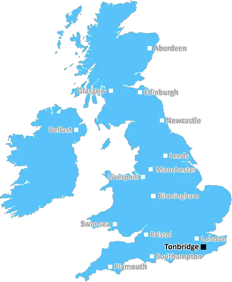
Tonbridge (TN19)
The TN19 postcode area is located in the Tonbridge postcode town region, within the county of East Sussex, and contains a total of 268 individual postcodes.
There are 24 electoral wards in the TN19 postcode area, including Ashford, Battle, Bexhill-On-Sea, Cranbrook, Crowborough, Edenbridge, Etchingham, Hartfield, Hastings, Heathfield, Mayfield, New Romney, Robertsbridge, Romney Marsh, Rye, Sevenoaks, St Leonards-On-Sea, Tenterden, Tonbridge, Tunbridge Wells, Uckfield, Wadhurst, Westerham, Winchelsea which come under the local authority of the Rother Council.
Combining the whole postcode region, 34% of people in TN19 are classed as having an AB social grade, (i.e. 'white-collar' middle-upper class), compared to 27% across the UK.
This does not mean that the people of TN19 are wealthier - or higher class - than average, but it can be an indication that the area may be prospering and desirable to live in.
The TN19 postcode covers parts of Tonbridge, Kent, in the South East of England. The area of Tonbridge in the TN19 postcode mainly includes High Brooms, Paddock Wood, Five Oak Green, East Peckham, Langton Green, Matfield, Brenchley, Goudhurst, Kilndown, Staplehurst, Frittenden, Marden, Sandhurst and some areas outside of these towns and villages.
TN19 has a population of around 15,000 and a total area of over 200 square miles. The postcode covers a wide range of terrains, from flat marshy land near High Brooms, to hilly terrain surrounding Paddock Wood and Five Oak Green, to higher elevation in Matfield and Brenchley. Despite the diverse physical terrain there is still strong cohesion in the area due to road and whole villages and towns being within the postcode.
High Brooms is the largest town in the postcode. It is mainly residential, with people of all ages living in the town. It also has a range of shops, caf�s, pubs and other facilities. The town borders Paddock Wood and the rest of the postcode. Just outside of High Brooms, there is also the High Brooms Train station, providing access to the national rail network.
Paddock Wood is a smaller town in the TN19 postcode. It is home to a variety of supermarkets, pubs and restaurants, as well as several parks and green open spaces. The town is very popular as a commuter town, and many commuters live here to access places of work in London and the South East.
Five Oak Green, East Peckham, Langton Green, Matfield, Brenchley, Goudhurst, Kilndown, Staplehurst, Frittenden, Marden and Sandhurst are all smaller villages within the TN19 postcode. While each has a unique character and offer a range of amenities and services, they are typically much quieter and less populated than the adjacent towns.
TN19 is a diverse mix of terrains, villages and towns. While it is part of the Tonbridge district, its distinct kind of countryside charm really makes TN19 stand out. From the hills of Paddock Wood, to the spaces of Brenchley, to the marshes of High Brooms, TN19 is a truly unique postcode.

Demographics

East Sussex

TN19 is located in the county of East Sussex, in England.
East Sussex has a total population of 837,000, making it the 29th largest county in the UK.
East Sussex has a total area of 692 square miles, and a population density of 467 people per square kilometre. For comparison, Greater London has a density of 5,618 people/km2.
| Outward Code | TN19 |
| Postal Town | Tonbridge |
| MSOA Name | Rother 001 |
| LSOA Name | Rother 001F |
| County | East Sussex |
| Region | East Sussex |
| Country | England |
| Local Authority | Rother |
| Area Classification | Largely Rural (rural including hub towns 50-79%) |
TN19 Electoral Wards
The postal region of TN19, includes the local towns, villages, electoral wards and stations of:
Dig even deeper into the TN19 postcode by clicking on a postcode below:
Click on an outward postal code below for more information about the area. Each 'outward' postcode give you a comprehensive list of all postcodes within the outward code area (TN) and estimated address.
Click on an 'outward' code for more information. For example, the outward postcode page 'EC2M' will give you an alphabetical list covering all postcodes located in the region, from 'EC2M 1BB' through to 'EC2M 7YA'.
Chris H
Thursday, May 16, 2024
We don't have any views of TN19 right now. If you live in TN19 or have visited it, please help us to help others by telling others what you think of this neighbourhood.
Add your view of TN19
People need your local expertise. If you live in TN19 or have first-hand knowledge of the neighbourhood, please consider sharing your views. It's completely anonymous - all we ask is for your initials.
Please tell us what you like about the TN19 postcode area, what you don't like, and what it's like to live or work here.
| LOCAL AMENITIES | |
| FAMILY FRIENDLY | |
| PARKING | |
| GREEN SPACES |
Local News Sussex
Money approved to stop travellers staying in car parks
Chichester District Council has also approved planning permission for 14 traveller pitches.
BBC NewsDriver's lucky escape as branch goes through car
A branch fell and hit a car on the A283 between Dacre Gardens and Shoreham.
BBC NewsNew bus lane to help cut cancellations and delays
A council said the bus lane will not mean a reduction in the current number of traffic lanes.
BBC NewsNew Dean of Chichester appointed by King Charles
The Venerable Dr Edward Dowler will take over the position in September.
BBC NewsLaws strengthened after mortuary sex abuse case
The government says it will increase sentences for those convicted of abusing dead bodies.
BBC NewsPlans to restore waterways discussed by council
Plans to spend 180,000 to restore and protect three waterways in Chichester are discussed.
BBC NewsMidfielder Lallana to leave Brighton this summer
Adam Lallana says he "needs time to reflect" before deciding on his future after choosing to leave Brighton at the end of this season.
BBC NewsGatwick Express marks 40 years with waistcoats
Mark Thake, Gatwick Express supervisor, says he is proud to be on board for the anniversary.
BBC NewsFrom the Postcode Area blog

Deciphering Crime Rates - a Deep Dive Into UK Postcode Analysis
Ever wondered about the crime rate in your UK postcode? You're not alone. We've dug deep into the data, uncovering trends and patterns that'll make your head spin.

Death of the High Street?
The BBC reports that despite councils' attempts to kurb them, the UK's high streets have seen a huge growth in fast food outlets. Could this mark the death knell for the Great British high street, and what can we do about it to halt its decline?

Discrimination by Postcode
You really couldn't make it up, could you? Some of the country's most vulnerable people are missing out on their weekly £25 Cold Weather Payment, just because the system that's in operation is discriminating against them because payments are based on postcode, rather than geographic location.

The Redesign is Underway
Well, the current website was absolutely in dire need of a good redesign - from the ground up. So I set out to pull it all apart and get it up and running again to become the most comprehensive guide to every postcode in the UK. And it's been a long, tough job from start to finish - and quite possibly the biggest project I've ever undertaken.
SOCIAL GRADES
According to census records, 34% of people here have a social grade of AB (highest), compared to the national average of 27%.