tonbridge TN17 Postcodes
Spending a fortune on conveyancing?

Compare instant, low-cost online quotes from trusted conveyancing solicitors.
Backed by experts, our no-obligation service searches through the best conveyancing quotes on the market to save you time and money.
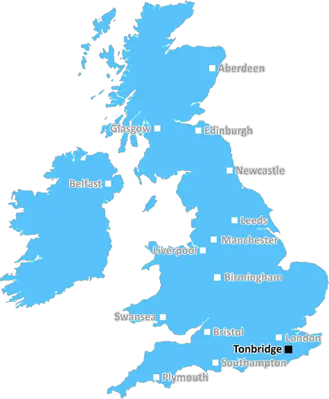
Tonbridge (TN17)
The TN17 postcode area is located in the Tonbridge postcode town region, within the county of Kent, and contains a total of 878 individual postcodes.
There are 86 electoral wards in the TN17 postcode area, including Ashford, Battle, Bexhill-On-Sea, Cranbrook, Crowborough, Edenbridge, Etchingham, Hartfield, Hastings, Heathfield, Mayfield, New Romney, Robertsbridge, Romney Marsh, Rye, Sevenoaks, St Leonards-On-Sea, Tenterden, Tonbridge, Tunbridge Wells, Uckfield, Wadhurst, Westerham, Winchelsea which come under the local authority of the Tunbridge Wells Council.
Combining the whole postcode region, 33% of people in TN17 are classed as having an AB social grade, (i.e. 'white-collar' middle-upper class), compared to 27% across the UK.
This does not mean that the people of TN17 are wealthier - or higher class - than average, but it can be an indication that the area may be prospering and desirable to live in.
TN17 is a postcode sector located in the Tonbridge district of Kent, in the South East of England. The postcode covers the area of Paddock Wood to the west, and Tudeley to the east. The district sits just north of the town of Tunbridge Wells.
TN17 incorporates the hamlet of Five Oak Green, and the medieval, Grade II* Listed church in of St Mark's Tudeley is one of the most notable sites in the district. Other heritage sites in the TN17 district include the Grade listed building of Larkfield Hall, and St Peter's Church, Five Oak Green.
The TN17 postcode district is part of the Tunbridge Wells post town, and includes the following post towns: Paddock Wood, Tudeley, Five Oak Green, and Matfield. The district also includes parts of the civil parishes of Frittenden, Five Oak Green, Horsmonden, Marden, and Tudeley.
The TN17 postcode sector contains approximately 2,611 postcodes, with seventy-five small businesses and fourteen medium to large firms employing people within the district.
TN17 covers an overall area of 21.81 square miles, with a population of 10,403 as of 2011. It has excellent transport links to London and the South East, including junction 5 of the M20, railway connections to Tonbridge and Maidstone, and national bus services.
The housing in TN17 consists largely of detached and semi-detached houses, with some terraced homes and a few flats. Area amenities include a selection of schools, parks, churches, pubs and restaurants, supermarkets, shops, banks, and post offices. The area also boasts some wonderful public green spaces, such as Tudeley woods, Crowthorne woods, and Horsmonden woods.
TN17 is a pleasant mix of rural and suburbia, giving residents a picturesque surrounding for a peaceful lifestyle.

Demographics

Kent

TN17 is located in the county of Kent, in England.
Kent has a total population of 1,820,400, making it the 6th largest county in the UK.
Kent has a total area of 1443 square miles, and a population density of 486 people per square kilometre. For comparison, Greater London has a density of 5,618 people/km2.
| Outward Code | TN17 |
| Postal Town | Tonbridge |
| MSOA Name | Tunbridge Wells 011 |
| LSOA Name | Tunbridge Wells 011E |
| County | Kent |
| Region | Kent |
| Country | England |
| Local Authority | Tunbridge Wells |
| Area Classification | Urban with Significant Rural (rural including hub towns 26-49%) |
TN17 Electoral Wards
The postal region of TN17, includes the local towns, villages, electoral wards and stations of:
Dig even deeper into the TN17 postcode by clicking on a postcode below:
Click on an outward postal code below for more information about the area. Each 'outward' postcode give you a comprehensive list of all postcodes within the outward code area (TN) and estimated address.
Click on an 'outward' code for more information. For example, the outward postcode page 'EC2M' will give you an alphabetical list covering all postcodes located in the region, from 'EC2M 1BB' through to 'EC2M 7YA'.
Chris H
Thursday, May 16, 2024
We don't have any views of TN17 right now. If you live in TN17 or have visited it, please help us to help others by telling others what you think of this neighbourhood.
Add your view of TN17
People need your local expertise. If you live in TN17 or have first-hand knowledge of the neighbourhood, please consider sharing your views. It's completely anonymous - all we ask is for your initials.
Please tell us what you like about the TN17 postcode area, what you don't like, and what it's like to live or work here.
| LOCAL AMENITIES | |
| FAMILY FRIENDLY | |
| PARKING | |
| GREEN SPACES |
Local News Kent
Former school in Kent leads Clive Emson's May auction
The May catalogue features 149 residential and commercial lotsfrom across southern England.
Property WeekHines makes European self-storage debut as it aims to build 200m portfolio
The firm snapped up a portfolio of self-storage assets in Ashford, Chatham and Ebbsfleet.
Property WeekPortsmouth NHS trust takes offices at Lakeside North Harbour
The trust has signed a 10-year lease for space at the business park.
Property WeekDeveloping housing in the South East Nimby heartlands'
Thakeham chief executive Rob Boughton talks to Ciaran Nerval about combating Nimbyism and negative views of development.
Property WeekBluewater thief knocked Apple worker to the ground in 1.6k phone swipe
A robber who was captured on camera robbing an Apple store of a phone worth thousands of pounds has been jailed.
Kent OnlineSoldier graffiti may show Napoleon hanged - castle
Staff scaled a ladder to discover graffiti thought to date back to the 1789 French Revolution.
BBC NewsVintage-style art aims to boost rail travel
Southeastern has commissioned seven posters to encourage people to travel by train this summer.
BBC NewsResidents' anger as sea still unsafe for swimming
The sea in parts of Kent remains unsafe for swimming 15 months after it was first declared hazardous.
BBC NewsFrom the Postcode Area blog

Deciphering Crime Rates - a Deep Dive Into UK Postcode Analysis
Ever wondered about the crime rate in your UK postcode? You're not alone. We've dug deep into the data, uncovering trends and patterns that'll make your head spin.

Death of the High Street?
The BBC reports that despite councils' attempts to kurb them, the UK's high streets have seen a huge growth in fast food outlets. Could this mark the death knell for the Great British high street, and what can we do about it to halt its decline?

Discrimination by Postcode
You really couldn't make it up, could you? Some of the country's most vulnerable people are missing out on their weekly £25 Cold Weather Payment, just because the system that's in operation is discriminating against them because payments are based on postcode, rather than geographic location.

The Redesign is Underway
Well, the current website was absolutely in dire need of a good redesign - from the ground up. So I set out to pull it all apart and get it up and running again to become the most comprehensive guide to every postcode in the UK. And it's been a long, tough job from start to finish - and quite possibly the biggest project I've ever undertaken.
SOCIAL GRADES
According to census records, 33% of people here have a social grade of AB (highest), compared to the national average of 27%.