tonbridge TN12 Postcodes
Spending a fortune on conveyancing?

Compare instant, low-cost online quotes from trusted conveyancing solicitors.
Backed by experts, our no-obligation service searches through the best conveyancing quotes on the market to save you time and money.
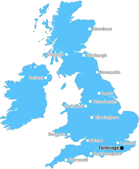
Tonbridge (TN12)
The TN12 postcode area is located in the Tonbridge postcode town region, within the county of Kent, and contains a total of 1425 individual postcodes.
There are 90 electoral wards in the TN12 postcode area, including Ashford, Battle, Bexhill-On-Sea, Cranbrook, Crowborough, Edenbridge, Etchingham, Hartfield, Hastings, Heathfield, Mayfield, New Romney, Robertsbridge, Romney Marsh, Rye, Sevenoaks, St Leonards-On-Sea, Tenterden, Tonbridge, Tunbridge Wells, Uckfield, Wadhurst, Westerham, Winchelsea which come under the local authority of the Maidstone Council.
Combining the whole postcode region, 29% of people in TN12 are classed as having an AB social grade, (i.e. 'white-collar' middle-upper class), compared to 27% across the UK.
This does not mean that the people of TN12 are wealthier - or higher class - than average, but it can be an indication that the area may be prospering and desirable to live in.
TN12 is a postcode district that covers a large part of the Tonbridge district of Kent in the United Kingdom. It is a two-part code, the first part of which is TN for Tonbridge, and the second part being 12.
The area of TN12 includes the towns of East Peckham, Five Oak Green, and Tonbridge, as well as numerous villages and hamlets such as Hilden Park, Hadlow, Leigh, Horsmonden, Lamberhurst, Paddock Wood, Tudeley, and Plaxtol. The M20 motorway crosses the northern part of TN12 and provides easy access to London, along with the nearby Tonbridge mainline railway station.
In terms of local amenities, TN12 is home to a variety of schools, churches, parks, and recreation grounds, as well as a number of well-known local eateries and soft play centres. Further education is available at nearby Hadlow College, and local businesses include a heritage museum, farm shop, and a renowned theatre.
TN12 is particularly well known for its beautiful countryside, where rivers such as the Medway, Teise and Beult provide a picturesque backdrop for walking, cycling, and bird watching. The area's well-preserved historic sites, such as Tonbridge Castle, Scotney Castle and Penshurst Place, as well as its many picturesque gardens, add to the rural charm of the area.
TN12 also boasts plenty of cultural attractions, such as an array of galleries, museums, caf�s, and local markets, including the monthly �Tonbridge Farmers' Market'. Here, local artisans and farmers sell their wares, and visitors are encouraged to sample the best of the local produce. The area is also home to many pubs and restaurants, as well as many sports and leisure centres. All in all,TN12 is a great place to live, boasting truly beautiful surroundings and an excellent quality of life.

Demographics

Kent

TN12 is located in the county of Kent, in England.
Kent has a total population of 1,820,400, making it the 6th largest county in the UK.
Kent has a total area of 1443 square miles, and a population density of 486 people per square kilometre. For comparison, Greater London has a density of 5,618 people/km2.
| Outward Code | TN12 |
| Postal Town | Tonbridge |
| MSOA Name | Maidstone 019 |
| LSOA Name | Maidstone 019D |
| County | Kent |
| Region | Kent |
| Country | England |
| Local Authority | Maidstone |
| Area Classification | Urban with Significant Rural (rural including hub towns 26-49%) |
TN12 Electoral Wards
The postal region of TN12, includes the local towns, villages, electoral wards and stations of:
Dig even deeper into the TN12 postcode by clicking on a postcode below:
Click on an outward postal code below for more information about the area. Each 'outward' postcode give you a comprehensive list of all postcodes within the outward code area (TN) and estimated address.
Click on an 'outward' code for more information. For example, the outward postcode page 'EC2M' will give you an alphabetical list covering all postcodes located in the region, from 'EC2M 1BB' through to 'EC2M 7YA'.
Chris H
Thursday, May 16, 2024
We don't have any views of TN12 right now. If you live in TN12 or have visited it, please help us to help others by telling others what you think of this neighbourhood.
Add your view of TN12
People need your local expertise. If you live in TN12 or have first-hand knowledge of the neighbourhood, please consider sharing your views. It's completely anonymous - all we ask is for your initials.
Please tell us what you like about the TN12 postcode area, what you don't like, and what it's like to live or work here.
| LOCAL AMENITIES | |
| FAMILY FRIENDLY | |
| PARKING | |
| GREEN SPACES |
Local News Kent
Ex-minister denies concealing Elphicke lobbying
Tory MP Sir Robert Buckland says Natalie Elphicke asked him to help move the date of her then-husband's trial.
BBC NewsBritish Land seeks retail park acquisitions outside South East
Company is comfortable looking out into the regions, where there is more value, head of retail parks Matt Reed said.
Property WeekCambridge science campus gets go-ahead
Landmark science and innovation park in South Cambridge given the green light.
Property WeekSavills bolsters Chelmsford office with return of senior development director
Kibblewhite originally joined the agency in 1990 and spent 16 years working there.
Property WeekUnique' outdoor pool officially recognised as historically significant'
A popular lido thought to be the last riverside pool of its kind in the country has been officially recognised ahead of its summer reopening.
Kent OnlineFormer school in Kent leads Clive Emson's May auction
The May catalogue features 149 residential and commercial lotsfrom across southern England.
Property WeekLarge police response at town centre Lidl
A number of police vehicles and at least eight officers have been spotted at a supermarket.
Kent OnlineCouncil calls for public hearing over border checks
Officials criticised the decision to move biosecurity checks from the Port of Dover 35km inland.
BBC NewsFrom the Postcode Area blog

Deciphering Crime Rates - a Deep Dive Into UK Postcode Analysis
Ever wondered about the crime rate in your UK postcode? You're not alone. We've dug deep into the data, uncovering trends and patterns that'll make your head spin.

Death of the High Street?
The BBC reports that despite councils' attempts to kurb them, the UK's high streets have seen a huge growth in fast food outlets. Could this mark the death knell for the Great British high street, and what can we do about it to halt its decline?

Discrimination by Postcode
You really couldn't make it up, could you? Some of the country's most vulnerable people are missing out on their weekly £25 Cold Weather Payment, just because the system that's in operation is discriminating against them because payments are based on postcode, rather than geographic location.

The Redesign is Underway
Well, the current website was absolutely in dire need of a good redesign - from the ground up. So I set out to pull it all apart and get it up and running again to become the most comprehensive guide to every postcode in the UK. And it's been a long, tough job from start to finish - and quite possibly the biggest project I've ever undertaken.
SOCIAL GRADES
According to census records, 29% of people here have a social grade of AB (highest), compared to the national average of 27%.