taunton TA19 Postcodes
Spending a fortune on conveyancing?

Compare instant, low-cost online quotes from trusted conveyancing solicitors.
Backed by experts, our no-obligation service searches through the best conveyancing quotes on the market to save you time and money.
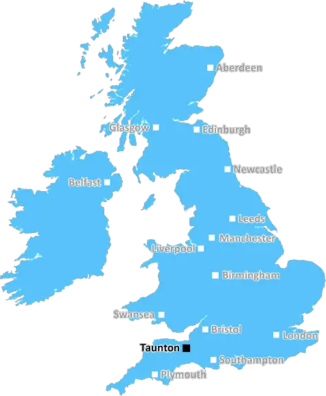
Taunton (TA19)
The TA19 postcode area is located in the Taunton postcode town region, within the county of Somerset, and contains a total of 527 individual postcodes.
There are 60 electoral wards in the TA19 postcode area, including Bridgwater, Burnham-On-Sea, Chard, Crewkerne, Dulverton, Highbridge, Hinton St George, Ilminster, Langport, Martock, Merriott, Minehead, Montacute, Somerton, South Petherton, Stoke-Sub-Hamdon, Taunton, Watchet, Wellington which come under the local authority of the South Somerset Council.
Combining the whole postcode region, 24% of people in TA19 are classed as having an AB social grade, (i.e. 'white-collar' middle-upper class), compared to 27% across the UK.
This does not mean that the people of TA19 are poorer than other areas, but it may give an indication that there are areas of deprivation.
The TA19 postcode is in the Taunton district in the south-west of England. The postcode covers a large area, from the banks of the Tone River in the west to Curry Rivel, Ilminster, and South Petherton to the east. The main centres of population are Taunton, Creech St Michael and Henlade, as well as rural villages such as Corfe, Hatch Beauchamp and Langford Budville.
The TA19 area offers a great mix of local facilities, including schools, medical services such as hospitals or doctors' surgeries, a variety of shops and leisure activities, as well as sporting and cultural opportunities. There are also numerous parks and outdoor recreational spaces, such as the Quantock Hills AONB, Taunton Deane and Quantock Hills, Creech Heathfield and the Blackdown Hills.
Taunton itself is the largest town and county town for Somerset, and offers a variety of attractions and renowned historic buildings. Some of the other notable landmarks of the TA19 area include the St. James's Church in Thornfalcon, Alfoxton and Othery Church, Barrington Court, Ruishton Hall, Winsford House and the Cleeve Abbey ruins.
The TA19 area enjoys excellent transport links, with the M5 motorway providing access to the rest of the UK, and direct train services to nearby Bristol, Exeter and London. Public buses also run regularly throughout the area.
The TA19 postcode is home to a population of just over 37,000 people, with a range of housing styles offering something for everyone. There are a number of different housing types available, including cosy cottages, larger family homes and modern new builds.
TheTA19 postcode is an excellent place to live, offering a great combination of a rural location, plenty of amenities, historic sites, beautiful countryside and good transport links.

Demographics

Somerset

TA19 is located in the county of Somerset, in England.
Somerset has a total population of 948,900, making it the 22nd largest county in the UK.
Somerset has a total area of 1610 square miles, and a population density of 227 people per square kilometre. For comparison, Greater London has a density of 5,618 people/km2.
| Outward Code | TA19 |
| Postal Town | Taunton |
| MSOA Name | South Somerset 019 |
| LSOA Name | South Somerset 019A |
| County | Somerset |
| Region | Somerset |
| Country | England |
| Local Authority | South Somerset |
| Area Classification | Largely Rural (rural including hub towns 50-79%) |
TA19 Electoral Wards
The postal region of TA19, includes the local towns, villages, electoral wards and stations of:
Dig even deeper into the TA19 postcode by clicking on a postcode below:
Click on an outward postal code below for more information about the area. Each 'outward' postcode give you a comprehensive list of all postcodes within the outward code area (TA) and estimated address.
Click on an 'outward' code for more information. For example, the outward postcode page 'EC2M' will give you an alphabetical list covering all postcodes located in the region, from 'EC2M 1BB' through to 'EC2M 7YA'.
Chris H
Wednesday, April 17, 2024
We don't have any views of TA19 right now. If you live in TA19 or have visited it, please help us to help others by telling others what you think of this neighbourhood.
Add your view of TA19
People need your local expertise. If you live in TA19 or have first-hand knowledge of the neighbourhood, please consider sharing your views. It's completely anonymous - all we ask is for your initials.
Please tell us what you like about the TA19 postcode area, what you don't like, and what it's like to live or work here.
| LOCAL AMENITIES | |
| FAMILY FRIENDLY | |
| PARKING | |
| GREEN SPACES |
Local News Somerset
Inquiry starts into community use of ex-factory
The ZigZag building, former factory, is now being used as a community events and performance space.
BBC NewsPontins: Rundown & Ruined?
The serious state of disrepair at three Pontins Holiday Parks exposed.
BBC News'When my twin died I lost a part of myself'
Inara Merali has completed a charity half marathon to mark the 21st birthday her twin could not.
BBC NewsAnger as cars break down after fuel pumps 'mix-up'
Drivers in Somerset say they have been affected after a "possible contamination" at the fuel stations.
BBC NewsSurrey abort thrilling chase to draw with Somerset
Surrey try to chase 209 in 19 overs before shaking hands on a draw with Somerset.
BBC NewsFamily pays tribute to 'beautiful' daughter Natasha
Natasha Poore, 25, from Evercreech, died in a crash on the A361 near Frome on 8 April.
BBC NewsRussell and Redpath suffer 'significant' injuries
Scotland duo Finn Russell and Cameron Redpath face lay-offs after sustaining what Bath describe as "significant" injuries.
BBC NewsLifeboat station given mystery 1,100 cash donation
An envelope packed with 1,100 worth of "old" 20 notes is posted through the charity's letterbox.
BBC NewsFrom the Postcode Area blog

Deciphering Crime Rates - a Deep Dive Into UK Postcode Analysis
Ever wondered about the crime rate in your UK postcode? You're not alone. We've dug deep into the data, uncovering trends and patterns that'll make your head spin.

Death of the High Street?
The BBC reports that despite councils' attempts to kurb them, the UK's high streets have seen a huge growth in fast food outlets. Could this mark the death knell for the Great British high street, and what can we do about it to halt its decline?

Discrimination by Postcode
You really couldn't make it up, could you? Some of the country's most vulnerable people are missing out on their weekly £25 Cold Weather Payment, just because the system that's in operation is discriminating against them because payments are based on postcode, rather than geographic location.

The Redesign is Underway
Well, the current website was absolutely in dire need of a good redesign - from the ground up. So I set out to pull it all apart and get it up and running again to become the most comprehensive guide to every postcode in the UK. And it's been a long, tough job from start to finish - and quite possibly the biggest project I've ever undertaken.
SOCIAL GRADES
According to census records, 24% of people here have a social grade of AB (highest), compared to the national average of 27%.