kingston-upon-thames KT20 Postcodes
Spending a fortune on conveyancing?

Compare instant, low-cost online quotes from trusted conveyancing solicitors.
Backed by experts, our no-obligation service searches through the best conveyancing quotes on the market to save you time and money.
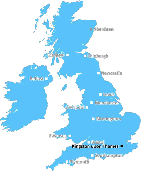
Kingston Upon Thames (KT20)
The KT20 postcode area is located in the Kingston Upon Thames postcode town region, within the county of Surrey, and contains a total of 1004 individual postcodes.
There are 15 electoral wards in the KT20 postcode area, including Addlestone, Ashtead, Chertsey, Chessington, Cobham, East Molesey, Epsom, Esher, Kingston Upon Thames, Leatherhead, New Malden, Surbiton, Tadworth, Thames Ditton, Walton-On-Thames, West Byfleet, West Molesey, Weybridge, Worcester Park which come under the local authority of the Reigate and Banstead Council.
Combining the whole postcode region, 33% of people in KT20 are classed as having an AB social grade, (i.e. 'white-collar' middle-upper class), compared to 27% across the UK.
This does not mean that the people of KT20 are wealthier - or higher class - than average, but it can be an indication that the area may be prospering and desirable to live in.
KT20 is a postcode district in the Kingston upon Thames postcode area, England. It covers the northern part of Epsom district and includes the towns Leatherhead, Ashtead, Fetcham, Tadworth, Langley Vale and parts of South West Charlton, Walton-on-the-Hill and Kingswood Park.
The district has been an affluent area since its inception for many years. In recent years, the postcode has seen much growth due to an influx of new homeowners in the area. The majority of homes in KT20 are single family dwellings and detached houses with some terraced homes and other dwellings. Most homes have an average price of around �570,000.
KT20 has two railway routes running from Leatherhead. One line connects Leatherhead to London Waterloo, while the other connects the village to London Victoria. There are direct suburban commuter services and additional non-stop services to London Waterloo. The postcode district contains the Grade 1-listed 13th century Effingham Manor, Effingham Golf Club, and parks, including Langleyvale and Kingswood.
The area is popular for its entertainment and cultural attractions, such as the Hampton Court Palace and the River Thames. KT20 provides a diverse array of leisure activities, including golf and cricket clubs, fine dining, numerous pubs, cafes and restaurants, and Ashtead Common, a large nature reserve.
KT20 contains four secondary schools: St John Hardham's School in Leatherhead, Therfield School, Ashtead Peace Memorial Hall in Tadworth, and Langley Vale High School in Langley.
education is accessible for students of all ages in the postcode district. Therfield School is a state secondary school that serves pupils aged 11-16. Leatherhead Trinity School is a mixed Methodist secondary school and sixth form for pupils aged 11-18. Ashtead Peace Memorial Hall serves both primary and secondary pupils aged 4-11 and 11-16 respectively.
The region also benefits from good transport links via the M3 and the M25 motorways, two airports (Heathrow and Gatwick) and the South West railway.

Demographics

Surrey

KT20 is located in the county of Surrey, in England.
Surrey has a total population of 1,176,500, making it the 13th largest county in the UK.
Surrey has a total area of 642 square miles, and a population density of 707 people per square kilometre. For comparison, Greater London has a density of 5,618 people/km2.
| Outward Code | KT20 |
| Postal Town | Kingston Upon Thames |
| MSOA Name | Reigate and Banstead 006 |
| LSOA Name | Reigate and Banstead 006E |
| County | Surrey |
| Region | Surrey |
| Country | England |
| Local Authority | Reigate and Banstead |
| Area Classification | Urban with City and Town |
KT20 Electoral Wards
The postal region of KT20, includes the local towns, villages, electoral wards and stations of:
Dig even deeper into the KT20 postcode by clicking on a postcode below:
Click on an outward postal code below for more information about the area. Each 'outward' postcode give you a comprehensive list of all postcodes within the outward code area (KT) and estimated address.
Click on an 'outward' code for more information. For example, the outward postcode page 'EC2M' will give you an alphabetical list covering all postcodes located in the region, from 'EC2M 1BB' through to 'EC2M 7YA'.
Chris H
Tuesday, May 7, 2024
We don't have any views of KT20 right now. If you live in KT20 or have visited it, please help us to help others by telling others what you think of this neighbourhood.
Add your view of KT20
People need your local expertise. If you live in KT20 or have first-hand knowledge of the neighbourhood, please consider sharing your views. It's completely anonymous - all we ask is for your initials.
Please tell us what you like about the KT20 postcode area, what you don't like, and what it's like to live or work here.
| LOCAL AMENITIES | |
| FAMILY FRIENDLY | |
| PARKING | |
| GREEN SPACES |
Local News Surrey
Plans for 83 new homes to be discussed by council
The proposed site location is north of the University for the Creative Arts, in Farnham.
BBC NewsFull Elmbridge Local Election 2024 results as Lib Dems largest party but leader loses seat
16 seats, one for every ward in Elmbridge, are being contested
Get SurreyMiss Surrey 2024 contestant joins pagent after concussion left her feeling like her brain had been 'rewired'
Chloe Ching, from Frimley, took classes to help with walking and talking after her injury
Get SurreyWhich South East trains will run on strike day?
Aslef train drivers strikes have been announced, affecting services across Kent, Surrey and Sussex.
BBC NewsThe towns that used to be Surrey but people mistakenly forget are actually London
So many Surrey towns have been absorbed into the capital
Get SurreyMole Valley Local Election Results 2024 in full as Lib Dems maintain dominant position
14 seats were up for grabs across the district as the Lib Dems looked to maintain their strong position on the district council
Get SurreyGuildford's Lush manager explains how town loves Intergalactic bath bombs and one shaped like a magic cow
Guildford's Lush manager celebrates world bath bomb day by telling Surrey Live what the town's bestsellers are
Get SurreyEnglish teen Kim hits 68 on PGA debut as Wallace leads
English teenager Kris Kim hits a three-under-par 68 on his PGA Tour debut as compatriot Matt Wallace leads in Texas.
BBC NewsFrom the Postcode Area blog

Deciphering Crime Rates - a Deep Dive Into UK Postcode Analysis
Ever wondered about the crime rate in your UK postcode? You're not alone. We've dug deep into the data, uncovering trends and patterns that'll make your head spin.

Death of the High Street?
The BBC reports that despite councils' attempts to kurb them, the UK's high streets have seen a huge growth in fast food outlets. Could this mark the death knell for the Great British high street, and what can we do about it to halt its decline?

Discrimination by Postcode
You really couldn't make it up, could you? Some of the country's most vulnerable people are missing out on their weekly £25 Cold Weather Payment, just because the system that's in operation is discriminating against them because payments are based on postcode, rather than geographic location.

The Redesign is Underway
Well, the current website was absolutely in dire need of a good redesign - from the ground up. So I set out to pull it all apart and get it up and running again to become the most comprehensive guide to every postcode in the UK. And it's been a long, tough job from start to finish - and quite possibly the biggest project I've ever undertaken.
SOCIAL GRADES
According to census records, 33% of people here have a social grade of AB (highest), compared to the national average of 27%.