swindon SN12 Postcodes
Spending a fortune on conveyancing?

Compare instant, low-cost online quotes from trusted conveyancing solicitors.
Backed by experts, our no-obligation service searches through the best conveyancing quotes on the market to save you time and money.
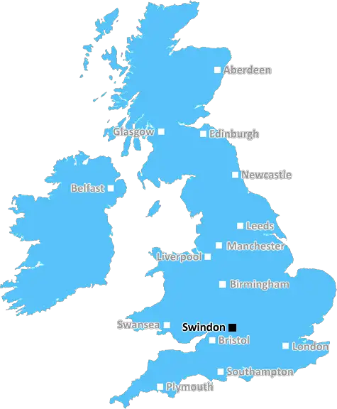
Swindon (SN12)
The SN12 postcode area is located in the Swindon postcode town region, within the county of Wiltshire, and contains a total of 962 individual postcodes.
There are 28 electoral wards in the SN12 postcode area, including Calne, Chippenham, Corsham, Devizes, Faringdon, Malmesbury, Marlborough, Melksham, Pewsey, Swindon which come under the local authority of the Wiltshire Council.
Combining the whole postcode region, 22% of people in SN12 are classed as having an AB social grade, (i.e. 'white-collar' middle-upper class), compared to 27% across the UK.
This does not mean that the people of SN12 are poorer than other areas, but it may give an indication that there are areas of deprivation.
The SN12 postcode area is located in the Swindon district of England, which is in the county of Wiltshire. Swindon is a town located approximately 47 miles west of London. It is an ancient settlement which was first recorded in the Domesday Book of 1086 and became a market town in the 18th century.
SN12 is the postcode for Stratton St Margaret, a civil parish in the north east of Swindon. It is a large residential area located close to the M4 corridor and the Swindon ring road, making it an ideal location for commuters. It has good access to both Gloucestershire and Oxfordshire, making it a popular location for those looking to move to a more rural area.
SN12 is covered by the North Wiltshire constituency and is the constituency of minister of Health & Social Care, Matt Hancock. The area also falls within the North Swindon district of Wiltshire Council.
The SN12 postcode is served by numerous schools from early years education through to secondary school, including the town's two secondary schools; The Ridgeway School, and Royal Wootton Bassett Academy. The area also offers day care for children aged 0-5 years.
For those looking to do their shopping, the area has numerous retail parks, supermarkets and the Trident shopping centre in the town centre. The nearby Orbital retail park also offers a varied range of stores.
For leisure and recreation, there are parks, a golf course and various sports and fitness facilities all within the SN12 postcode. The area is a popular destination for cycling and walking owing to the nearby Kennet & Avon Canal. The area also boasts a leisure centre with swimming pool, gym and fitness amenities.
The SN12 postcode is a popular choice for those looking to relocate to a residential area with plenty of choice for education, shopping, leisure and recreation - making it an attractive location for those looking for a family area.

Demographics

Wiltshire

SN12 is located in the county of Wiltshire, in England.
Wiltshire has a total population of 706,300, making it the 34th largest county in the UK.
Wiltshire has a total area of 1346 square miles, and a population density of 202 people per square kilometre. For comparison, Greater London has a density of 5,618 people/km2.
| Outward Code | SN12 |
| Postal Town | Swindon |
| MSOA Name | Wiltshire 022 |
| LSOA Name | Wiltshire 022D |
| County | Wiltshire |
| Region | Wiltshire |
| Country | England |
| Local Authority | Wiltshire |
| Area Classification | Largely Rural (rural including hub towns 50-79%) |
SN12 Electoral Wards
The postal region of SN12, includes the local towns, villages, electoral wards and stations of:
Dig even deeper into the SN12 postcode by clicking on a postcode below:
Click on an outward postal code below for more information about the area. Each 'outward' postcode give you a comprehensive list of all postcodes within the outward code area (SN) and estimated address.
Click on an 'outward' code for more information. For example, the outward postcode page 'EC2M' will give you an alphabetical list covering all postcodes located in the region, from 'EC2M 1BB' through to 'EC2M 7YA'.
Chris H
Sunday, April 7, 2024
We don't have any views of SN12 right now. If you live in SN12 or have visited it, please help us to help others by telling others what you think of this neighbourhood.
Add your view of SN12
People need your local expertise. If you live in SN12 or have first-hand knowledge of the neighbourhood, please consider sharing your views. It's completely anonymous - all we ask is for your initials.
Please tell us what you like about the SN12 postcode area, what you don't like, and what it's like to live or work here.
| LOCAL AMENITIES | |
| FAMILY FRIENDLY | |
| PARKING | |
| GREEN SPACES |
Local News Wiltshire
Warning ahead of fresh round of train strikes
Passengers told to plan ahead as rail and underground services to be hit by weekend walkouts.
BBC NewsSwindon Town 2-1 Notts County
Swindon break a four-match winless streak as they beat Notts County thanks to two pieces of comedic defending.
BBC NewsTitian 16th-century painting set to be auctioned
The painting is expected to fetch between 15m and 25m at auction on 2 July.
BBC NewsRapist who pretended to be a taxi driver jailed
Fareed Tariq has been given an 18-year sentence for raping a woman he had lured into his car.
BBC NewsSwindon Town 2-1 Notts County
Swindon break a four-match winless streak as they beat Notts County thanks to two pieces of comedic defending.
BBC NewsUkrainians risking air strikes to see a dentist
Natalia Nehriba returned to Ukraine despite the ongoing war after being left in "excruciating" pain.
BBC NewsPolice witness appeal after suspected arson
Police would like to speak to anyone with information regarding a fire at a derelict cottage.
BBC NewsBarrow 0-2 Swindon Town
Paul Glatzel continues his fine recent goalscoring form as Swindon stun League Two promotion-chasers Barrow with a 2-0 victory.
BBC NewsFrom the Postcode Area blog

Deciphering Crime Rates - a Deep Dive Into UK Postcode Analysis
Ever wondered about the crime rate in your UK postcode? You're not alone. We've dug deep into the data, uncovering trends and patterns that'll make your head spin.

Death of the High Street?
The BBC reports that despite councils' attempts to kurb them, the UK's high streets have seen a huge growth in fast food outlets. Could this mark the death knell for the Great British high street, and what can we do about it to halt its decline?

Discrimination by Postcode
You really couldn't make it up, could you? Some of the country's most vulnerable people are missing out on their weekly £25 Cold Weather Payment, just because the system that's in operation is discriminating against them because payments are based on postcode, rather than geographic location.

The Redesign is Underway
Well, the current website was absolutely in dire need of a good redesign - from the ground up. So I set out to pull it all apart and get it up and running again to become the most comprehensive guide to every postcode in the UK. And it's been a long, tough job from start to finish - and quite possibly the biggest project I've ever undertaken.
SOCIAL GRADES
According to census records, 22% of people here have a social grade of AB (highest), compared to the national average of 27%.