swansea SA73 Postcodes
Spending a fortune on conveyancing?

Compare instant, low-cost online quotes from trusted conveyancing solicitors.
Backed by experts, our no-obligation service searches through the best conveyancing quotes on the market to save you time and money.
Swansea (SA73)
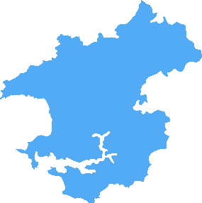
The SA73 postcode area is located in the Swansea postcode town region, within the county of Pembrokeshire, and contains a total of 756 individual postcodes.
There are 37 electoral wards in the SA73 postcode area, including Aberaeron, Ammanford, Boncath, Burry Port, Cardigan, Carmarthen, Clarbeston Road, Clynderwen, Crymych, Ferryside, Fishguard, Glogue, Goodwick, Haverfordwest, Kidwelly, Kilgetty, Lampeter, Llanarth, Llandeilo, Llandovery, Llandysul, Llanelli, Llanfyrnach, Llangadog, Llanwrda, Llanybydder, Milford Haven, Narberth, Neath, New Quay, Newcastle Emlyn, Newport, Pembroke, Pembroke Dock, Pencader, Port Talbot, Saundersfoot, Swansea, Tenby, Whitland which come under the local authority of the Pembrokeshire Council.
Combining the whole postcode region, 14% of people in SA73 are classed as having an AB social grade, (i.e. 'white-collar' middle-upper class), compared to 27% across the UK.
This does not mean that the people of SA73 are poorer than other areas, but it may give an indication that there are areas of deprivation.
SA73 is a postcode in the Swansea district in the United Kingdom. The postcode covers several areas in the north of Swansea, including Mayals, Sketty, Waunarlwydd, Cockett, and Gendros.
The majority of individuals living in this postcode live in the Mayals and Sketty areas along with cockett which are all residential suburbs of Swansea. This area is home to a wide range of populations, from students, to young families, and retirees.
This postcode is home to many local amenities, such as shops, pubs, and takeaways. In this area, there are two primary schools, Cyril Porter by Mayals and Hendrefoilan Primary School in Sketty. It is also home to St Teresa's Catholic Primary School and Penyrheol Secondary School, both in Gendros. As well as these schools, there are also two Further and Higher Education colleges located nearby: Gower College Swansea in Sketty and Swansea University in Singleton Park.
For leisure, the area is home to many parks, including Vivian, Singleton, Graig Felen, and Fairyland Park. As well as this, there are three golf courses in the postcode � Fairwood, Sketty Hall, and Langland Bay.
For commuters, the postcode is served by the M4 motorway and several bus routes. There are also train links to the centre of Swansea and out of the city by travelling via Swansea High Street station.
Educational provision, shopping opportunities and a wide range of leisure activities make SA73 an attractive postcode for many who live in the area. It is also a popular destination for those looking to rent and buy alike, making it an ideal place for those of all ages and tastes.

Demographics

Pembrokeshire
SA73 is located in the county of Pembrokeshire, in Wales.
Pembrokeshire has a total population of 124,000, making it the 13th largest county in the UK.
Pembrokeshire has a total area of 610 square miles, and a population density of 76 people per square kilometre. For comparison, Greater London has a density of 5,618 people/km2.

| Outward Code | SA73 |
| Postal Town | Swansea |
| MSOA Name | Pembrokeshire 010 |
| LSOA Name | Pembrokeshire 010B |
| County | Pembrokeshire |
| Region | Pembrokeshire |
| Country | Wales |
| Local Authority | Pembrokeshire |
| Area Classification | Unclassified |
SA73 Electoral Wards
The postal region of SA73, includes the local towns, villages, electoral wards and stations of:
Dig even deeper into the SA73 postcode by clicking on a postcode below:
Click on an outward postal code below for more information about the area. Each 'outward' postcode give you a comprehensive list of all postcodes within the outward code area (SA) and estimated address.
Click on an 'outward' code for more information. For example, the outward postcode page 'EC2M' will give you an alphabetical list covering all postcodes located in the region, from 'EC2M 1BB' through to 'EC2M 7YA'.
Chris H
Monday, April 8, 2024
We don't have any views of SA73 right now. If you live in SA73 or have visited it, please help us to help others by telling others what you think of this neighbourhood.
Add your view of SA73
People need your local expertise. If you live in SA73 or have first-hand knowledge of the neighbourhood, please consider sharing your views. It's completely anonymous - all we ask is for your initials.
Please tell us what you like about the SA73 postcode area, what you don't like, and what it's like to live or work here.
| LOCAL AMENITIES | |
| FAMILY FRIENDLY | |
| PARKING | |
| GREEN SPACES |
From the Postcode Area blog

Deciphering Crime Rates - a Deep Dive Into UK Postcode Analysis
Ever wondered about the crime rate in your UK postcode? You're not alone. We've dug deep into the data, uncovering trends and patterns that'll make your head spin.

Death of the High Street?
The BBC reports that despite councils' attempts to kurb them, the UK's high streets have seen a huge growth in fast food outlets. Could this mark the death knell for the Great British high street, and what can we do about it to halt its decline?

Discrimination by Postcode
You really couldn't make it up, could you? Some of the country's most vulnerable people are missing out on their weekly £25 Cold Weather Payment, just because the system that's in operation is discriminating against them because payments are based on postcode, rather than geographic location.

The Redesign is Underway
Well, the current website was absolutely in dire need of a good redesign - from the ground up. So I set out to pull it all apart and get it up and running again to become the most comprehensive guide to every postcode in the UK. And it's been a long, tough job from start to finish - and quite possibly the biggest project I've ever undertaken.
SOCIAL GRADES
According to census records, 14% of people here have a social grade of AB (highest), compared to the national average of 27%.