swansea SA66 Postcodes
Spending a fortune on conveyancing?

Compare instant, low-cost online quotes from trusted conveyancing solicitors.
Backed by experts, our no-obligation service searches through the best conveyancing quotes on the market to save you time and money.
Swansea (SA66)
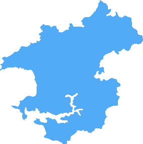
The SA66 postcode area is located in the Swansea postcode town region, within the county of Pembrokeshire, and contains a total of 175 individual postcodes.
There are 37 electoral wards in the SA66 postcode area, including Aberaeron, Ammanford, Boncath, Burry Port, Cardigan, Carmarthen, Clarbeston Road, Clynderwen, Crymych, Ferryside, Fishguard, Glogue, Goodwick, Haverfordwest, Kidwelly, Kilgetty, Lampeter, Llanarth, Llandeilo, Llandovery, Llandysul, Llanelli, Llanfyrnach, Llangadog, Llanwrda, Llanybydder, Milford Haven, Narberth, Neath, New Quay, Newcastle Emlyn, Newport, Pembroke, Pembroke Dock, Pencader, Port Talbot, Saundersfoot, Swansea, Tenby, Whitland which come under the local authority of the Pembrokeshire Council.
Combining the whole postcode region, 20% of people in SA66 are classed as having an AB social grade, (i.e. 'white-collar' middle-upper class), compared to 27% across the UK.
This does not mean that the people of SA66 are poorer than other areas, but it may give an indication that there are areas of deprivation.
The SA66 postcode is a postcode area that covers the villages of Blaen-y-Glyn, Horeb, and Llanddewi in western Carmarthenshire, Wales. The postcode area is located within the Swansea district council, and the postcode covers a total of 23 square miles of the countryside in southwest Wales.
Horeb is the only settlement with a substantial population within this postcode area, with most areas being rural locations. Horeb is well-known for its traditional stone houses in hilly terrain close to the coast. This is an ideal location for cyclists, hikers, and anyone looking for a rural escape.
The SA66 postcode area is located on the West Wales Heritage Coastline, and is the closest location to explore the marine environment. The area is known for the diverse range of wildlife, and is particularly rich in sealife. Popular activities in the area include sailing, bird watching, and crabbing.
Blaen-y-Glyn is the largest village in this postcode area, and is situated around the river Blaen. It is a pleasant rural location, with a caf�, pub, and a historic chapel. The farmhouse of Blaen-y-Glyn is also a popular destination for visitors, with its picturesque setting.
Llanddewi is another small settlement located in this postcode area, with a number of holiday cottages available to rent and a nearby pub and bed and breakfast. There is plenty of history in the area, and the nearby Ragwen Marsh Nature Reserve offers visitors the chance to explore the wetlands.
In addition to the various rural locations, there is also plenty of tourist activity in this postcode area. Popular visitor attractions in this region of Wales include the National Botanic Garden of Wales, the Tenby Dinosaur Park, and the Folly Farm Adventure Park. There are also numerous arts and culture events throughout the year, such as the Gwyl Dewi Music Festival.

Demographics

Pembrokeshire
SA66 is located in the county of Pembrokeshire, in Wales.
Pembrokeshire has a total population of 124,000, making it the 13th largest county in the UK.
Pembrokeshire has a total area of 610 square miles, and a population density of 76 people per square kilometre. For comparison, Greater London has a density of 5,618 people/km2.

| Outward Code | SA66 |
| Postal Town | Swansea |
| MSOA Name | Pembrokeshire 007 |
| LSOA Name | Pembrokeshire 007A |
| County | Pembrokeshire |
| Region | Pembrokeshire |
| Country | Wales |
| Local Authority | Pembrokeshire |
| Area Classification | Unclassified |
SA66 Electoral Wards
The postal region of SA66, includes the local towns, villages, electoral wards and stations of:
Dig even deeper into the SA66 postcode by clicking on a postcode below:
Click on an outward postal code below for more information about the area. Each 'outward' postcode give you a comprehensive list of all postcodes within the outward code area (SA) and estimated address.
Click on an 'outward' code for more information. For example, the outward postcode page 'EC2M' will give you an alphabetical list covering all postcodes located in the region, from 'EC2M 1BB' through to 'EC2M 7YA'.
Chris H
Wednesday, March 27, 2024
We don't have any views of SA66 right now. If you live in SA66 or have visited it, please help us to help others by telling others what you think of this neighbourhood.
Add your view of SA66
People need your local expertise. If you live in SA66 or have first-hand knowledge of the neighbourhood, please consider sharing your views. It's completely anonymous - all we ask is for your initials.
Please tell us what you like about the SA66 postcode area, what you don't like, and what it's like to live or work here.
| LOCAL AMENITIES | |
| FAMILY FRIENDLY | |
| PARKING | |
| GREEN SPACES |
From the Postcode Area blog

Deciphering Crime Rates - a Deep Dive Into UK Postcode Analysis
Ever wondered about the crime rate in your UK postcode? You're not alone. We've dug deep into the data, uncovering trends and patterns that'll make your head spin.

Death of the High Street?
The BBC reports that despite councils' attempts to kurb them, the UK's high streets have seen a huge growth in fast food outlets. Could this mark the death knell for the Great British high street, and what can we do about it to halt its decline?

Discrimination by Postcode
You really couldn't make it up, could you? Some of the country's most vulnerable people are missing out on their weekly £25 Cold Weather Payment, just because the system that's in operation is discriminating against them because payments are based on postcode, rather than geographic location.

The Redesign is Underway
Well, the current website was absolutely in dire need of a good redesign - from the ground up. So I set out to pull it all apart and get it up and running again to become the most comprehensive guide to every postcode in the UK. And it's been a long, tough job from start to finish - and quite possibly the biggest project I've ever undertaken.
SOCIAL GRADES
According to census records, 20% of people here have a social grade of AB (highest), compared to the national average of 27%.