swansea SA46 Postcodes
Spending a fortune on conveyancing?

Compare instant, low-cost online quotes from trusted conveyancing solicitors.
Backed by experts, our no-obligation service searches through the best conveyancing quotes on the market to save you time and money.
Swansea (SA46)
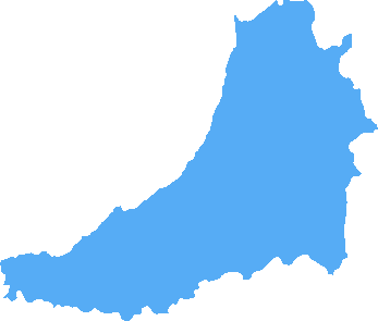
The SA46 postcode area is located in the Swansea postcode town region, within the county of Ceredigion, and contains a total of 149 individual postcodes.
There are 3 electoral wards in the SA46 postcode area, including Aberaeron, Ammanford, Boncath, Burry Port, Cardigan, Carmarthen, Clarbeston Road, Clynderwen, Crymych, Ferryside, Fishguard, Glogue, Goodwick, Haverfordwest, Kidwelly, Kilgetty, Lampeter, Llanarth, Llandeilo, Llandovery, Llandysul, Llanelli, Llanfyrnach, Llangadog, Llanwrda, Llanybydder, Milford Haven, Narberth, Neath, New Quay, Newcastle Emlyn, Newport, Pembroke, Pembroke Dock, Pencader, Port Talbot, Saundersfoot, Swansea, Tenby, Whitland which come under the local authority of the Ceredigion Council.
Combining the whole postcode region, 20% of people in SA46 are classed as having an AB social grade, (i.e. 'white-collar' middle-upper class), compared to 27% across the UK.
This does not mean that the people of SA46 are poorer than other areas, but it may give an indication that there are areas of deprivation.
SA46 is a postcode in Wales that covers part of the Dyfed county and is one of the Welsh postcode areas which is used to identify specific areas. It includes the towns of Newcastle Emlyn and Cardigan, as well as several smaller villages. Areas included are Llandysul, Henllan, Llanybydder, Llangoedmor, Penparcau, Tycroes, Llwyndafydd and Cilgerran.
The area is well known for its scenic rural landscape, with rolling hills, rolling countryside, valleys, forests and coastal inlets. It's a popular destination for hikers, cyclists, and holidaymakers alike, who relish in the peaceful atmosphere and picturesque views.
Newcastle Emlyn is a small town, with a population of 1,527 people according to the latest census. It is home to a 12th century castle, which is open to visitors, and the town offers access to the Cardigan Bay coastline. Cardigan is a larger settlement and the main town that the SA46 postcode covers, with a population of 2,735 according to the census. It offers a range of amenities including a castle, shops, restaurants and pubs, as well as a sports club.
The area benefits from excellent transport links, with the A484 road offering access to both Newcastle Emlyn and Cardigan. The A487 runs through the centre of the two towns, and there are regular bus services to and from other towns and cities in the region.
There are several secondary schools located in the area, including Calon Cym, Ysgol Llandysul, and Ysgol Dyffryn Teifi, with several primary schools located in Cardigan too.
The area also offers several sports and leisure facilities, including a leisure centre, tennis and squash courts, health clubs, and a range of outdoor activity centres. There is also a cinema, theatre and various arts events throughout the year, as well as a range of bars, restaurants and nightlife.
SA46 is a picturesque area offering a range of amenities, attractions, facilities and activities, making it an attractive place to live and work.

Demographics

Ceredigion
SA46 is located in the county of Ceredigion, in Wales.
Ceredigion has a total population of 74,100, making it the 19th largest county in the UK.
Ceredigion has a total area of 688 square miles, and a population density of 41 people per square kilometre. For comparison, Greater London has a density of 5,618 people/km2.

| Outward Code | SA46 |
| Postal Town | Swansea |
| MSOA Name | Ceredigion 005 |
| LSOA Name | Ceredigion 005A |
| County | Ceredigion |
| Region | Ceredigion |
| Country | Wales |
| Local Authority | Ceredigion |
| Area Classification | Unclassified |
SA46 Electoral Wards
The postal region of SA46, includes the local towns, villages, electoral wards and stations of:
Dig even deeper into the SA46 postcode by clicking on a postcode below:
Click on an outward postal code below for more information about the area. Each 'outward' postcode give you a comprehensive list of all postcodes within the outward code area (SA) and estimated address.
Click on an 'outward' code for more information. For example, the outward postcode page 'EC2M' will give you an alphabetical list covering all postcodes located in the region, from 'EC2M 1BB' through to 'EC2M 7YA'.
Chris H
Wednesday, April 17, 2024
We don't have any views of SA46 right now. If you live in SA46 or have visited it, please help us to help others by telling others what you think of this neighbourhood.
Add your view of SA46
People need your local expertise. If you live in SA46 or have first-hand knowledge of the neighbourhood, please consider sharing your views. It's completely anonymous - all we ask is for your initials.
Please tell us what you like about the SA46 postcode area, what you don't like, and what it's like to live or work here.
| LOCAL AMENITIES | |
| FAMILY FRIENDLY | |
| PARKING | |
| GREEN SPACES |
From the Postcode Area blog

Deciphering Crime Rates - a Deep Dive Into UK Postcode Analysis
Ever wondered about the crime rate in your UK postcode? You're not alone. We've dug deep into the data, uncovering trends and patterns that'll make your head spin.

Death of the High Street?
The BBC reports that despite councils' attempts to kurb them, the UK's high streets have seen a huge growth in fast food outlets. Could this mark the death knell for the Great British high street, and what can we do about it to halt its decline?

Discrimination by Postcode
You really couldn't make it up, could you? Some of the country's most vulnerable people are missing out on their weekly £25 Cold Weather Payment, just because the system that's in operation is discriminating against them because payments are based on postcode, rather than geographic location.

The Redesign is Underway
Well, the current website was absolutely in dire need of a good redesign - from the ground up. So I set out to pull it all apart and get it up and running again to become the most comprehensive guide to every postcode in the UK. And it's been a long, tough job from start to finish - and quite possibly the biggest project I've ever undertaken.
SOCIAL GRADES
According to census records, 20% of people here have a social grade of AB (highest), compared to the national average of 27%.