swansea SA11 Postcodes
Spending a fortune on conveyancing?

Compare instant, low-cost online quotes from trusted conveyancing solicitors.
Backed by experts, our no-obligation service searches through the best conveyancing quotes on the market to save you time and money.
Swansea (SA11)
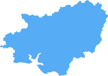
The SA11 postcode area is located in the Swansea postcode town region, within the county of Carmarthenshire, and contains a total of 1227 individual postcodes.
There are 97 electoral wards in the SA11 postcode area, including Aberaeron, Ammanford, Boncath, Burry Port, Cardigan, Carmarthen, Clarbeston Road, Clynderwen, Crymych, Ferryside, Fishguard, Glogue, Goodwick, Haverfordwest, Kidwelly, Kilgetty, Lampeter, Llanarth, Llandeilo, Llandovery, Llandysul, Llanelli, Llanfyrnach, Llangadog, Llanwrda, Llanybydder, Milford Haven, Narberth, Neath, New Quay, Newcastle Emlyn, Newport, Pembroke, Pembroke Dock, Pencader, Port Talbot, Saundersfoot, Swansea, Tenby, Whitland which come under the local authority of the Neath Port Talbot Council.
Combining the whole postcode region, 13% of people in SA11 are classed as having an AB social grade, (i.e. 'white-collar' middle-upper class), compared to 27% across the UK.
This does not mean that the people of SA11 are poorer than other areas, but it may give an indication that there are areas of deprivation.
The SA11 postcode in the Swansea district of the United Kingdom covers an area of over 2,000 hectacres, spanning across 4 different wards of Morriston, Sandfields East, St. Thomas, and Llansamlet. It includes almost all of the west side of Swansea, including the city centre and the surrounding residential areas. There is a diverse mix of properties, from council estates and private housing to student accommodation and industrial areas.
The SA11 postcode encompasses a range of amenities, including Gorseinon College, Morriston Hospital, and Morriston Comprehensive School. It also features a busy commercial area at The Quadrant Shopping Centre and the recently developed Parc Tawe retail and leisure complex. This area is also a hub of business for companies such as HSBC, Barclays, and Swansea Council, as well as an array of independent stores and cafes.
Swansea is a beautiful area, and the SA11 postcode is home to some of the best scenery in the district. Morriston and the surrounding landscape is filled with rolling hills, wooded areas, picturesque valleys, and the calm waters of the River Tawe. Popular parks and green spaces also add natural beauty to the area, including Cwm Clydach, Cwmdu, Crymlyn Burrows, and several golf courses.
This area is well-connected, with a strong transport network, excellent road links to other parts of Wales, and three train stations. There are also a number of cycle paths and public transport services, including the South Wales Metro, bus and tram services to the Cardiff area.
SA11 is a vibrant area to live, work, and visit. Its scenic location and excellent transport links make it a popular choice for both locals and visitors alike. The range of amenities, businesses, and leisure facilities create a buzzing atmosphere, whilst still nurturing a strong sense of community.

Demographics

Carmarthenshire
SA11 is located in the county of Carmarthenshire, in Wales.
Carmarthenshire has a total population of 185,600, making it the 4th largest county in the UK.
Carmarthenshire has a total area of 925 square miles, and a population density of 78 people per square kilometre. For comparison, Greater London has a density of 5,618 people/km2.

| Outward Code | SA11 |
| Postal Town | Swansea |
| MSOA Name | Neath Port Talbot 008 |
| LSOA Name | Neath Port Talbot 008B |
| County | Carmarthenshire |
| Region | Carmarthenshire |
| Country | Wales |
| Local Authority | Neath Port Talbot |
| Area Classification | Unclassified |
SA11 Electoral Wards
The postal region of SA11, includes the local towns, villages, electoral wards and stations of:
Dig even deeper into the SA11 postcode by clicking on a postcode below:
Click on an outward postal code below for more information about the area. Each 'outward' postcode give you a comprehensive list of all postcodes within the outward code area (SA) and estimated address.
Click on an 'outward' code for more information. For example, the outward postcode page 'EC2M' will give you an alphabetical list covering all postcodes located in the region, from 'EC2M 1BB' through to 'EC2M 7YA'.
Chris H
Thursday, April 11, 2024
We don't have any views of SA11 right now. If you live in SA11 or have visited it, please help us to help others by telling others what you think of this neighbourhood.
Add your view of SA11
People need your local expertise. If you live in SA11 or have first-hand knowledge of the neighbourhood, please consider sharing your views. It's completely anonymous - all we ask is for your initials.
Please tell us what you like about the SA11 postcode area, what you don't like, and what it's like to live or work here.
| LOCAL AMENITIES | |
| FAMILY FRIENDLY | |
| PARKING | |
| GREEN SPACES |
From the Postcode Area blog

Deciphering Crime Rates - a Deep Dive Into UK Postcode Analysis
Ever wondered about the crime rate in your UK postcode? You're not alone. We've dug deep into the data, uncovering trends and patterns that'll make your head spin.

Death of the High Street?
The BBC reports that despite councils' attempts to kurb them, the UK's high streets have seen a huge growth in fast food outlets. Could this mark the death knell for the Great British high street, and what can we do about it to halt its decline?

Discrimination by Postcode
You really couldn't make it up, could you? Some of the country's most vulnerable people are missing out on their weekly £25 Cold Weather Payment, just because the system that's in operation is discriminating against them because payments are based on postcode, rather than geographic location.

The Redesign is Underway
Well, the current website was absolutely in dire need of a good redesign - from the ground up. So I set out to pull it all apart and get it up and running again to become the most comprehensive guide to every postcode in the UK. And it's been a long, tough job from start to finish - and quite possibly the biggest project I've ever undertaken.
SOCIAL GRADES
According to census records, 13% of people here have a social grade of AB (highest), compared to the national average of 27%.