stoke-on-trent ST15 Postcodes
Spending a fortune on conveyancing?

Compare instant, low-cost online quotes from trusted conveyancing solicitors.
Backed by experts, our no-obligation service searches through the best conveyancing quotes on the market to save you time and money.
Stoke On Trent (ST15)
The ST15 postcode area is located in the Stoke On Trent postcode town region, within the county of Staffordshire, and contains a total of 829 individual postcodes.
There are 48 electoral wards in the ST15 postcode area, including Leek, Newcastle, Stafford, Stoke-On-Trent, Stone, Uttoxeter which come under the local authority of the Stafford Council.
Combining the whole postcode region, 30% of people in ST15 are classed as having an AB social grade, (i.e. 'white-collar' middle-upper class), compared to 27% across the UK.
This does not mean that the people of ST15 are wealthier - or higher class - than average, but it can be an indication that the area may be prospering and desirable to live in.
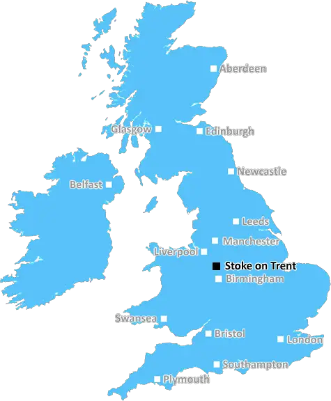
The ST15 postcode in the Stoke on Trent district is an area located in the centre of the city. It consists of the small town of Stone and its neighbouring villages, with the postcode covering a total area of 3.8 square miles. The population in ST15 is approximately 28,000.
The area of ST15 is made up of a mix of residential and commercial property. Many of the businesses are small or medium sized, though there are some larger business parks located nearby.
The area is served by two railway stations � Stone & Sandbach, with regular services to Manchester and Shrewsbury. There are a variety of local bus services, including routes into the nearby cities of Stafford, Crewe and Manchester.
Stone is the main shopping area in the ST15 postcode, with a variety of both independent and national high street stores, as well as a selection of restaurants and cafes that offer a variety of cuisines. The nearest supermarket is Asda, located in Stone. Other amenities include banks, pharmacies, libraries, primary and secondary schools, and youth clubs.
One of the main attractions in ST15 is Beaconside Heritage Centre. This is a converted factory complex that occupies an area of over 10 acres. It includes a range of interactive exhibits, gardens and a lake, and offers a variety of educational and recreational activities.
The Cannock Chase Area of Outstanding Natural Beauty is located to the west of the ST15 postcode boundary. It is an area of outstanding scenic beauty and includes forests, rivers, lakes, and heaths. There are a variety of opportunities for walking, cycling, and horse riding, as well as campsites, lakeside lodges, and a visitors centre.
In terms of sport, Stone Cricket Club is the local cricket club, while Stone Football Club plays in the Staffordshire Senior League. Stone Tennis Club, meanwhile, has six outdoor courts.

Demographics

Staffordshire

ST15 is located in the county of Staffordshire, in England.
Staffordshire has a total population of 1,120,300, making it the 17th largest county in the UK.
Staffordshire has a total area of 1047 square miles, and a population density of 412 people per square kilometre. For comparison, Greater London has a density of 5,618 people/km2.
| Outward Code | ST15 |
| Postal Town | Stoke On Trent |
| MSOA Name | Stafford 003 |
| LSOA Name | Stafford 003E |
| County | Staffordshire |
| Region | Staffordshire |
| Country | England |
| Local Authority | Stafford |
| Area Classification | Urban with Significant Rural (rural including hub towns 26-49%) |
ST15 Electoral Wards
The postal region of ST15, includes the local towns, villages, electoral wards and stations of:
Dig even deeper into the ST15 postcode by clicking on a postcode below:
Click on an outward postal code below for more information about the area. Each 'outward' postcode give you a comprehensive list of all postcodes within the outward code area (ST) and estimated address.
Click on an 'outward' code for more information. For example, the outward postcode page 'EC2M' will give you an alphabetical list covering all postcodes located in the region, from 'EC2M 1BB' through to 'EC2M 7YA'.
Chris H
Sunday, April 7, 2024
We don't have any views of ST15 right now. If you live in ST15 or have visited it, please help us to help others by telling others what you think of this neighbourhood.
Add your view of ST15
People need your local expertise. If you live in ST15 or have first-hand knowledge of the neighbourhood, please consider sharing your views. It's completely anonymous - all we ask is for your initials.
Please tell us what you like about the ST15 postcode area, what you don't like, and what it's like to live or work here.
| LOCAL AMENITIES | |
| FAMILY FRIENDLY | |
| PARKING | |
| GREEN SPACES |
Local News Staffordshire
County and city take steer on support for business and economic growth
Businesses across Staffordshire and Stoke-on-Trent will have a voice on a national level through a new joint committee set up by the county and city councils also ensuring they have expert support a&hellip
Staffordshire County CouncilJo Gideon MP on regeneration in Stoke town
Stoke on Trent Central MP, Jo Gideon talking about the regeneration of Stoke town.
BBC NewsHospice plans orange floral memorial for spring
People are being asked to dedicate a gerbera at the charity's memorial gardens.
BBC NewsSaturday Night Takeaway back in Newcastle - with Olivia Attwood in Andrew's shed
Ant & Dec have surprised Andrew Archer on tonight's show
Stoke SentinelStrategy will help unpaid carers of all ages
A strategy to help unpaid carers of all ages across Staffordshire will be discussed by the county council's cabinet next week.
Staffordshire County CouncilStoke-on-Trent asylum seeker, 31, who sneaked into UK in lorry found dead
Iraqi Gailan Matloob had been living in Normacot under a fake name
Stoke SentinelDriver handed court threat in row over 105 bus lane fine
Stoke-on-Trent City Council cameras caught Simon Ford, from Trentham, on College Road, in Shelton
Stoke SentinelThe price of feeding deer is dear, warns countryside officers
Feeding deer makes them vulnerable to disease, poaching and overpopulation, so rangers are urging country park users to buck the trend.
Staffordshire County CouncilFrom the Postcode Area blog

Deciphering Crime Rates - a Deep Dive Into UK Postcode Analysis
Ever wondered about the crime rate in your UK postcode? You're not alone. We've dug deep into the data, uncovering trends and patterns that'll make your head spin.

Death of the High Street?
The BBC reports that despite councils' attempts to kurb them, the UK's high streets have seen a huge growth in fast food outlets. Could this mark the death knell for the Great British high street, and what can we do about it to halt its decline?

Discrimination by Postcode
You really couldn't make it up, could you? Some of the country's most vulnerable people are missing out on their weekly £25 Cold Weather Payment, just because the system that's in operation is discriminating against them because payments are based on postcode, rather than geographic location.

The Redesign is Underway
Well, the current website was absolutely in dire need of a good redesign - from the ground up. So I set out to pull it all apart and get it up and running again to become the most comprehensive guide to every postcode in the UK. And it's been a long, tough job from start to finish - and quite possibly the biggest project I've ever undertaken.
SOCIAL GRADES
According to census records, 30% of people here have a social grade of AB (highest), compared to the national average of 27%.