stevenage SG18 Postcodes
Spending a fortune on conveyancing?

Compare instant, low-cost online quotes from trusted conveyancing solicitors.
Backed by experts, our no-obligation service searches through the best conveyancing quotes on the market to save you time and money.
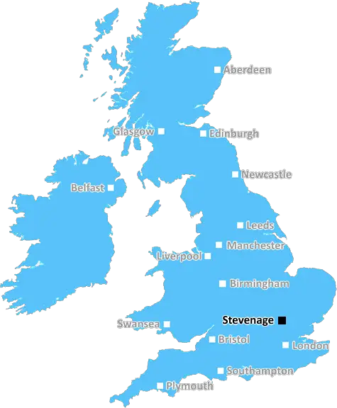
Stevenage (SG18)
The SG18 postcode area is located in the Stevenage postcode town region, within the county of Bedfordshire, and contains a total of 892 individual postcodes.
There are 37 electoral wards in the SG18 postcode area, including Arlesey, Baldock, Biggleswade, Buntingford, Henlow, Hertford, Hitchin, Knebworth, Letchworth Garden City, Much Hadham, Royston, Sandy, Shefford, Stevenage, Ware which come under the local authority of the Central Bedfordshire Council.
Combining the whole postcode region, 25% of people in SG18 are classed as having an AB social grade, (i.e. 'white-collar' middle-upper class), compared to 27% across the UK.
This does not mean that the people of SG18 are poorer than other areas, but it may give an indication that there are areas of deprivation.
The SG18 postcode is located in the Stevenage district of the East of England, in the county of Hertfordshire. It encompasses the villages of Arlesey, Henlow, Langford, Stotfold and Shefford, as well as parts of North Hertfordshire. It includes a number of substantial industries, including electronics, automotive, plastic injection moulding, steel and aerospace engineering, and is home to regional offices of organisations such as the Environment Agency, Natural England and the National Health Service.
Residents of the SG18 postcode enjoy good transport links, with the A1, A507 and A600 travelling through the area. Several railway stations, including Arlesey, Stotfold and Henlow, provide services to London and the north-east of England, and there are also regular bus services.
In terms of local amenities, the SG18 postcode area has excellent leisure facilities. There are a number of sports clubs and a golf course, as well as a leisure centre with a swimming pool, a library, a skate park and a large nature reserve. There are also a number of schools in the area, including primary, secondary and tertiary education establishments.
The SG18 postcode also has a range of retail outlets, from supermarkets and convenience stores to pubs and restaurants. There is a weekly market in Arlesey, as well as a number of small, independent shops. It also hosts a range of festivals and events throughout the year, including music, theatre, food and drink, film and literature as well as charity and community activities.

Demographics

Bedfordshire

SG18 is located in the county of Bedfordshire, in England.
Bedfordshire has a total population of 664,500, making it the 36th largest county in the UK.
Bedfordshire has a total area of 477 square miles, and a population density of 537 people per square kilometre. For comparison, Greater London has a density of 5,618 people/km2.
| Outward Code | SG18 |
| Postal Town | Stevenage |
| MSOA Name | Central Bedfordshire 005 |
| LSOA Name | Central Bedfordshire 005E |
| County | Bedfordshire |
| Region | Bedfordshire |
| Country | England |
| Local Authority | Central Bedfordshire |
| Area Classification | Largely Rural (rural including hub towns 50-79%) |
SG18 Electoral Wards
The postal region of SG18, includes the local towns, villages, electoral wards and stations of:
Dig even deeper into the SG18 postcode by clicking on a postcode below:
Click on an outward postal code below for more information about the area. Each 'outward' postcode give you a comprehensive list of all postcodes within the outward code area (SG) and estimated address.
Click on an 'outward' code for more information. For example, the outward postcode page 'EC2M' will give you an alphabetical list covering all postcodes located in the region, from 'EC2M 1BB' through to 'EC2M 7YA'.
Chris H
Sunday, April 7, 2024
We don't have any views of SG18 right now. If you live in SG18 or have visited it, please help us to help others by telling others what you think of this neighbourhood.
Add your view of SG18
People need your local expertise. If you live in SG18 or have first-hand knowledge of the neighbourhood, please consider sharing your views. It's completely anonymous - all we ask is for your initials.
Please tell us what you like about the SG18 postcode area, what you don't like, and what it's like to live or work here.
| LOCAL AMENITIES | |
| FAMILY FRIENDLY | |
| PARKING | |
| GREEN SPACES |
Local News Bedfordshire
Just forgotten': The adults who can't read
Sue Warden is Coordinator at Readeasy in Milton Keynes which helps adults with literacy.
BBC NewsBoreham Wood 4-0 Wealdstone
Boreham Wood thump Wealdstone in a huge match at the bottom of the National League table.
BBC NewsWoman defrauded stepfather out of shares and money
Geraldine Skevington-Roberts is considered to have used her power of attorney to "enrich herself".
BBC NewsHotel refugees 'gone by end of June', says MP
MP Andrew Selous says the Home Office has terminated its contract with the hotel.
BBC NewsRunning 5k every day while fasting during Ramadan
Bilal Hussain took on the challenge to raise money for Luton Food Bank.
BBC NewsUniversal begins public meetings for UK theme park
The company says the public engagement does not mean the proposal is confirmed.
BBC NewsAm-dram group thankful for support after burglary
The group says equipment worth about 5,000 was taken from its village hall base.
BBC NewsExeter City 1-0 Stevenage
Exeter move into the top half of the League One table with a 1-0 win that dented Stevenage's hopes of making the play-offs.
BBC NewsFrom the Postcode Area blog

Deciphering Crime Rates - a Deep Dive Into UK Postcode Analysis
Ever wondered about the crime rate in your UK postcode? You're not alone. We've dug deep into the data, uncovering trends and patterns that'll make your head spin.

Death of the High Street?
The BBC reports that despite councils' attempts to kurb them, the UK's high streets have seen a huge growth in fast food outlets. Could this mark the death knell for the Great British high street, and what can we do about it to halt its decline?

Discrimination by Postcode
You really couldn't make it up, could you? Some of the country's most vulnerable people are missing out on their weekly £25 Cold Weather Payment, just because the system that's in operation is discriminating against them because payments are based on postcode, rather than geographic location.

The Redesign is Underway
Well, the current website was absolutely in dire need of a good redesign - from the ground up. So I set out to pull it all apart and get it up and running again to become the most comprehensive guide to every postcode in the UK. And it's been a long, tough job from start to finish - and quite possibly the biggest project I've ever undertaken.
SOCIAL GRADES
According to census records, 25% of people here have a social grade of AB (highest), compared to the national average of 27%.